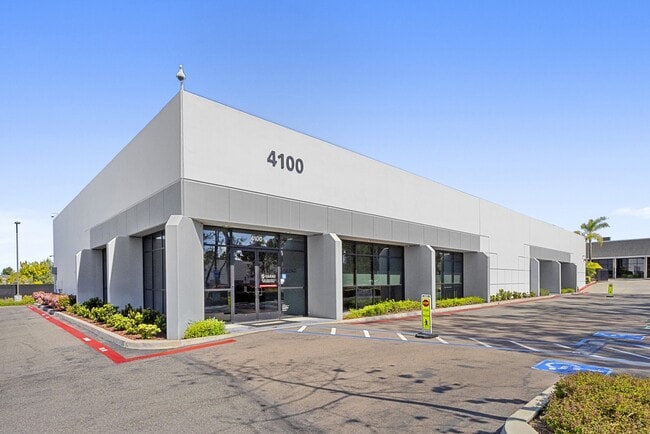
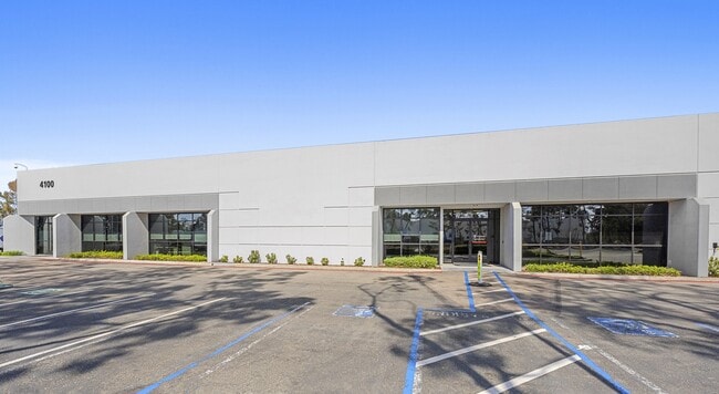
Property Record
4100 Avenida De La Plata, Oceanside, CA 92056

Property Detail
4100 Avenida De La Plata
162-502-01
LOT 21 TR 010248
Warehouse
San Diego
PD-1 (IL)
California
B and X Area of moderate flood hazard, usually the area between the limits of the 100-year and 500-year floods.
21
2024
1.01 AC
2025
Oceanside
018522
San Diego
14,533 SF
San Diego-Chula Vista-Carlsbad, CA
NEARBY LISTINGS FOR SALE OR LEASE
DEMOGRAPHICS near 4100 Avenida De La Plata
1 mile
3 mile
5 mile
2025 Total Population
13,949
150,307
318,965
2030 Population
14,012
150,782
320,397
Pop Growth 2025-2030
+ 0.45%
+ 0.32%
+ 0.45%
Average Age
39
40
40
2025 Total Households
4,560
51,413
110,962
HH Growth 2025-2030
+ 0.24%
+ 0.24%
+ 0.38%
Median Household Inc
$112,293
$95,910
$100,013
Avg Household Size
2.90
2.80
2.70
2025 Avg HH Vehicles
2.00
2.00
2.00
Median Home Value
$747,391
$718,402
$791,815
Median Year Built
1986
1984
1983
Nearby Places
Map Layers
Map Styles
 Street
 Aerial
Layers
 Traffic
 Biking
Places
Listings with unknown addresses are not visible on the map
- Restaurants
- Banks
- Shops
- Fitness
- Groceries
PUBLIC TRANSPORTATION
TRANSIT/SUBWAY
College Boulevard (Sprinter - San Diego North County Transit District (Coaster/Sprinter/Breeze))
Drive
Walk
Distance
College Boulevard (Sprinter - San Diego North County Transit District (Coaster/Sprinter/Breeze))
2 min
12 min
0.6 mi
COMMUTER RAIL
Oceanside Transit Center (Metrolink Inland Empire-Orange County Line - Metrolink Trains, Metrolink Orange County Line - Metrolink Trains, Orange County Line - Metrolink Trains)
Drive
Walk
Distance
Oceanside Transit Center (Metrolink Inland Empire-Orange County Line - Metrolink Trains, Metrolink Orange County Line - Metrolink Trains, Orange County Line - Metrolink Trains)
14 min
6.3 mi
Carlsbad Village (Coaster - San Diego North County Transit District (Coaster/Sprinter/Breeze))
Drive
Walk
Distance
Carlsbad Village (Coaster - San Diego North County Transit District (Coaster/Sprinter/Breeze))
13 min
7.4 mi
Freight Ports
Port of San Diego
Drive
Walk
Distance
Port of San Diego
57 min
44.0 mi
SALE & LEASE HISTORY
LISTING DATE
SALE/LEASE

May 30, 2025
For Sale
Nearby Properties
Address
Land Use
TOTAL SIZE
Lot Size
Zoning
Address
Land Use
TOTAL SIZE
Lot Size
Zoning
20.96 AC
SP-1-84 (I
Address
Land Use
TOTAL SIZE
Lot Size
Zoning
20.10 AC
M-U
Address
Land Use
TOTAL SIZE
Lot Size
Zoning
15.74 AC
SP-1-84 (I
Address
Land Use
TOTAL SIZE
Lot Size
Zoning
10.39 AC
M-U (40)
Address
Land Use
TOTAL SIZE
Lot Size
Zoning
18.89 AC
PD-1 (Res)
Address
Land Use
TOTAL SIZE
Lot Size
Zoning
15.25 AC
P-C
Address
Land Use
TOTAL SIZE
Lot Size
Zoning
11.17 AC
M-U
Address
Land Use
TOTAL SIZE
Lot Size
Zoning
31.94 AC
RM-B
Address
Land Use
TOTAL SIZE
Lot Size
Zoning
38.61 AC
PD-1 (IL)
Address
Land Use
TOTAL SIZE
Lot Size
Zoning
21.44 AC
C-1
Address
Land Use
TOTAL SIZE
Lot Size
Zoning
9.22 AC
RH
Address
Land Use
TOTAL SIZE
Lot Size
Zoning
1.23 AC
SPI
Address
Land Use
TOTAL SIZE
Lot Size
Zoning
12 AC
SP-1-09
Address
Land Use
TOTAL SIZE
Lot Size
Zoning
7.57 AC
R-M
Address
Land Use
TOTAL SIZE
Lot Size
Zoning
5.10 AC
R-M
Address
Land Use
TOTAL SIZE
Lot Size
Zoning
8.01 AC
PD-19-H
Address
Land Use
TOTAL SIZE
Lot Size
Zoning
96,240 SF
22.25 AC
PD-2
Address
Land Use
TOTAL SIZE
Lot Size
Zoning
5.24 AC
SP-1-09
Address
Land Use
TOTAL SIZE
Lot Size
Zoning
9.48 AC
R-M
Address
Land Use
TOTAL SIZE
Lot Size
Zoning
10.63 AC
RD-M
Address
Land Use
TOTAL SIZE
Lot Size
Zoning
14.08 AC
RH
Address
Land Use
TOTAL SIZE
Lot Size
Zoning
10.38 AC
R-M
Address
Land Use
TOTAL SIZE
Lot Size
Zoning
6.55 AC
R-M
Address
Land Use
TOTAL SIZE
Lot Size
Zoning
15.02 AC
SP-1-84 (I
Address
Land Use
TOTAL SIZE
Lot Size
Zoning
25.16 AC
SP-1-84 (I
Address
Land Use
TOTAL SIZE
Lot Size
Zoning
87,472 SF
4.96 AC
RM-A
Address
Land Use
TOTAL SIZE
Lot Size
Zoning
65,156 SF
2.52 AC
PD-1 (IL)
Address
Land Use
TOTAL SIZE
Lot Size
Zoning
11.60 AC
RM-C
Address
Land Use
TOTAL SIZE
Lot Size
Zoning
10,500 SF
43.77 AC
RM-A-SMH
Address
Land Use
TOTAL SIZE
Lot Size
Zoning
6.63 AC
RD-M
The World's #1 Commercial Real Estate Marketplace
Connect with us
© 2026 CoStar Group
The information above has been obtained from sources believed reliable. While we do not doubt its accuracy we have not verified it and make no guarantee, warranty or representation about it. It is your responsibility to independently confirm its accuracy and completeness. Any projections, opinions, assumptions, or estimates used are for example only and do not represent the current or future performance of the property. The value of this transaction to you depends on tax and other factors which should be evaluated by your tax, financial, and legal advisors. You and your advisors should conduct a careful, independent investigation of the property to determine to your satisfaction the suitability of the property for your needs.