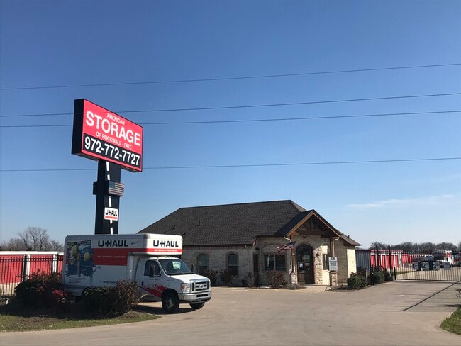
Property Record
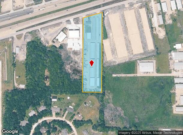
4100 E Interstate 30, Rockwall, TX 75087

Property Detail
4100 E Interstate 30
11206
R Irvine
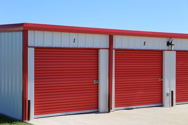
Commercialnec
A0120 R IRVINE, TRACT 23, ACRES 3.982
X
Rockwall
48113C0275K
Texas
2024
3.98 AC
2025
Rockwall
040408
Dallas/Ft Worth
48,131 SF
Dallas-Fort Worth-Arlington, TX
NEARBY LISTINGS FOR SALE OR LEASE
-
-
View all Rockwall listings for sale on LoopNet.com
DEMOGRAPHICS near 4100 E Interstate 30
1 mile
3 mile
5 mile
2024 Total Population
1,541
38,345
94,924
2029 Population
2,169
52,593
129,982
Pop Growth 2024-2029
+ 40.75%
+ 37.16%
+ 36.93%
Average Age
36
36
37
2024 Total Households
483
12,445
31,855
HH Growth 2024-2029
+ 40.99%
+ 37.55%
+ 37.22%
Median Household Inc
$88,616
$110,561
$114,627
Avg Household Size
3.10
3.00
2.90
2024 Avg HH Vehicles
2.00
2.00
2.00
Median Home Value
$285,570
$279,752
$309,635
Median Year Built
2010
2010
2007
Nearby Places
Map Layers
Map Styles
 Street
 Aerial
Transit
 Traffic
 Biking
Places
Listings with unknown addresses are not visible on the map
- Restaurants
- Banks
- Shops
- Fitness
- Groceries
PUBLIC TRANSPORTATION
AIRPORT
Dallas Love Field
Drive
Walk
Distance
Dallas Love Field
51 min
34.6 mi
Freight Ports
Port of Shreveport
Drive
Walk
Distance
Port of Shreveport
209 min
185.4 mi
SALE & LEASE HISTORY
LISTING DATE
SALE/LEASE

Mar 10, 2021
For Sale
Nearby Properties
Address
Land Use
TOTAL SIZE
Lot Size
Zoning
Address
Land Use
TOTAL SIZE
Lot Size
Zoning
193,393 SF
80 AC
Address
Land Use
TOTAL SIZE
Lot Size
Zoning
408,932 SF
12.93 AC
Address
Land Use
TOTAL SIZE
Lot Size
Zoning
44,191 SF
32.66 AC
Address
Land Use
TOTAL SIZE
Lot Size
Zoning
326,842 SF
21.28 AC
Address
Land Use
TOTAL SIZE
Lot Size
Zoning
378,763 SF
12.92 AC
Address
Land Use
TOTAL SIZE
Lot Size
Zoning
288,677 SF
41.65 AC
P11
Address
Land Use
TOTAL SIZE
Lot Size
Zoning
311,294 SF
21.28 AC
Address
Land Use
TOTAL SIZE
Lot Size
Zoning
656,340 SF
34.23 AC
Address
Land Use
TOTAL SIZE
Lot Size
Zoning
157,834 SF
30.89 AC
Address
Land Use
TOTAL SIZE
Lot Size
Zoning
250,627 SF
18.17 AC
Address
Land Use
TOTAL SIZE
Lot Size
Zoning
153,541 SF
27.44 AC
Address
Land Use
TOTAL SIZE
Lot Size
Zoning
391,599 SF
30.04 AC
Address
Land Use
TOTAL SIZE
Lot Size
Zoning
126,341 SF
18.41 AC
L1
Address
Land Use
TOTAL SIZE
Lot Size
Zoning
211,790 SF
11.58 AC
MF1
Address
Land Use
TOTAL SIZE
Lot Size
Zoning
353,525 SF
42.99 AC
Address
Land Use
TOTAL SIZE
Lot Size
Zoning
174,826 SF
11.13 AC
Address
Land Use
TOTAL SIZE
Lot Size
Zoning
191,568 SF
10.31 AC
Address
Land Use
TOTAL SIZE
Lot Size
Zoning
288,266 SF
38.93 AC
Address
Land Use
TOTAL SIZE
Lot Size
Zoning
101,024 SF
8.46 AC
Address
Land Use
TOTAL SIZE
Lot Size
Zoning
253,274 SF
18.76 AC
Address
Land Use
TOTAL SIZE
Lot Size
Zoning
83,268 SF
8.67 AC
Address
Land Use
TOTAL SIZE
Lot Size
Zoning
190,558 SF
49.75 AC
Address
Land Use
TOTAL SIZE
Lot Size
Zoning
227,610 SF
11.15 AC
Address
Land Use
TOTAL SIZE
Lot Size
Zoning
91,612 SF
14.20 AC
Address
Land Use
TOTAL SIZE
Lot Size
Zoning
152,094 SF
20.29 AC
Address
Land Use
TOTAL SIZE
Lot Size
Zoning
211,211 SF
10.19 AC
L1
Address
Land Use
TOTAL SIZE
Lot Size
Zoning
213,280 SF
15.31 AC
Address
Land Use
TOTAL SIZE
Lot Size
Zoning
91,039 SF
13.35 AC
Address
Land Use
TOTAL SIZE
Lot Size
Zoning
42,023 SF
4.19 AC
The World's #1 Commercial Real Estate Marketplace
Connect with us
© 2026 CoStar Group
The information above has been obtained from sources believed reliable. While we do not doubt its accuracy we have not verified it and make no guarantee, warranty or representation about it. It is your responsibility to independently confirm its accuracy and completeness. Any projections, opinions, assumptions, or estimates used are for example only and do not represent the current or future performance of the property. The value of this transaction to you depends on tax and other factors which should be evaluated by your tax, financial, and legal advisors. You and your advisors should conduct a careful, independent investigation of the property to determine to your satisfaction the suitability of the property for your needs.