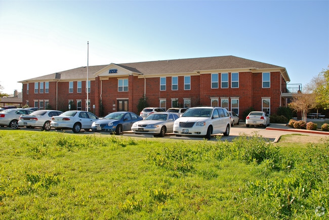
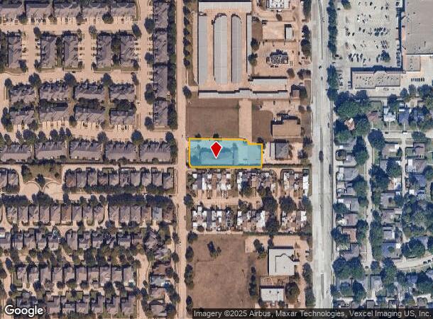
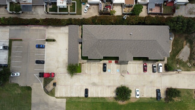
Property Record
4100 Medical Pkwy, Carrollton, TX 75007
NEARBY LISTINGS FOR SALE OR LEASE
Property Detail
4100 Medical Pkwy
Dallas-Fort Worth-Arlington, TX
Hsr Plaza Phase 2
R579666
HSR PLAZA PHASE 2 BLK 1 LOT 2
Commercialnec
Denton
X
Texas
48113C0020K
2
2024
1.02 AC
2025
Lewisville
021631
Dallas/Ft Worth
13,760 SF
DEMOGRAPHICS near 4100 Medical Pkwy
1 mile
3 mile
5 mile
2024 Total Population
17,373
148,653
291,453
2029 Population
20,744
177,731
341,355
Pop Growth 2024-2029
+ 19.40%
+ 19.56%
+ 17.12%
Average Age
42
39
39
2024 Total Households
6,299
60,606
121,902
HH Growth 2024-2029
+ 19.99%
+ 20.15%
+ 17.69%
Median Household Inc
$125,244
$90,253
$86,281
Avg Household Size
2.70
2.40
2.30
2024 Avg HH Vehicles
2.00
2.00
2.00
Median Home Value
$343,629
$368,114
$375,883
Median Year Built
1988
1993
1992
Nearby Places
Map Layers
Map Styles
 Street
 Aerial
Transit
 Traffic
 Biking
Places
Listings with unknown addresses are not visible on the map
- Restaurants
- Banks
- Shops
- Fitness
- Groceries
PUBLIC TRANSPORTATION
COMMUTER RAIL
Trinity Mills Station (Green Line - Dallas Area Rapid Transit (DART))
Drive
Walk
Distance
Trinity Mills Station (Green Line - Dallas Area Rapid Transit (DART))
11 min
5.3 mi
Drive
Walk
Distance
13 min
5.7 mi
AIRPORT
Dallas-Fort Worth International
Drive
Walk
Distance
Dallas-Fort Worth International
22 min
16.1 mi
Dallas Love Field
Drive
Walk
Distance
Dallas Love Field
30 min
19.2 mi
SALE & LEASE HISTORY
LISTING DATE
SALE/LEASE

May 24, 2022
For Lease
Nearby Properties
Address
Land Use
TOTAL SIZE
Lot Size
Zoning
Address
Land Use
TOTAL SIZE
Lot Size
Zoning
542,570 SF
75.67 AC
Address
Land Use
TOTAL SIZE
Lot Size
Zoning
526,509 SF
135.02 AC
Address
Land Use
TOTAL SIZE
Lot Size
Zoning
615,249 SF
16.17 AC
COMM
Address
Land Use
TOTAL SIZE
Lot Size
Zoning
417,990 SF
10.42 AC
Address
Land Use
TOTAL SIZE
Lot Size
Zoning
578,457 SF
31.79 AC
Address
Land Use
TOTAL SIZE
Lot Size
Zoning
554,780 SF
23.81 AC
Address
Land Use
TOTAL SIZE
Lot Size
Zoning
512,903 SF
18 AC
Address
Land Use
TOTAL SIZE
Lot Size
Zoning
399,442 SF
10.24 AC
Address
Land Use
TOTAL SIZE
Lot Size
Zoning
460,403 SF
19.26 AC
Address
Land Use
TOTAL SIZE
Lot Size
Zoning
389,014 SF
20.91 AC
Address
Land Use
TOTAL SIZE
Lot Size
Zoning
448,915 SF
20.37 AC
Address
Land Use
TOTAL SIZE
Lot Size
Zoning
396,669 SF
18.50 AC
Address
Land Use
TOTAL SIZE
Lot Size
Zoning
462,888 SF
20.17 AC
Address
Land Use
TOTAL SIZE
Lot Size
Zoning
434,639 SF
16.20 AC
Address
Land Use
TOTAL SIZE
Lot Size
Zoning
343,234 SF
32.41 AC
Address
Land Use
TOTAL SIZE
Lot Size
Zoning
462,429 SF
5.70 AC
Address
Land Use
TOTAL SIZE
Lot Size
Zoning
291,446 SF
16.18 AC
Address
Land Use
TOTAL SIZE
Lot Size
Zoning
285,835 SF
15.61 AC
Address
Land Use
TOTAL SIZE
Lot Size
Zoning
364,000 SF
8.11 AC
Address
Land Use
TOTAL SIZE
Lot Size
Zoning
961,306 SF
44.52 AC
Address
Land Use
TOTAL SIZE
Lot Size
Zoning
97,750 SF
69.90 AC
Address
Land Use
TOTAL SIZE
Lot Size
Zoning
267,413 SF
5.25 AC
Address
Land Use
TOTAL SIZE
Lot Size
Zoning
350,292 SF
7.75 AC
Address
Land Use
TOTAL SIZE
Lot Size
Zoning
189,500 SF
53.90 AC
Address
Land Use
TOTAL SIZE
Lot Size
Zoning
338,886 SF
18.82 AC
PD-165
Address
Land Use
TOTAL SIZE
Lot Size
Zoning
305,026 SF
9.75 AC
Address
Land Use
TOTAL SIZE
Lot Size
Zoning
303,962 SF
9.82 AC
Address
Land Use
TOTAL SIZE
Lot Size
Zoning
357,863 SF
16.85 AC
MF-M
Address
Land Use
TOTAL SIZE
Lot Size
Zoning
349,784 SF
17.71 AC
Address
Land Use
TOTAL SIZE
Lot Size
Zoning
298,991 SF
15.72 AC
The World's #1 Commercial Real Estate Marketplace
Connect with us
© 2026 CoStar Group
The information above has been obtained from sources believed reliable. While we do not doubt its accuracy we have not verified it and make no guarantee, warranty or representation about it. It is your responsibility to independently confirm its accuracy and completeness. Any projections, opinions, assumptions, or estimates used are for example only and do not represent the current or future performance of the property. The value of this transaction to you depends on tax and other factors which should be evaluated by your tax, financial, and legal advisors. You and your advisors should conduct a careful, independent investigation of the property to determine to your satisfaction the suitability of the property for your needs.