Property Record
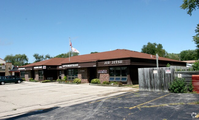
4100 Milwaukee St, Madison, WI 53714

Property Detail
4100 Milwaukee St
Madison, WI
C A GALLAGHER GARDEN SUBD BLOCK 1 LOTS 8 & 9 EXC N 150 FT THF SUBJ TO ESMT IN DO C #4085762
0710-041-4128-5
DANE
Commercialnec
Wisconsin
C-1
8,9
B and X Area of moderate flood hazard, usually the area between the limits of the 100-year and 500-year floods.
0.45 AC
2025
Northeast Madison
2025
Milwaukee/Madison
003002
NEARBY LISTINGS FOR SALE OR LEASE
DEMOGRAPHICS near 4100 Milwaukee St
1 mile
3 mile
5 mile
2025 Total Population
9,040
71,198
150,835
2030 Population
9,348
73,777
157,247
Pop Growth 2025-2030
+ 3.41%
+ 3.62%
+ 4.25%
Average Age
41
41
37
2025 Total Households
4,141
33,506
68,891
HH Growth 2025-2030
+ 3.89%
+ 3.98%
+ 4.56%
Median Household Inc
$69,217
$78,866
$68,736
Avg Household Size
2.10
2.10
2.00
2025 Avg HH Vehicles
1.00
2.00
1.00
Median Home Value
$285,800
$329,161
$341,022
Median Year Built
1972
1970
1977
Nearby Places
Map Layers
Map Styles
 Street
 Aerial
Layers
 Traffic
 Biking
Places
Listings with unknown addresses are not visible on the map
- Restaurants
- Banks
- Shops
- Fitness
- Groceries
PUBLIC TRANSPORTATION
AIRPORT
Dane County Regional/Truax Field
Drive
Walk
Distance
Dane County Regional/Truax Field
10 min
4.7 mi
Nearby Properties
Address
Land Use
TOTAL SIZE
Lot Size
Zoning
Address
Land Use
TOTAL SIZE
Lot Size
Zoning
287,341 SF
40.17 AC
IL
Address
Land Use
TOTAL SIZE
Lot Size
Zoning
461,594 SF
3.37 AC
CC-T
Address
Land Use
TOTAL SIZE
Lot Size
Zoning
278,154 SF
3.88 AC
TE
Address
Land Use
TOTAL SIZE
Lot Size
Zoning
289,884 SF
19.36 AC
SR-V2
Address
Land Use
TOTAL SIZE
Lot Size
Zoning
50,400 SF
5.74 AC
SE
Address
Land Use
TOTAL SIZE
Lot Size
Zoning
237,832 SF
CC
Address
Land Use
TOTAL SIZE
Lot Size
Zoning
266,955 SF
12.77 AC
PD
Address
Land Use
TOTAL SIZE
Lot Size
Zoning
216,017 SF
3.35 AC
TE
Address
Land Use
TOTAL SIZE
Lot Size
Zoning
286,104 SF
19.47 AC
SR-V2
Address
Land Use
TOTAL SIZE
Lot Size
Zoning
20,965 SF
10.98 AC
IL
Address
Land Use
TOTAL SIZE
Lot Size
Zoning
547,019 SF
29.06 AC
RMX
Address
Land Use
TOTAL SIZE
Lot Size
Zoning
166,108 SF
2 AC
WP-25
Address
Land Use
TOTAL SIZE
Lot Size
Zoning
156,054 SF
9.40 AC
SE
Address
Land Use
TOTAL SIZE
Lot Size
Zoning
103,769 SF
11.21 AC
WP-15
Address
Land Use
TOTAL SIZE
Lot Size
Zoning
176,088 SF
6.29 AC
PD
Address
Land Use
TOTAL SIZE
Lot Size
Zoning
109,450 SF
4.33 AC
TR-U1
Address
Land Use
TOTAL SIZE
Lot Size
Zoning
109,396 SF
3 AC
PD
Address
Land Use
TOTAL SIZE
Lot Size
Zoning
113,483 SF
4.61 AC
CC
Address
Land Use
TOTAL SIZE
Lot Size
Zoning
63,081 SF
3.36 AC
PD
Address
Land Use
TOTAL SIZE
Lot Size
Zoning
131,000 SF
4.51 AC
WP-25
Address
Land Use
TOTAL SIZE
Lot Size
Zoning
149,897 SF
17.72 AC
IL
Address
Land Use
TOTAL SIZE
Lot Size
Zoning
191,145 SF
12.24 AC
SR-V2
Address
Land Use
TOTAL SIZE
Lot Size
Zoning
74,286 SF
1.02 AC
CC-T
Address
Land Use
TOTAL SIZE
Lot Size
Zoning
150,439 SF
4.71 AC
CC-T
Address
Land Use
TOTAL SIZE
Lot Size
Zoning
131,307 SF
1.21 AC
PD
Address
Land Use
TOTAL SIZE
Lot Size
Zoning
87,541 SF
1.85 AC
TR-U2
Address
Land Use
TOTAL SIZE
Lot Size
Zoning
134,088 SF
6.45 AC
PD
Address
Land Use
TOTAL SIZE
Lot Size
Zoning
105,743 SF
9.50 AC
IG
Address
Land Use
TOTAL SIZE
Lot Size
Zoning
149,650 SF
21.35 AC
CC
Address
Land Use
TOTAL SIZE
Lot Size
Zoning
140,832 SF
3.51 AC
WP-25
The World's #1 Commercial Real Estate Marketplace
Connect with us
© 2026 CoStar Group
The information above has been obtained from sources believed reliable. While we do not doubt its accuracy we have not verified it and make no guarantee, warranty or representation about it. It is your responsibility to independently confirm its accuracy and completeness. Any projections, opinions, assumptions, or estimates used are for example only and do not represent the current or future performance of the property. The value of this transaction to you depends on tax and other factors which should be evaluated by your tax, financial, and legal advisors. You and your advisors should conduct a careful, independent investigation of the property to determine to your satisfaction the suitability of the property for your needs.