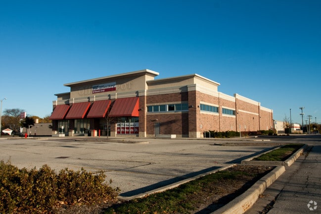
Property Record
4100 N 56Th St, Milwaukee, WI 53216


NEARBY LISTINGS FOR SALE OR LEASE
Property Detail
4100 N 56Th St
Milwaukee-Waukesha-West Allis, WI
Midtown Center Subdivision
249-0873-000-X
MIDTOWN CENTER SUBDIVISION IN SW 1/4 SEC 2-7-21 LOT 3 25-14 TID #42
Medicalbuilding
Milwaukee
X
Wisconsin
55079C0100E
3
2024
8.23 AC
2024
Milwaukee NW
003800
Milwaukee/Madison
61,433 SF
DEMOGRAPHICS near 4100 N 56Th St
1 Mile
3 Mile
5 Mile
2024 Total Population
23,794
198,935
404,495
2029 Population
23,347
196,219
398,425
Pop Growth 2024-2029
(1.88%)
(1.37%)
(1.50%)
Average Age
37
36
36
2024 Total Households
9,223
77,808
166,058
HH Growth 2024-2029
(1.98%)
(1.50%)
(1.58%)
Median Household Inc
$38,160
$43,629
$48,698
Avg Household Size
2.50
2.50
2.30
2024 Avg HH Vehicles
1.00
1.00
1.00
Median Home Value
$122,068
$139,665
$179,496
Median Year Built
1951
1950
1951
Nearby Places
Map Layers
Map Styles
 Street
 Aerial
- Restaurants
- Banks
- Shops
- Fitness
- Groceries
PUBLIC TRANSPORTATION
COMMUTER RAIL
Milwaukee (Empire Builder - Amtrak)
DRIVE
WALK
Distance
Milwaukee (Empire Builder - Amtrak)
15 min
5.7 mi
AIRPORT
General Mitchell International
DRIVE
WALK
Distance
General Mitchell International
26 min
12.4 mi
Freight Ports
Port Milwaukee
DRIVE
WALK
Distance
Port Milwaukee
19 min
8.2 mi
Nearby Properties
Address
Land Use
TOTAL SIZE
Lot Size
Zoning
Address
Land Use
TOTAL SIZE
Lot Size
Zoning
0.71 AC
RM2
Address
Land Use
TOTAL SIZE
Lot Size
Zoning
8.03 AC
RM1
Address
Land Use
TOTAL SIZE
Lot Size
Zoning
0.71 AC
RM2
Address
Land Use
TOTAL SIZE
Lot Size
Zoning
1.76 AC
LB2
Address
Land Use
TOTAL SIZE
Lot Size
Zoning
12.49 AC
TL
Address
Land Use
TOTAL SIZE
Lot Size
Zoning
66.42 AC
IL1
Address
Land Use
TOTAL SIZE
Lot Size
Zoning
17.84 AC
TL
Address
Land Use
TOTAL SIZE
Lot Size
Zoning
169,550 SF
12.04 AC
RB2
Address
Land Use
TOTAL SIZE
Lot Size
Zoning
18.54 AC
RS6
Address
Land Use
TOTAL SIZE
Lot Size
Zoning
0.51 AC
RT2
Address
Land Use
TOTAL SIZE
Lot Size
Zoning
7.38 AC
TL
Address
Land Use
TOTAL SIZE
Lot Size
Zoning
6.66 AC
RT3
Address
Land Use
TOTAL SIZE
Lot Size
Zoning
28.12 AC
RM1
Address
Land Use
TOTAL SIZE
Lot Size
Zoning
11.45 AC
RS6
Address
Land Use
TOTAL SIZE
Lot Size
Zoning
17,613 SF
1.44 AC
Address
Land Use
TOTAL SIZE
Lot Size
Zoning
163,539 SF
7.17 AC
PUD
Address
Land Use
TOTAL SIZE
Lot Size
Zoning
1.40 AC
RM1
Address
Land Use
TOTAL SIZE
Lot Size
Zoning
90,360 SF
6.52 AC
LB1
Address
Land Use
TOTAL SIZE
Lot Size
Zoning
63,201 SF
5.69 AC
PD
Address
Land Use
TOTAL SIZE
Lot Size
Zoning
267,589 SF
7.65 AC
TL
Address
Land Use
TOTAL SIZE
Lot Size
Zoning
344,223 SF
26.39 AC
IL1
Address
Land Use
TOTAL SIZE
Lot Size
Zoning
64,440 SF
12.28 AC
CS
Address
Land Use
TOTAL SIZE
Lot Size
Zoning
265,000 SF
14.70 AC
RS5
Address
Land Use
TOTAL SIZE
Lot Size
Zoning
197,684 SF
10.67 AC
RM1
Address
Land Use
TOTAL SIZE
Lot Size
Zoning
44,000 SF
0.63 AC
CS
Address
Land Use
TOTAL SIZE
Lot Size
Zoning
42,489 SF
3.95 AC
IO2
Address
Land Use
TOTAL SIZE
Lot Size
Zoning
3.52 AC
RM5
Address
Land Use
TOTAL SIZE
Lot Size
Zoning
13.44 AC
CS
Address
Land Use
TOTAL SIZE
Lot Size
Zoning
9.50 AC
RS5
Address
Land Use
TOTAL SIZE
Lot Size
Zoning
80,307 SF
7.45 AC
PD
The World's #1 Commercial Real Estate Marketplace
Connect with us
© 2025 CoStar Group
The information above has been obtained from sources believed reliable. While we do not doubt its accuracy we have not verified it and make no guarantee, warranty or representation about it. It is your responsibility to independently confirm its accuracy and completeness. Any projections, opinions, assumptions, or estimates used are for example only and do not represent the current or future performance of the property. The value of this transaction to you depends on tax and other factors which should be evaluated by your tax, financial, and legal advisors. You and your advisors should conduct a careful, independent investigation of the property to determine to your satisfaction the suitability of the property for your needs.