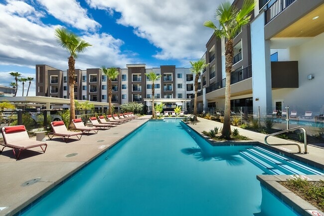
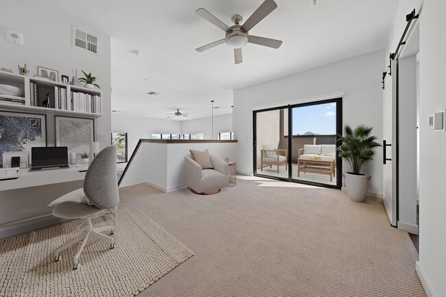
Property Record
100 W Indian School Rd, Phoenix, AZ 85013

Current Lease Availabilities
Property Detail
100 W Indian School Rd
Phoenix-Mesa-Chandler, AZ
NORTHWEST CORNER OF CENTRAL AVENUE & INDIAN SCHOOL MCR 1642-04
155-31-091
MARICOPA
Apartment
Arizona
2025
1
2025
8.29 AC
110501
Midtown Phoenix
423,681 SF
Phoenix
NEARBY LISTINGS FOR SALE OR LEASE
DEMOGRAPHICS near 100 W Indian School Rd
1 mile
3 mile
5 mile
2025 Total Population
23,144
188,624
462,292
2030 Population
24,401
197,150
481,289
Pop Growth 2025-2030
+ 5.43%
+ 4.52%
+ 4.11%
Average Age
38
37
37
2025 Total Households
12,159
82,547
181,101
HH Growth 2025-2030
+ 5.45%
+ 4.95%
+ 4.45%
Median Household Inc
$66,899
$69,048
$66,521
Avg Household Size
1.80
2.10
2.40
2025 Avg HH Vehicles
1.00
1.00
2.00
Median Home Value
$488,167
$494,757
$457,245
Median Year Built
1972
1971
1971
Nearby Places
Map Layers
Map Styles
 Street
 Aerial
Transit
 Traffic
 Biking
Places
Listings with unknown addresses are not visible on the map
- Restaurants
- Banks
- Shops
- Fitness
- Groceries
PUBLIC TRANSPORTATION
TRANSIT/SUBWAY
Indian School/Central Ave (METRO Light Rail - Valley Metro (Phoenix Light Rail))
Drive
Walk
Distance
Indian School/Central Ave (METRO Light Rail - Valley Metro (Phoenix Light Rail))
1 min
3 min
0.2 mi
Campbell/Central Ave (METRO Light Rail - Valley Metro (Phoenix Light Rail))
Drive
Walk
Distance
Campbell/Central Ave (METRO Light Rail - Valley Metro (Phoenix Light Rail))
1 min
12 min
0.7 mi
Osborn/Central Ave (METRO Light Rail - Valley Metro (Phoenix Light Rail))
Drive
Walk
Distance
Osborn/Central Ave (METRO Light Rail - Valley Metro (Phoenix Light Rail))
2 min
13 min
0.7 mi
Thomas/Central Ave (METRO Light Rail - Valley Metro (Phoenix Light Rail))
Drive
Walk
Distance
Thomas/Central Ave (METRO Light Rail - Valley Metro (Phoenix Light Rail))
2 min
20 min
1.1 mi
AIRPORT
Phoenix Sky Harbor International
Drive
Walk
Distance
Phoenix Sky Harbor International
15 min
8.3 mi
Phoenix-Mesa Gateway
Drive
Walk
Distance
Phoenix-Mesa Gateway
48 min
35.1 mi
Freight Ports
Port of San Diego
Drive
Walk
Distance
Port of San Diego
399 min
356.8 mi
Nearby Properties
Address
Land Use
TOTAL SIZE
Lot Size
Zoning
Address
Land Use
TOTAL SIZE
Lot Size
Zoning
582,073 SF
1.45 AC
C-C
Address
Land Use
TOTAL SIZE
Lot Size
Zoning
1.85 AC
Address
Land Use
TOTAL SIZE
Lot Size
Zoning
455,443 SF
3.21 AC
C-C
Address
Land Use
TOTAL SIZE
Lot Size
Zoning
339,909 SF
3 AC
C-C
Address
Land Use
TOTAL SIZE
Lot Size
Zoning
2,568,761 SF
48.36 AC
C-C
Address
Land Use
TOTAL SIZE
Lot Size
Zoning
437,102 SF
1.02 AC
C-2
Address
Land Use
TOTAL SIZE
Lot Size
Zoning
2,006,402 SF
18.66 AC
C-C
Address
Land Use
TOTAL SIZE
Lot Size
Zoning
2,334,671 SF
32.63 AC
C-2
Address
Land Use
TOTAL SIZE
Lot Size
Zoning
191,120 SF
1.43 AC
C-C
Address
Land Use
TOTAL SIZE
Lot Size
Zoning
71,306 SF
8.93 AC
M-H
Address
Land Use
TOTAL SIZE
Lot Size
Zoning
96,183 SF
11.04 AC
R-6
Address
Land Use
TOTAL SIZE
Lot Size
Zoning
981,015 SF
2.83 AC
C-DT
Address
Land Use
TOTAL SIZE
Lot Size
Zoning
913,637 SF
35.53 AC
M-H
Address
Land Use
TOTAL SIZE
Lot Size
Zoning
322,557 SF
2 AC
C-C
Address
Land Use
TOTAL SIZE
Lot Size
Zoning
222,983 SF
1.61 AC
C-DT
Address
Land Use
TOTAL SIZE
Lot Size
Zoning
686,094 SF
5.09 AC
C-C
Address
Land Use
TOTAL SIZE
Lot Size
Zoning
953,192 SF
28.99 AC
Address
Land Use
TOTAL SIZE
Lot Size
Zoning
244,924 SF
1.90 AC
C2
Address
Land Use
TOTAL SIZE
Lot Size
Zoning
645,508 SF
4.66 AC
C-DT
Address
Land Use
TOTAL SIZE
Lot Size
Zoning
359,395 SF
1.20 AC
C-DT
Address
Land Use
TOTAL SIZE
Lot Size
Zoning
860,020 SF
5.89 AC
C2
Address
Land Use
TOTAL SIZE
Lot Size
Zoning
21,587 SF
3.66 AC
R-10
Address
Land Use
TOTAL SIZE
Lot Size
Zoning
956,022 SF
14.86 AC
Address
Land Use
TOTAL SIZE
Lot Size
Zoning
410,000 SF
1.86 AC
C-C
Address
Land Use
TOTAL SIZE
Lot Size
Zoning
547,141 SF
18.52 AC
R-6
Address
Land Use
TOTAL SIZE
Lot Size
Zoning
367,982 SF
0.48 AC
DTCWEV
Address
Land Use
TOTAL SIZE
Lot Size
Zoning
812,968 SF
7.08 AC
Address
Land Use
TOTAL SIZE
Lot Size
Zoning
517,609 SF
1.67 AC
C-C
Address
Land Use
TOTAL SIZE
Lot Size
Zoning
349,454 SF
1.75 AC
DTCBCORE
Address
Land Use
TOTAL SIZE
Lot Size
Zoning
599,524 SF
5.09 AC
R5
The World's #1 Commercial Real Estate Marketplace
Connect with us
© 2026 CoStar Group
The information above has been obtained from sources believed reliable. While we do not doubt its accuracy we have not verified it and make no guarantee, warranty or representation about it. It is your responsibility to independently confirm its accuracy and completeness. Any projections, opinions, assumptions, or estimates used are for example only and do not represent the current or future performance of the property. The value of this transaction to you depends on tax and other factors which should be evaluated by your tax, financial, and legal advisors. You and your advisors should conduct a careful, independent investigation of the property to determine to your satisfaction the suitability of the property for your needs.