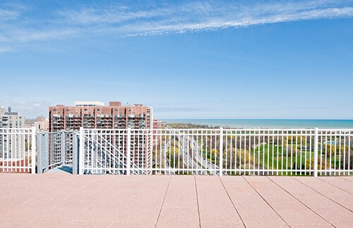
Property Record
4100 N Marine Dr, Chicago, IL 60613


NEARBY LISTINGS FOR SALE OR LEASE
Property Detail
4100 N Marine Dr
Chicago-Naperville-Elgin, IL-IN-WI
Bacons Sub
14-16-304-037-0000
(BACONS) SUB OF LT16 OF BITTERSWEET A SUB OF LTS13 & 16 & VAC ST LYING BETWEEN 13 & 16 OF SCHOOL TRUSTEES SUB OF SEC 16-40-14
Commercialnec
Cook
X
Illinois
17031C0409K
13,16
2023
0.58 AC
2024
Uptown Chicago
031400
Chicago
DEMOGRAPHICS near 4100 N Marine Dr
1 Mile
3 Mile
5 Mile
2024 Total Population
66,533
369,902
932,293
2029 Population
65,061
359,329
902,634
Pop Growth 2024-2029
(2.21%)
(2.86%)
(3.18%)
Average Age
38
37
37
2024 Total Households
38,263
191,686
454,353
HH Growth 2024-2029
(2.50%)
(3.04%)
(3.19%)
Median Household Inc
$74,343
$89,422
$89,886
Avg Household Size
1.70
1.80
2.00
2024 Avg HH Vehicles
1.00
1.00
1.00
Median Home Value
$358,295
$478,207
$456,136
Median Year Built
1961
1954
1956
Nearby Places
Map Layers
Map Styles
 Street
 Aerial
- Restaurants
- Banks
- Shops
- Fitness
- Groceries
PUBLIC TRANSPORTATION
TRANSIT/SUBWAY
Sheridan Station (Red Line - Chicago Transit Authority "L" Trains (The "L"))
DRIVE
WALK
Distance
Sheridan Station (Red Line - Chicago Transit Authority "L" Trains (The "L"))
2 min
10 min
0.5 mi
Addison Station (Red Line) (Red Line - Chicago Transit Authority "L" Trains (The "L"))
DRIVE
WALK
Distance
Addison Station (Red Line) (Red Line - Chicago Transit Authority "L" Trains (The "L"))
2 min
18 min
1.0 mi
Wilson-North Inner (Purple Line - Chicago Transit Authority, Red Line - Chicago Transit Authority)
DRIVE
WALK
Distance
Wilson-North Inner (Purple Line - Chicago Transit Authority, Red Line - Chicago Transit Authority)
2 min
19 min
1.0 mi
COMMUTER RAIL
Ravenswood Station (Union Pacific North Line - Northeast Illinois Regional Commuter Railroad (Metra))
DRIVE
WALK
Distance
Ravenswood Station (Union Pacific North Line - Northeast Illinois Regional Commuter Railroad (Metra))
5 min
2.3 mi
Peterson/Ridge (Union Pacific North - Metra)
DRIVE
WALK
Distance
Peterson/Ridge (Union Pacific North - Metra)
6 min
3.6 mi
AIRPORT
Chicago O'Hare International
DRIVE
WALK
Distance
Chicago O'Hare International
24 min
14.6 mi
Chicago Midway International
DRIVE
WALK
Distance
Chicago Midway International
26 min
17.5 mi
Freight Ports
Port Milwaukee
DRIVE
WALK
Distance
Port Milwaukee
102 min
82.8 mi
SALE & LEASE HISTORY
LISTING DATE
SALE/LEASE

Oct 05, 2017
For Lease
Nearby Properties
Address
Land Use
TOTAL SIZE
Lot Size
Zoning
Address
Land Use
TOTAL SIZE
Lot Size
Zoning
228,018 SF
8.72 AC
PD 958
Address
Land Use
TOTAL SIZE
Lot Size
Zoning
222,240 SF
2.45 AC
PD 1439
Address
Land Use
TOTAL SIZE
Lot Size
Zoning
0.96 AC
PD 958
Address
Land Use
TOTAL SIZE
Lot Size
Zoning
16.93 AC
POS-1,PD 1
Address
Land Use
TOTAL SIZE
Lot Size
Zoning
19,500 SF
12.06 AC
PD 367
Address
Land Use
TOTAL SIZE
Lot Size
Zoning
268,778 SF
0.59 AC
RM-6.5
Address
Land Use
TOTAL SIZE
Lot Size
Zoning
301,100 SF
2.20 AC
PD 37
Address
Land Use
TOTAL SIZE
Lot Size
Zoning
1 AC
RS-3
Address
Land Use
TOTAL SIZE
Lot Size
Zoning
0.64 AC
PD 158
Address
Land Use
TOTAL SIZE
Lot Size
Zoning
0.81 AC
PD 158
Address
Land Use
TOTAL SIZE
Lot Size
Zoning
82,000 SF
9.68 AC
PD 437
Address
Land Use
TOTAL SIZE
Lot Size
Zoning
277,195 SF
1.78 AC
PD 1094
Address
Land Use
TOTAL SIZE
Lot Size
Zoning
190,011 SF
5.90 AC
PD 353
Address
Land Use
TOTAL SIZE
Lot Size
Zoning
147,835 SF
1.03 AC
PD 37
Address
Land Use
TOTAL SIZE
Lot Size
Zoning
170,538 SF
0.76 AC
PD 112
Address
Land Use
TOTAL SIZE
Lot Size
Zoning
331,294 SF
13.03 AC
PD 439
Address
Land Use
TOTAL SIZE
Lot Size
Zoning
311,556 SF
PD 1420
Address
Land Use
TOTAL SIZE
Lot Size
Zoning
2.25 AC
PD 612
Address
Land Use
TOTAL SIZE
Lot Size
Zoning
162,700 SF
0.64 AC
PD 50
Address
Land Use
TOTAL SIZE
Lot Size
Zoning
55,476 SF
6.16 AC
PD 619
Address
Land Use
TOTAL SIZE
Lot Size
Zoning
140,451 SF
9.48 AC
PD 213
Address
Land Use
TOTAL SIZE
Lot Size
Zoning
1.35 AC
PD 1194
Address
Land Use
TOTAL SIZE
Lot Size
Zoning
73,338 SF
0.19 AC
B3-5
Address
Land Use
TOTAL SIZE
Lot Size
Zoning
226,345 SF
3.71 AC
PD 1203
Address
Land Use
TOTAL SIZE
Lot Size
Zoning
144,865 SF
0.21 AC
Address
Land Use
TOTAL SIZE
Lot Size
Zoning
0.88 AC
RM-6.5
Address
Land Use
TOTAL SIZE
Lot Size
Zoning
85,214 SF
1.25 AC
PD 940
Address
Land Use
TOTAL SIZE
Lot Size
Zoning
340,838 SF
31 AC
PD 1411
Address
Land Use
TOTAL SIZE
Lot Size
Zoning
197,785 SF
4.03 AC
PD 943
Address
Land Use
TOTAL SIZE
Lot Size
Zoning
32,200 SF
5.67 AC
B3-5,RM-6.
The World's #1 Commercial Real Estate Marketplace
Connect with us
© 2025 CoStar Group
The information above has been obtained from sources believed reliable. While we do not doubt its accuracy we have not verified it and make no guarantee, warranty or representation about it. It is your responsibility to independently confirm its accuracy and completeness. Any projections, opinions, assumptions, or estimates used are for example only and do not represent the current or future performance of the property. The value of this transaction to you depends on tax and other factors which should be evaluated by your tax, financial, and legal advisors. You and your advisors should conduct a careful, independent investigation of the property to determine to your satisfaction the suitability of the property for your needs.