Property Record
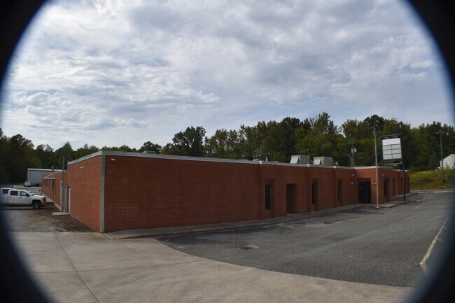
4100 Randleman Rd, Greensboro, NC 27406


Property Detail
4100 Randleman Rd
0142787
3.51 AC DAVIS BK1821-557 RANDLEMAN RD
Industrialgeneral
GUILFORD
LI
North Carolina
B and X Area of moderate flood hazard, usually the area between the limits of the 100-year and 500-year floods.
38
2024
3.51 AC
2025
South Greensboro
016701
Greensboro/Winston-Salem
44,183 SF
Greensboro-High Point, NC
NEARBY LISTINGS FOR SALE OR LEASE
DEMOGRAPHICS near 4100 Randleman Rd
1 mile
3 mile
5 mile
2025 Total Population
2,546
22,981
66,117
2030 Population
2,604
23,523
67,863
Pop Growth 2025-2030
+ 2.28%
+ 2.36%
+ 2.64%
Average Age
38
39
39
2025 Total Households
999
9,426
27,064
HH Growth 2025-2030
+ 2.30%
+ 2.50%
+ 2.83%
Median Household Inc
$65,000
$61,928
$57,532
Avg Household Size
2.50
2.40
2.40
2025 Avg HH Vehicles
2.00
2.00
2.00
Median Home Value
$164,560
$192,638
$200,965
Median Year Built
1995
1987
1982
Nearby Places
Map Layers
Map Styles
 Street
 Aerial
Layers
 Traffic
 Biking
Places
Listings with unknown addresses are not visible on the map
- Restaurants
- Banks
- Shops
- Fitness
- Groceries
PUBLIC TRANSPORTATION
COMMUTER RAIL
Greensboro Station (Piedmont - North Carolina by Train (NC Train))
Drive
Walk
Distance
Greensboro Station (Piedmont - North Carolina by Train (NC Train))
11 min
6.7 mi
AIRPORT
Piedmont Triad International
Drive
Walk
Distance
Piedmont Triad International
26 min
18.9 mi
SALE & LEASE HISTORY
LISTING DATE
SALE/LEASE

Oct 07, 2021
For Sale
Nearby Properties
Address
Land Use
TOTAL SIZE
Lot Size
Zoning
Address
Land Use
TOTAL SIZE
Lot Size
Zoning
412,479 SF
19.68 AC
RM-26
Address
Land Use
TOTAL SIZE
Lot Size
Zoning
300,901 SF
20.39 AC
RM-18
Address
Land Use
TOTAL SIZE
Lot Size
Zoning
280,200 SF
19.28 AC
RM-12
Address
Land Use
TOTAL SIZE
Lot Size
Zoning
201,999 SF
22.18 AC
C-H
Address
Land Use
TOTAL SIZE
Lot Size
Zoning
188,976 SF
41.46 AC
R-5
Address
Land Use
TOTAL SIZE
Lot Size
Zoning
97,679 SF
17.18 AC
PI
Address
Land Use
TOTAL SIZE
Lot Size
Zoning
172,950 SF
11.49 AC
RM-18
Address
Land Use
TOTAL SIZE
Lot Size
Zoning
118,707 SF
15.94 AC
C-H
Address
Land Use
TOTAL SIZE
Lot Size
Zoning
107,867 SF
14.75 AC
RM-8
Address
Land Use
TOTAL SIZE
Lot Size
Zoning
112,960 SF
23.36 AC
PI
Address
Land Use
TOTAL SIZE
Lot Size
Zoning
158,500 SF
17.35 AC
RM-12
Address
Land Use
TOTAL SIZE
Lot Size
Zoning
49,728 SF
9.29 AC
PI
Address
Land Use
TOTAL SIZE
Lot Size
Zoning
114,434 SF
10.89 AC
RM-12
Address
Land Use
TOTAL SIZE
Lot Size
Zoning
95,304 SF
4.58 AC
RM-12
Address
Land Use
TOTAL SIZE
Lot Size
Zoning
117,356 SF
10.11 AC
RM-12
Address
Land Use
TOTAL SIZE
Lot Size
Zoning
177,850 SF
93.40 AC
AG
Address
Land Use
TOTAL SIZE
Lot Size
Zoning
451,367 SF
50.59 AC
LI
Address
Land Use
TOTAL SIZE
Lot Size
Zoning
152,820 SF
9 AC
RM-12
Address
Land Use
TOTAL SIZE
Lot Size
Zoning
55,923 SF
37.65 AC
C-M
Address
Land Use
TOTAL SIZE
Lot Size
Zoning
79,560 SF
8.23 AC
RM-12
Address
Land Use
TOTAL SIZE
Lot Size
Zoning
83,832 SF
7.63 AC
RM-12
Address
Land Use
TOTAL SIZE
Lot Size
Zoning
109,740 SF
6.41 AC
LI
Address
Land Use
TOTAL SIZE
Lot Size
Zoning
77,658 SF
6.27 AC
C-H
Address
Land Use
TOTAL SIZE
Lot Size
Zoning
85,191 SF
10.09 AC
RM-12
Address
Land Use
TOTAL SIZE
Lot Size
Zoning
105,301 SF
10.08 AC
RM-12
Address
Land Use
TOTAL SIZE
Lot Size
Zoning
154,028 SF
17.91 AC
LI
Address
Land Use
TOTAL SIZE
Lot Size
Zoning
121,176 SF
7.49 AC
LI
Address
Land Use
TOTAL SIZE
Lot Size
Zoning
61,593 SF
6.33 AC
C-H
Address
Land Use
TOTAL SIZE
Lot Size
Zoning
43,800 SF
16.78 AC
LI
Address
Land Use
TOTAL SIZE
Lot Size
Zoning
177,610 SF
13.19 AC
LI
The World's #1 Commercial Real Estate Marketplace
Connect with us
© 2026 CoStar Group
The information above has been obtained from sources believed reliable. While we do not doubt its accuracy we have not verified it and make no guarantee, warranty or representation about it. It is your responsibility to independently confirm its accuracy and completeness. Any projections, opinions, assumptions, or estimates used are for example only and do not represent the current or future performance of the property. The value of this transaction to you depends on tax and other factors which should be evaluated by your tax, financial, and legal advisors. You and your advisors should conduct a careful, independent investigation of the property to determine to your satisfaction the suitability of the property for your needs.