Property Record
4100 Stonegate Blvd, Fort Worth, TX 76109


Property Detail
4100 Stonegate Blvd
Dallas-Fort Worth-Arlington, TX
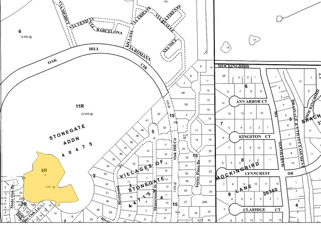
STONEGATE ADDITION-FT WORTH BLOCK 8R LOT A
06862551
Tarrant
Commercialacreage
Texas
B and X Area of moderate flood hazard, usually the area between the limits of the 100-year and 500-year floods.
a
2024
2.92 AC
2025
West Fort Worth
105403
Dallas/Ft Worth
14,899 SF
NEARBY LISTINGS FOR SALE OR LEASE
DEMOGRAPHICS near 4100 Stonegate Blvd
1 mile
3 mile
5 mile
2025 Total Population
9,400
116,085
309,457
2030 Population
9,986
123,002
327,822
Pop Growth 2025-2030
+ 6.23%
+ 5.96%
+ 5.93%
Average Age
38
37
38
2025 Total Households
4,290
48,564
123,546
HH Growth 2025-2030
+ 6.74%
+ 6.35%
+ 6.27%
Median Household Inc
$89,641
$77,684
$68,083
Avg Household Size
2.10
2.30
2.40
2025 Avg HH Vehicles
2.00
2.00
2.00
Median Home Value
$572,917
$432,270
$313,181
Median Year Built
1985
1973
1976
Nearby Places
Map Layers
Map Styles
 Street
 Aerial
Layers
 Traffic
 Biking
Places
Listings with unknown addresses are not visible on the map
- Restaurants
- Banks
- Shops
- Fitness
- Groceries
PUBLIC TRANSPORTATION
COMMUTER RAIL
Drive
Walk
Distance
12 min
6.0 mi
Drive
Walk
Distance
12 min
6.0 mi
AIRPORT
Dallas-Fort Worth International
Drive
Walk
Distance
Dallas-Fort Worth International
42 min
30.5 mi
Dallas Love Field
Drive
Walk
Distance
Dallas Love Field
53 min
39.2 mi
Nearby Properties
Address
Land Use
TOTAL SIZE
Lot Size
Zoning
Address
Land Use
TOTAL SIZE
Lot Size
Zoning
802,865 SF
17.38 AC
Address
Land Use
TOTAL SIZE
Lot Size
Zoning
1,135,360 SF
7.30 AC
Address
Land Use
TOTAL SIZE
Lot Size
Zoning
1,545,212 SF
8.90 AC
Address
Land Use
TOTAL SIZE
Lot Size
Zoning
505,069 SF
6.49 AC
Address
Land Use
TOTAL SIZE
Lot Size
Zoning
616,686 SF
2.82 AC
Address
Land Use
TOTAL SIZE
Lot Size
Zoning
438,943 SF
3.77 AC
Address
Land Use
TOTAL SIZE
Lot Size
Zoning
508,378 SF
6.02 AC
Address
Land Use
TOTAL SIZE
Lot Size
Zoning
477,907 SF
11.83 AC
Address
Land Use
TOTAL SIZE
Lot Size
Zoning
346,920 SF
9.88 AC
Address
Land Use
TOTAL SIZE
Lot Size
Zoning
482,938 SF
22.22 AC
Address
Land Use
TOTAL SIZE
Lot Size
Zoning
407,056 SF
17.20 AC
Address
Land Use
TOTAL SIZE
Lot Size
Zoning
509,560 SF
3.06 AC
Address
Land Use
TOTAL SIZE
Lot Size
Zoning
323,685 SF
19.61 AC
Address
Land Use
TOTAL SIZE
Lot Size
Zoning
353,842 SF
101.26 AC
Address
Land Use
TOTAL SIZE
Lot Size
Zoning
765,141 SF
56.28 AC
Address
Land Use
TOTAL SIZE
Lot Size
Zoning
336,310 SF
2.85 AC
Address
Land Use
TOTAL SIZE
Lot Size
Zoning
348,025 SF
26.33 AC
Address
Land Use
TOTAL SIZE
Lot Size
Zoning
382,376 SF
21.61 AC
Address
Land Use
TOTAL SIZE
Lot Size
Zoning
492,130 SF
6.55 AC
Address
Land Use
TOTAL SIZE
Lot Size
Zoning
437,641 SF
6.60 AC
Address
Land Use
TOTAL SIZE
Lot Size
Zoning
525,051 SF
6.87 AC
Address
Land Use
TOTAL SIZE
Lot Size
Zoning
283,106 SF
11.17 AC
Address
Land Use
TOTAL SIZE
Lot Size
Zoning
446,116 SF
12.50 AC
Address
Land Use
TOTAL SIZE
Lot Size
Zoning
411,395 SF
12.24 AC
Address
Land Use
TOTAL SIZE
Lot Size
Zoning
642,632 SF
27.73 AC
Address
Land Use
TOTAL SIZE
Lot Size
Zoning
355,125 SF
21.29 AC
Address
Land Use
TOTAL SIZE
Lot Size
Zoning
595,372 SF
12.24 AC
Address
Land Use
TOTAL SIZE
Lot Size
Zoning
350,654 SF
21.29 AC
Address
Land Use
TOTAL SIZE
Lot Size
Zoning
296,664 SF
14.71 AC
Address
Land Use
TOTAL SIZE
Lot Size
Zoning
220,000 SF
9.92 AC
The World's #1 Commercial Real Estate Marketplace
Connect with us
© 2026 CoStar Group
The information above has been obtained from sources believed reliable. While we do not doubt its accuracy we have not verified it and make no guarantee, warranty or representation about it. It is your responsibility to independently confirm its accuracy and completeness. Any projections, opinions, assumptions, or estimates used are for example only and do not represent the current or future performance of the property. The value of this transaction to you depends on tax and other factors which should be evaluated by your tax, financial, and legal advisors. You and your advisors should conduct a careful, independent investigation of the property to determine to your satisfaction the suitability of the property for your needs.