Property Record
4100 W Highway 372 Blvd, Pahrump, NV 89048

NEARBY LISTINGS FOR SALE OR LEASE
-
-
View all Pahrump listings for sale on LoopNet.com
Property Detail
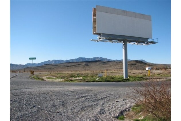
4100 W Highway 372 Blvd
Pahrump, NV
Northeast
27-611-33
T20S R52E S35 F#487265 TRACT 1 13AC P#12445
Commercialnec
Nye
AO
Nevada
32023C8905G
13 AC
2024
Carson City/Nevada Area
2025
Other Market Areas
960408
DEMOGRAPHICS near 4100 W Highway 372 Blvd
1 Mile
3 Mile
5 Mile
2024 Total Population
350
4,985
15,163
2029 Population
407
5,775
17,630
Pop Growth 2024-2029
+ 16.29%
+ 15.85%
+ 16.27%
Average Age
47
48
49
2024 Total Households
135
2,024
6,454
HH Growth 2024-2029
+ 16.30%
+ 15.91%
+ 16.36%
Median Household Inc
$71,911
$58,536
$53,233
Avg Household Size
2.40
2.40
2.30
2024 Avg HH Vehicles
3.00
2.00
2.00
Median Home Value
$312,500
$269,893
$244,425
Median Year Built
1997
1996
1996
Nearby Places
Map Layers
Map Styles
 Street
 Aerial
- Restaurants
- Banks
- Shops
- Fitness
- Groceries
Nearby Properties
Address
Land Use
TOTAL SIZE
Lot Size
Zoning
Address
Land Use
TOTAL SIZE
Lot Size
Zoning
9,564 SF
8.51 AC
CF
Address
Land Use
TOTAL SIZE
Lot Size
Zoning
8,330 SF
2.06 AC
NC
Address
Land Use
TOTAL SIZE
Lot Size
Zoning
75.78 AC
GC
Address
Land Use
TOTAL SIZE
Lot Size
Zoning
67.55 AC
GC
Address
Land Use
TOTAL SIZE
Lot Size
Zoning
4.97 AC
Address
Land Use
TOTAL SIZE
Lot Size
Zoning
Address
Land Use
TOTAL SIZE
Lot Size
Zoning
4,560 SF
9.42 AC
RH-4.5
Address
Land Use
TOTAL SIZE
Lot Size
Zoning
160 AC
R
Address
Land Use
TOTAL SIZE
Lot Size
Zoning
Address
Land Use
TOTAL SIZE
Lot Size
Zoning
42.51 AC
GC
Address
Land Use
TOTAL SIZE
Lot Size
Zoning
32.49 AC
GC
Address
Land Use
TOTAL SIZE
Lot Size
Zoning
29.95 AC
GC
Address
Land Use
TOTAL SIZE
Lot Size
Zoning
29.32 AC
GC
Address
Land Use
TOTAL SIZE
Lot Size
Zoning
6,014 SF
1 AC
RE-2
Address
Land Use
TOTAL SIZE
Lot Size
Zoning
25.13 AC
GC
Address
Land Use
TOTAL SIZE
Lot Size
Zoning
23.55 AC
GC
Address
Land Use
TOTAL SIZE
Lot Size
Zoning
2,776 SF
5 AC
RE-1
Address
Land Use
TOTAL SIZE
Lot Size
Zoning
2,060 SF
0.92 AC
RE-1
Address
Land Use
TOTAL SIZE
Lot Size
Zoning
13.62 AC
GC
Address
Land Use
TOTAL SIZE
Lot Size
Zoning
19.55 AC
GC
Address
Land Use
TOTAL SIZE
Lot Size
Zoning
13.63 AC
GC
Address
Land Use
TOTAL SIZE
Lot Size
Zoning
3,291 SF
1.03 AC
RE-1
Address
Land Use
TOTAL SIZE
Lot Size
Zoning
99.99 AC
RH-4.5
Address
Land Use
TOTAL SIZE
Lot Size
Zoning
12.30 AC
VC
Address
Land Use
TOTAL SIZE
Lot Size
Zoning
11.52 AC
GC
Address
Land Use
TOTAL SIZE
Lot Size
Zoning
21.51 AC
SPLIT
Address
Land Use
TOTAL SIZE
Lot Size
Zoning
4.13 AC
Address
Land Use
TOTAL SIZE
Lot Size
Zoning
80 AC
RH-4.5
Address
Land Use
TOTAL SIZE
Lot Size
Zoning
160 AC
RH-4.5
The World's #1 Commercial Real Estate Marketplace
Connect with us
© 2025 CoStar Group
The information above has been obtained from sources believed reliable. While we do not doubt its accuracy we have not verified it and make no guarantee, warranty or representation about it. It is your responsibility to independently confirm its accuracy and completeness. Any projections, opinions, assumptions, or estimates used are for example only and do not represent the current or future performance of the property. The value of this transaction to you depends on tax and other factors which should be evaluated by your tax, financial, and legal advisors. You and your advisors should conduct a careful, independent investigation of the property to determine to your satisfaction the suitability of the property for your needs.