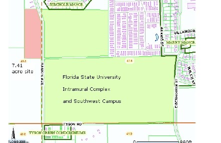
Property Record
4100 W Orange Ave W, Tallahassee, FL 32310

NEARBY LISTINGS FOR SALE OR LEASE
Property Detail
4100 W Orange Ave W
Tallahassee, FL
Unplatted Land
41-05-20-403-000.0
SECTION 5 T1S R1W OR 1803/1147 LESS 4499/602 5675/1913 (G L)
Shipyard
Leon
A
Florida
12073C0286F
63.95 AC
0
SW Tallahassee
2025
Tallahassee
002701
DEMOGRAPHICS near 4100 W Orange Ave W
1 Mile
3 Mile
5 Mile
2024 Total Population
2,779
37,397
112,628
2029 Population
2,964
38,895
117,864
Pop Growth 2024-2029
+ 6.66%
+ 4.01%
+ 4.65%
Average Age
33
30
32
2024 Total Households
1,075
15,592
46,546
HH Growth 2024-2029
+ 6.79%
+ 3.70%
+ 4.78%
Median Household Inc
$41,088
$29,400
$35,766
Avg Household Size
2.50
2.20
2.20
2024 Avg HH Vehicles
1.00
2.00
2.00
Median Home Value
$94,883
$114,408
$150,846
Median Year Built
1983
1985
1983
Nearby Places
Map Layers
Map Styles
 Street
 Aerial
- Restaurants
- Banks
- Shops
- Fitness
- Groceries
PUBLIC TRANSPORTATION
AIRPORT
Tallahassee International
DRIVE
WALK
Distance
Tallahassee International
6 min
2.3 mi
Freight Ports
Port of Panama City
DRIVE
WALK
Distance
Port of Panama City
139 min
97.6 mi
Nearby Properties
Address
Land Use
TOTAL SIZE
Lot Size
Zoning
Address
Land Use
TOTAL SIZE
Lot Size
Zoning
1,635,322 SF
29.76 AC
UT
Address
Land Use
TOTAL SIZE
Lot Size
Zoning
4,577,528 SF
108.47 AC
UT
Address
Land Use
TOTAL SIZE
Lot Size
Zoning
1,604,893 SF
175.71 AC
MR1
Address
Land Use
TOTAL SIZE
Lot Size
Zoning
704,857 SF
4.95 AC
UT
Address
Land Use
TOTAL SIZE
Lot Size
Zoning
959,505 SF
32.03 AC
M1
Address
Land Use
TOTAL SIZE
Lot Size
Zoning
664,514 SF
2.49 AC
UT
Address
Land Use
TOTAL SIZE
Lot Size
Zoning
981,563 SF
2,146.52 AC
GO2
Address
Land Use
TOTAL SIZE
Lot Size
Zoning
369,383 SF
4.51 AC
UT
Address
Land Use
TOTAL SIZE
Lot Size
Zoning
758,762 SF
20.82 AC
UT
Address
Land Use
TOTAL SIZE
Lot Size
Zoning
452,530 SF
10.30 AC
UV
Address
Land Use
TOTAL SIZE
Lot Size
Zoning
719,149 SF
40.73 AC
MR1
Address
Land Use
TOTAL SIZE
Lot Size
Zoning
445,676 SF
23.50 AC
PUD
Address
Land Use
TOTAL SIZE
Lot Size
Zoning
721,205 SF
6.19 AC
UT
Address
Land Use
TOTAL SIZE
Lot Size
Zoning
556,751 SF
20.60 AC
CP
Address
Land Use
TOTAL SIZE
Lot Size
Zoning
859,666 SF
20.17 AC
MR1
Address
Land Use
TOTAL SIZE
Lot Size
Zoning
479,705 SF
9.24 AC
UT
Address
Land Use
TOTAL SIZE
Lot Size
Zoning
538,290 SF
11.05 AC
Address
Land Use
TOTAL SIZE
Lot Size
Zoning
392,437 SF
10 AC
UT
Address
Land Use
TOTAL SIZE
Lot Size
Zoning
607,000 SF
37.55 AC
PUD
Address
Land Use
TOTAL SIZE
Lot Size
Zoning
828,694 SF
25.98 AC
MR1
Address
Land Use
TOTAL SIZE
Lot Size
Zoning
739,671 SF
20.04 AC
MR1
Address
Land Use
TOTAL SIZE
Lot Size
Zoning
1,048,414 SF
5.88 AC
UT
Address
Land Use
TOTAL SIZE
Lot Size
Zoning
660,721 SF
30.95 AC
Address
Land Use
TOTAL SIZE
Lot Size
Zoning
489,720 SF
2.07 AC
UPUD
Address
Land Use
TOTAL SIZE
Lot Size
Zoning
185,570 SF
13.08 AC
PUD
Address
Land Use
TOTAL SIZE
Lot Size
Zoning
358,501 SF
1.98 AC
UT
Address
Land Use
TOTAL SIZE
Lot Size
Zoning
309,700 SF
22.20 AC
UT
Address
Land Use
TOTAL SIZE
Lot Size
Zoning
196,915 SF
3.33 AC
UT
Address
Land Use
TOTAL SIZE
Lot Size
Zoning
153,404 SF
12.05 AC
M1
Address
Land Use
TOTAL SIZE
Lot Size
Zoning
463,831 SF
44.63 AC
M1
The World's #1 Commercial Real Estate Marketplace
Connect with us
© 2025 CoStar Group
The information above has been obtained from sources believed reliable. While we do not doubt its accuracy we have not verified it and make no guarantee, warranty or representation about it. It is your responsibility to independently confirm its accuracy and completeness. Any projections, opinions, assumptions, or estimates used are for example only and do not represent the current or future performance of the property. The value of this transaction to you depends on tax and other factors which should be evaluated by your tax, financial, and legal advisors. You and your advisors should conduct a careful, independent investigation of the property to determine to your satisfaction the suitability of the property for your needs.