Property Record
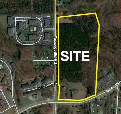
4100 Yanceyville Rd, Browns Summit, NC 27214

NEARBY LISTINGS FOR SALE OR LEASE
Property Detail
4100 Yanceyville Rd
Greensboro-High Point, NC
Exempt Plat Easement And Right Of Way De
0091124
19.33AC PIEDMONT CLASSICAL SCHOOL
Publicschool
Guilford
X
North Carolina
3710787700J
21
2023
19.33 AC
2025
NE Guilford County
012705
Greensboro/Winston-Salem
38,940 SF
DEMOGRAPHICS near 4100 Yanceyville Rd
1 Mile
3 Mile
5 Mile
2024 Total Population
9,640
53,598
121,454
2029 Population
9,579
53,560
121,472
Pop Growth 2024-2029
(0.63%)
(0.07%)
+ 0.01%
Average Age
34
39
39
2024 Total Households
3,765
21,878
49,396
HH Growth 2024-2029
(0.72%)
(0.14%)
0.00%
Median Household Inc
$50,941
$57,603
$57,604
Avg Household Size
2.50
2.40
2.30
2024 Avg HH Vehicles
2.00
2.00
2.00
Median Home Value
$160,714
$190,427
$198,606
Median Year Built
1997
1989
1981
Nearby Places
Map Layers
Map Styles
 Street
 Aerial
- Restaurants
- Banks
- Shops
- Fitness
- Groceries
PUBLIC TRANSPORTATION
COMMUTER RAIL
Greensboro Station (Piedmont - North Carolina by Train (NC Train))
DRIVE
WALK
Distance
Greensboro Station (Piedmont - North Carolina by Train (NC Train))
12 min
6.1 mi
AIRPORT
Piedmont Triad International
DRIVE
WALK
Distance
Piedmont Triad International
21 min
12.9 mi
Freight Ports
Virginia Port Authority - Richmond
DRIVE
WALK
Distance
Virginia Port Authority - Richmond
230 min
200.8 mi
Nearby Properties
Address
Land Use
TOTAL SIZE
Lot Size
Zoning
Address
Land Use
TOTAL SIZE
Lot Size
Zoning
646,229 SF
25.47 AC
LI
Address
Land Use
TOTAL SIZE
Lot Size
Zoning
223,891 SF
10.53 AC
PUD
Address
Land Use
TOTAL SIZE
Lot Size
Zoning
281,337 SF
20.64 AC
PUD
Address
Land Use
TOTAL SIZE
Lot Size
Zoning
252,109 SF
8.83 AC
PUD
Address
Land Use
TOTAL SIZE
Lot Size
Zoning
336,133 SF
23.93 AC
CU-RM-12
Address
Land Use
TOTAL SIZE
Lot Size
Zoning
171,358 SF
11.91 AC
PUD
Address
Land Use
TOTAL SIZE
Lot Size
Zoning
112,050 SF
9.24 AC
LI
Address
Land Use
TOTAL SIZE
Lot Size
Zoning
504,000 SF
42.01 AC
HI
Address
Land Use
TOTAL SIZE
Lot Size
Zoning
584,848 SF
32.91 AC
HI
Address
Land Use
TOTAL SIZE
Lot Size
Zoning
270,848 SF
18.28 AC
RM-18
Address
Land Use
TOTAL SIZE
Lot Size
Zoning
214,583 SF
20.64 AC
C-H
Address
Land Use
TOTAL SIZE
Lot Size
Zoning
259,434 SF
23.69 AC
RM-12
Address
Land Use
TOTAL SIZE
Lot Size
Zoning
168,798 SF
15.45 AC
RM-12
Address
Land Use
TOTAL SIZE
Lot Size
Zoning
236,995 SF
14.09 AC
RM-18
Address
Land Use
TOTAL SIZE
Lot Size
Zoning
204,260 SF
11.83 AC
RM-18
Address
Land Use
TOTAL SIZE
Lot Size
Zoning
99,926 SF
8.13 AC
O
Address
Land Use
TOTAL SIZE
Lot Size
Zoning
189,979 SF
44.76 AC
PI
Address
Land Use
TOTAL SIZE
Lot Size
Zoning
191,654 SF
11.31 AC
RM-12
Address
Land Use
TOTAL SIZE
Lot Size
Zoning
305,428 SF
13.72 AC
PUD
Address
Land Use
TOTAL SIZE
Lot Size
Zoning
119,780 SF
8.50 AC
PUD
Address
Land Use
TOTAL SIZE
Lot Size
Zoning
127,976 SF
40.04 AC
R-3
Address
Land Use
TOTAL SIZE
Lot Size
Zoning
167,490 SF
11.51 AC
C-H
Address
Land Use
TOTAL SIZE
Lot Size
Zoning
227,536 SF
20.57 AC
RM-12
Address
Land Use
TOTAL SIZE
Lot Size
Zoning
103,218 SF
11.65 AC
RM-12
Address
Land Use
TOTAL SIZE
Lot Size
Zoning
65,185 SF
26.29 AC
R-3
Address
Land Use
TOTAL SIZE
Lot Size
Zoning
257,713 SF
24.07 AC
HI
Address
Land Use
TOTAL SIZE
Lot Size
Zoning
110,908 SF
10.10 AC
C-H
Address
Land Use
TOTAL SIZE
Lot Size
Zoning
243,880 SF
29.56 AC
HI
Address
Land Use
TOTAL SIZE
Lot Size
Zoning
18.71 AC
R-3
The World's #1 Commercial Real Estate Marketplace
Connect with us
© 2025 CoStar Group
The information above has been obtained from sources believed reliable. While we do not doubt its accuracy we have not verified it and make no guarantee, warranty or representation about it. It is your responsibility to independently confirm its accuracy and completeness. Any projections, opinions, assumptions, or estimates used are for example only and do not represent the current or future performance of the property. The value of this transaction to you depends on tax and other factors which should be evaluated by your tax, financial, and legal advisors. You and your advisors should conduct a careful, independent investigation of the property to determine to your satisfaction the suitability of the property for your needs.