Property Record
4101 Anderson Ave, Manhattan, KS 66503


NEARBY LISTINGS FOR SALE OR LEASE
Property Detail
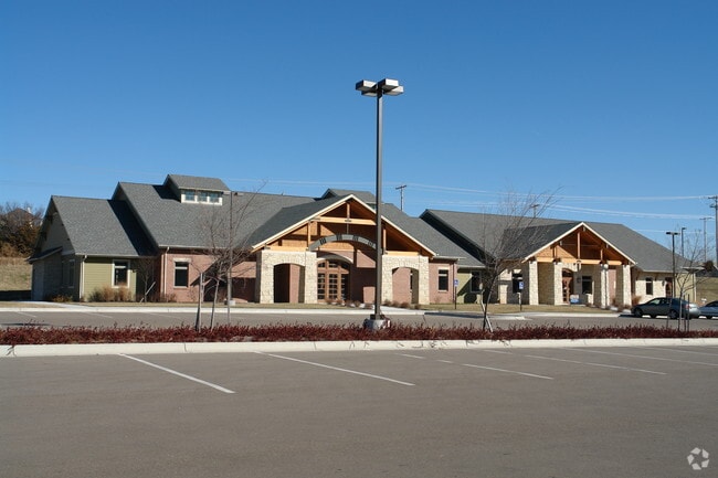
4101 Anderson Ave
212-10-0-00-00-005.00-0
Stone Creek
Medicalbuilding
STONE CREEK, LOT 1, ACRES 4.4, SECTION 10 TOWNSHIP 10 RANGE 07E
X
Riley
20161C0334G
Kansas
2024
1
2025
4.45 AC
000602
Other Market Areas
22,087 SF
Manhattan, KS
DEMOGRAPHICS near 4101 Anderson Ave
1 Mile
3 Mile
5 Mile
2024 Total Population
5,208
33,058
57,206
2029 Population
5,203
33,087
57,240
Pop Growth 2024-2029
(0.10%)
+ 0.09%
+ 0.06%
Average Age
37
34
33
2024 Total Households
2,092
12,687
22,769
HH Growth 2024-2029
(0.33%)
+ 0.06%
(0.03%)
Median Household Inc
$112,663
$83,317
$57,249
Avg Household Size
2.40
2.20
2.20
2024 Avg HH Vehicles
2.00
2.00
2.00
Median Home Value
$299,391
$263,243
$231,259
Median Year Built
2001
1986
1983
Nearby Places
Map Layers
Map Styles
 Street
 Aerial
- Restaurants
- Banks
- Shops
- Fitness
- Groceries
PUBLIC TRANSPORTATION
AIRPORT
Manhattan Regional
DRIVE
WALK
Distance
Manhattan Regional
14 min
6.2 mi
Nearby Properties
Address
Land Use
TOTAL SIZE
Lot Size
Zoning
Address
Land Use
TOTAL SIZE
Lot Size
Zoning
4,748,887 SF
261.83 AC
U
Address
Land Use
TOTAL SIZE
Lot Size
Zoning
125.53 AC
U
Address
Land Use
TOTAL SIZE
Lot Size
Zoning
1,084,753 SF
69.85 AC
U
Address
Land Use
TOTAL SIZE
Lot Size
Zoning
518,756 SF
11.88 AC
U
Address
Land Use
TOTAL SIZE
Lot Size
Zoning
69,440 SF
27.76 AC
U
Address
Land Use
TOTAL SIZE
Lot Size
Zoning
41,664 SF
22.69 AC
U
Address
Land Use
TOTAL SIZE
Lot Size
Zoning
132.41 AC
U
Address
Land Use
TOTAL SIZE
Lot Size
Zoning
347,291 SF
21.20 AC
R
Address
Land Use
TOTAL SIZE
Lot Size
Zoning
126,616 SF
33.30 AC
R1
Address
Land Use
TOTAL SIZE
Lot Size
Zoning
1,920 SF
4.47 AC
Address
Land Use
TOTAL SIZE
Lot Size
Zoning
71,182 SF
11.80 AC
R
Address
Land Use
TOTAL SIZE
Lot Size
Zoning
89,898 SF
5.48 AC
R3
Address
Land Use
TOTAL SIZE
Lot Size
Zoning
46,653 SF
0.85 AC
U
Address
Land Use
TOTAL SIZE
Lot Size
Zoning
91,968 SF
5.69 AC
PUD
Address
Land Use
TOTAL SIZE
Lot Size
Zoning
71,899 SF
5.50 AC
R
Address
Land Use
TOTAL SIZE
Lot Size
Zoning
32,402 SF
5.76 AC
R
Address
Land Use
TOTAL SIZE
Lot Size
Zoning
67,276 SF
9 AC
R
Address
Land Use
TOTAL SIZE
Lot Size
Zoning
56,522 SF
17.60 AC
ROW
Address
Land Use
TOTAL SIZE
Lot Size
Zoning
25,505 SF
2.46 AC
U
Address
Land Use
TOTAL SIZE
Lot Size
Zoning
64,310 SF
9.64 AC
R
Address
Land Use
TOTAL SIZE
Lot Size
Zoning
46,607 SF
3 AC
Address
Land Use
TOTAL SIZE
Lot Size
Zoning
37,416 SF
0.29 AC
R1
Address
Land Use
TOTAL SIZE
Lot Size
Zoning
15.72 AC
Address
Land Use
TOTAL SIZE
Lot Size
Zoning
7,914 SF
5.70 AC
R3
Address
Land Use
TOTAL SIZE
Lot Size
Zoning
58,446 SF
8.45 AC
R
Address
Land Use
TOTAL SIZE
Lot Size
Zoning
1,387 SF
19 AC
R
Address
Land Use
TOTAL SIZE
Lot Size
Zoning
7,320 SF
55.90 AC
R
Address
Land Use
TOTAL SIZE
Lot Size
Zoning
27,808 SF
21.64 AC
PUD
Address
Land Use
TOTAL SIZE
Lot Size
Zoning
28,453 SF
2.09 AC
R
Address
Land Use
TOTAL SIZE
Lot Size
Zoning
12,875 SF
11.88 AC
U
The World's #1 Commercial Real Estate Marketplace
Connect with us
© 2026 CoStar Group
The information above has been obtained from sources believed reliable. While we do not doubt its accuracy we have not verified it and make no guarantee, warranty or representation about it. It is your responsibility to independently confirm its accuracy and completeness. Any projections, opinions, assumptions, or estimates used are for example only and do not represent the current or future performance of the property. The value of this transaction to you depends on tax and other factors which should be evaluated by your tax, financial, and legal advisors. You and your advisors should conduct a careful, independent investigation of the property to determine to your satisfaction the suitability of the property for your needs.