Property Record
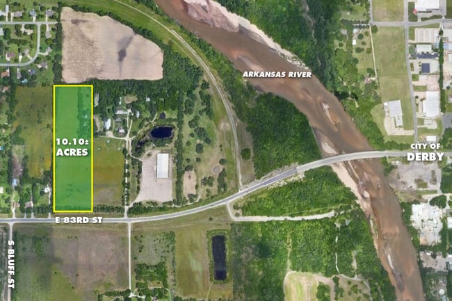
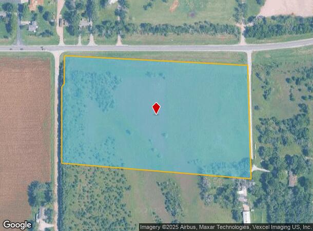
4101 E 83Rd St S, Derby, KS 67037
NEARBY LISTINGS FOR SALE OR LEASE
Property Detail
4101 E 83Rd St S
241-11-0-42-00-001.00
BEG NW COR SE1/4 E TO PT 1480.34 FTW OF NE COR SLY 783.18 FT NWLY 1192.12 FT TO PT W LI 629.76 FT N SW COR N1/2 SE1/4 TH N TO BEG EXC RDS SEC 11-29-1E
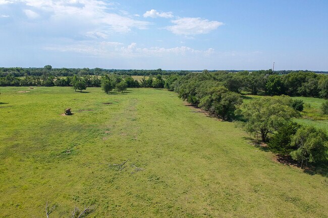
Farms
Sedgwick
AE
Kansas
20173C0516G
0.54 AC
2024
Derby/Haysville/Mulvane
2025
Wichita
009803
Wichita, KS
DEMOGRAPHICS near 4101 E 83Rd St S
1 Mile
3 Mile
5 Mile
2024 Total Population
541
24,989
55,210
2029 Population
548
25,035
55,615
Pop Growth 2024-2029
+ 1.29%
+ 0.18%
+ 0.73%
Average Age
42
39
39
2024 Total Households
210
9,571
20,907
HH Growth 2024-2029
+ 1.43%
(0.03%)
+ 0.56%
Median Household Inc
$76,786
$71,862
$67,610
Avg Household Size
2.50
2.60
2.60
2024 Avg HH Vehicles
2.00
2.00
2.00
Median Home Value
$202,459
$188,744
$167,425
Median Year Built
1976
1986
1986
Nearby Places
Map Layers
Map Styles
 Street
 Aerial
- Restaurants
- Banks
- Shops
- Fitness
- Groceries
PUBLIC TRANSPORTATION
AIRPORT
Wichita Dwight D Eisenhower Ntl
DRIVE
WALK
Distance
Wichita Dwight D Eisenhower Ntl
29 min
18.2 mi
Freight Ports
Tulsa Port Of Catoosa
DRIVE
WALK
Distance
Tulsa Port Of Catoosa
202 min
184.1 mi
SALE & LEASE HISTORY
LISTING DATE
SALE/LEASE

Aug 21, 2020
For Sale
Nearby Properties
Address
Land Use
TOTAL SIZE
Lot Size
Zoning
Address
Land Use
TOTAL SIZE
Lot Size
Zoning
308,541 SF
66.86 AC
R1
Address
Land Use
TOTAL SIZE
Lot Size
Zoning
202,301 SF
34.22 AC
R1
Address
Land Use
TOTAL SIZE
Lot Size
Zoning
102,574 SF
19.96 AC
R1
Address
Land Use
TOTAL SIZE
Lot Size
Zoning
42,611 SF
7.01 AC
B3
Address
Land Use
TOTAL SIZE
Lot Size
Zoning
64,858 SF
11.39 AC
R1
Address
Land Use
TOTAL SIZE
Lot Size
Zoning
67,322 SF
9.05 AC
R1
Address
Land Use
TOTAL SIZE
Lot Size
Zoning
72,472 SF
2.73 AC
R3
Address
Land Use
TOTAL SIZE
Lot Size
Zoning
37,640 SF
9.36 AC
Address
Land Use
TOTAL SIZE
Lot Size
Zoning
62,829 SF
7.15 AC
R1
Address
Land Use
TOTAL SIZE
Lot Size
Zoning
37,860 SF
4.77 AC
R1
Address
Land Use
TOTAL SIZE
Lot Size
Zoning
35,032 SF
12.62 AC
I1
Address
Land Use
TOTAL SIZE
Lot Size
Zoning
49,454 SF
23 AC
Address
Land Use
TOTAL SIZE
Lot Size
Zoning
53,691 SF
8.23 AC
R1
Address
Land Use
TOTAL SIZE
Lot Size
Zoning
21,420 SF
2.39 AC
R1
Address
Land Use
TOTAL SIZE
Lot Size
Zoning
41,961 SF
3.60 AC
B3
Address
Land Use
TOTAL SIZE
Lot Size
Zoning
16,392 SF
10.14 AC
R1
Address
Land Use
TOTAL SIZE
Lot Size
Zoning
52,285 SF
21.20 AC
R3
Address
Land Use
TOTAL SIZE
Lot Size
Zoning
43,300 SF
6.10 AC
I1
Address
Land Use
TOTAL SIZE
Lot Size
Zoning
33,846 SF
3.25 AC
R3
Address
Land Use
TOTAL SIZE
Lot Size
Zoning
24,900 SF
4.30 AC
Address
Land Use
TOTAL SIZE
Lot Size
Zoning
15,464 SF
0.24 AC
B4
Address
Land Use
TOTAL SIZE
Lot Size
Zoning
30,808 SF
1.99 AC
B3
Address
Land Use
TOTAL SIZE
Lot Size
Zoning
195,720 SF
9.87 AC
B5
Address
Land Use
TOTAL SIZE
Lot Size
Zoning
22,088 SF
1.62 AC
B4
Address
Land Use
TOTAL SIZE
Lot Size
Zoning
14,024 SF
2.10 AC
R1
Address
Land Use
TOTAL SIZE
Lot Size
Zoning
17,020 SF
0.83 AC
B3
Address
Land Use
TOTAL SIZE
Lot Size
Zoning
135,941 SF
15.11 AC
B5
Address
Land Use
TOTAL SIZE
Lot Size
Zoning
6,174 SF
9.32 AC
Address
Land Use
TOTAL SIZE
Lot Size
Zoning
21,400 SF
15.45 AC
R3
Address
Land Use
TOTAL SIZE
Lot Size
Zoning
14,261 SF
1 AC
B3
The World's #1 Commercial Real Estate Marketplace
Connect with us
© 2026 CoStar Group
The information above has been obtained from sources believed reliable. While we do not doubt its accuracy we have not verified it and make no guarantee, warranty or representation about it. It is your responsibility to independently confirm its accuracy and completeness. Any projections, opinions, assumptions, or estimates used are for example only and do not represent the current or future performance of the property. The value of this transaction to you depends on tax and other factors which should be evaluated by your tax, financial, and legal advisors. You and your advisors should conduct a careful, independent investigation of the property to determine to your satisfaction the suitability of the property for your needs.