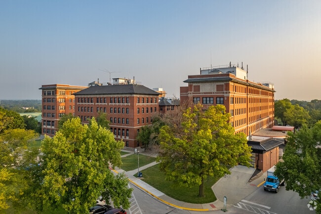
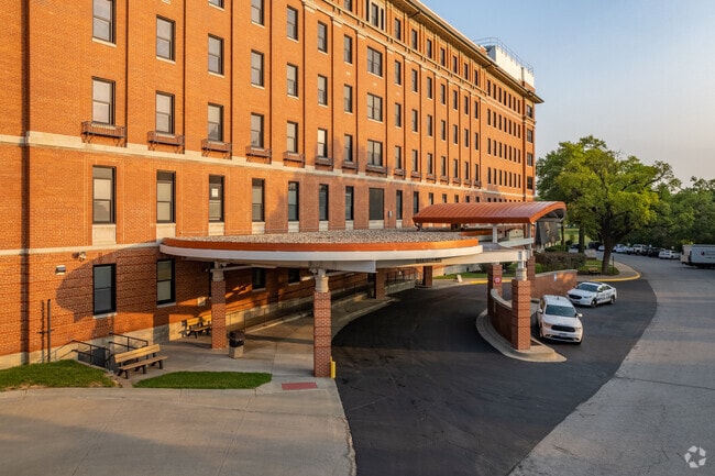
Property Record
4101 S 4Th St, Leavenworth, KS 66048
NEARBY LISTINGS FOR SALE OR LEASE
Property Detail
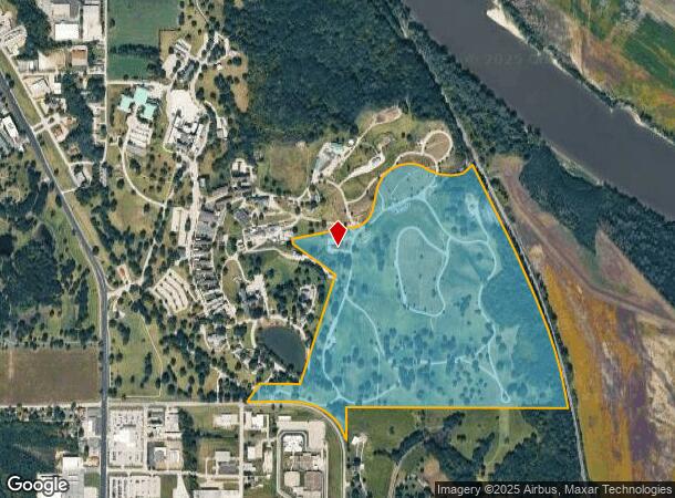
4101 S 4Th St
093-07-0-00-00-002.02-0
S07, T09, R23E, ACRES 133.73, PT SW1/4 & SE1/4;BEG 234.2W SE COR SE1/4, WLY2460, S300, NWLY642, W595, NLY259.7, E459, NLY1265, NWLY615, ELY885, NLY494, ELY1126 TO POB AKA NATIONAL CEMETARY
Cemetery
Leavenworth
AE
Kansas
20103C0144G
133.73 AC
0
Leavenworth County
2025
Kansas City
071102
Kansas City, MO-KS
7,780 SF
DEMOGRAPHICS near 4101 S 4Th St
1 Mile
3 Mile
5 Mile
2024 Total Population
3,475
29,284
50,940
2029 Population
3,582
30,156
52,609
Pop Growth 2024-2029
+ 3.08%
+ 2.98%
+ 3.28%
Average Age
39
41
39
2024 Total Households
1,080
10,979
17,781
HH Growth 2024-2029
+ 3.33%
+ 3.26%
+ 3.59%
Median Household Inc
$48,987
$64,421
$73,816
Avg Household Size
2.20
2.40
2.50
2024 Avg HH Vehicles
2.00
2.00
2.00
Median Home Value
$169,591
$177,328
$184,221
Median Year Built
1979
1973
1975
Nearby Places
Map Layers
Map Styles
 Street
 Aerial
- Restaurants
- Banks
- Shops
- Fitness
- Groceries
PUBLIC TRANSPORTATION
AIRPORT
Kansas City International
DRIVE
WALK
Distance
Kansas City International
38 min
22.0 mi
Freight Ports
Tulsa Port Of Catoosa
DRIVE
WALK
Distance
Tulsa Port Of Catoosa
291 min
253.9 mi
SALE & LEASE HISTORY
LISTING DATE
SALE/LEASE

Apr 20, 2020
For Sale
Nearby Properties
Address
Land Use
TOTAL SIZE
Lot Size
Zoning
Address
Land Use
TOTAL SIZE
Lot Size
Zoning
2,949 SF
398.40 AC
Address
Land Use
TOTAL SIZE
Lot Size
Zoning
546,636 SF
143.55 AC
Address
Land Use
TOTAL SIZE
Lot Size
Zoning
252,443 SF
61.24 AC
Address
Land Use
TOTAL SIZE
Lot Size
Zoning
99,467 SF
6.14 AC
Address
Land Use
TOTAL SIZE
Lot Size
Zoning
173,524 SF
17.52 AC
Address
Land Use
TOTAL SIZE
Lot Size
Zoning
141,398 SF
24.20 AC
Address
Land Use
TOTAL SIZE
Lot Size
Zoning
247,316 SF
192.75 AC
Address
Land Use
TOTAL SIZE
Lot Size
Zoning
200,862 SF
39.51 AC
Address
Land Use
TOTAL SIZE
Lot Size
Zoning
89,647 SF
24.76 AC
Address
Land Use
TOTAL SIZE
Lot Size
Zoning
48,496 SF
1.21 AC
Address
Land Use
TOTAL SIZE
Lot Size
Zoning
59,298 SF
9.20 AC
Address
Land Use
TOTAL SIZE
Lot Size
Zoning
26,066 SF
1.15 AC
Address
Land Use
TOTAL SIZE
Lot Size
Zoning
97,084 SF
2.87 AC
Address
Land Use
TOTAL SIZE
Lot Size
Zoning
28,224 SF
2.50 AC
Address
Land Use
TOTAL SIZE
Lot Size
Zoning
38,680 SF
4.30 AC
Address
Land Use
TOTAL SIZE
Lot Size
Zoning
48,527 SF
19.79 AC
Address
Land Use
TOTAL SIZE
Lot Size
Zoning
24,453 SF
1.57 AC
Address
Land Use
TOTAL SIZE
Lot Size
Zoning
15,241 SF
2.90 AC
Address
Land Use
TOTAL SIZE
Lot Size
Zoning
32,463 SF
7.60 AC
Address
Land Use
TOTAL SIZE
Lot Size
Zoning
203,193 SF
33.15 AC
Address
Land Use
TOTAL SIZE
Lot Size
Zoning
16,512 SF
1.17 AC
Address
Land Use
TOTAL SIZE
Lot Size
Zoning
346.96 AC
Address
Land Use
TOTAL SIZE
Lot Size
Zoning
42,056 SF
4.35 AC
Address
Land Use
TOTAL SIZE
Lot Size
Zoning
117,680 SF
8.49 AC
Address
Land Use
TOTAL SIZE
Lot Size
Zoning
25,661 SF
3.47 AC
Address
Land Use
TOTAL SIZE
Lot Size
Zoning
54,765 SF
4.02 AC
Address
Land Use
TOTAL SIZE
Lot Size
Zoning
20,526 SF
0.93 AC
Address
Land Use
TOTAL SIZE
Lot Size
Zoning
70.64 AC
Address
Land Use
TOTAL SIZE
Lot Size
Zoning
55,961 SF
22.45 AC
The World's #1 Commercial Real Estate Marketplace
Connect with us
© 2025 CoStar Group
The information above has been obtained from sources believed reliable. While we do not doubt its accuracy we have not verified it and make no guarantee, warranty or representation about it. It is your responsibility to independently confirm its accuracy and completeness. Any projections, opinions, assumptions, or estimates used are for example only and do not represent the current or future performance of the property. The value of this transaction to you depends on tax and other factors which should be evaluated by your tax, financial, and legal advisors. You and your advisors should conduct a careful, independent investigation of the property to determine to your satisfaction the suitability of the property for your needs.