Property Record
4101 S Sheridan Rd, Lennon, MI 48449

NEARBY LISTINGS FOR SALE OR LEASE
-
-
View all Lennon listings for sale on LoopNet.com
Property Detail
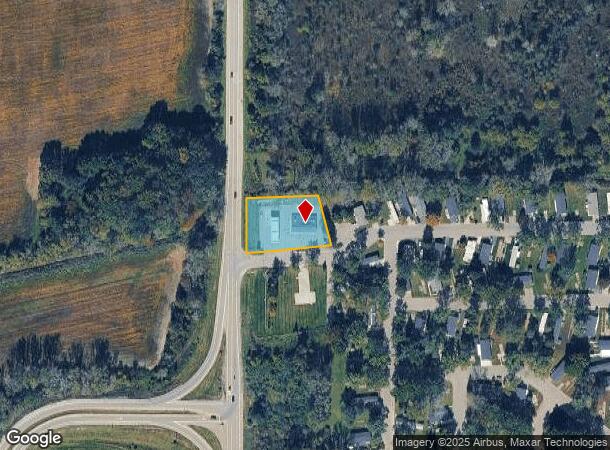
4101 S Sheridan Rd
04-31-100-013
A PARCEL OF LAND BEG N 0 DEG 41 MIN 34 SEC W 303.04 FT & S 88 DEG 42 MIN 40 SEC W 5189.18 FT & N 0 DEG 20 MIN 58 SEC E 867.41
Commercialnec
Genesee
X
Michigan
26155C0300C
0.98 AC
2024
Flint
2025
Detroit
012703
Flint, MI
3,105 SF
DEMOGRAPHICS near 4101 S Sheridan Rd
1 Mile
3 Mile
5 Mile
2024 Total Population
885
4,151
16,244
2029 Population
881
4,158
16,010
Pop Growth 2024-2029
(0.45%)
+ 0.17%
(1.44%)
Average Age
40
45
43
2024 Total Households
345
1,733
6,704
HH Growth 2024-2029
(0.58%)
+ 0.58%
(1.28%)
Median Household Inc
$42,870
$60,189
$58,759
Avg Household Size
2.60
2.40
2.40
2024 Avg HH Vehicles
2.00
2.00
2.00
Median Home Value
$125,781
$161,527
$161,172
Median Year Built
1992
1972
1969
Nearby Places
Map Layers
Map Styles
 Street
 Aerial
- Restaurants
- Banks
- Shops
- Fitness
- Groceries
PUBLIC TRANSPORTATION
COMMUTER RAIL
Durand Amtrak Station (Blue Water - Amtrak)
DRIVE
WALK
Distance
Durand Amtrak Station (Blue Water - Amtrak)
12 min
5.7 mi
AIRPORT
Bishop International
DRIVE
WALK
Distance
Bishop International
23 min
12.2 mi
Freight Ports
Port of Toledo
DRIVE
WALK
Distance
Port of Toledo
141 min
121.1 mi
Nearby Properties
Address
Land Use
TOTAL SIZE
Lot Size
Zoning
Address
Land Use
TOTAL SIZE
Lot Size
Zoning
Address
Land Use
TOTAL SIZE
Lot Size
Zoning
4,241 SF
107.20 AC
RMH,MOB
Address
Land Use
TOTAL SIZE
Lot Size
Zoning
Address
Land Use
TOTAL SIZE
Lot Size
Zoning
11.10 AC
Address
Land Use
TOTAL SIZE
Lot Size
Zoning
32.90 AC
Address
Land Use
TOTAL SIZE
Lot Size
Zoning
157.53 AC
Address
Land Use
TOTAL SIZE
Lot Size
Zoning
3,278 SF
197.90 AC
RA,AGRI
Address
Land Use
TOTAL SIZE
Lot Size
Zoning
19,404 SF
1.97 AC
RM
Address
Land Use
TOTAL SIZE
Lot Size
Zoning
27.60 AC
Address
Land Use
TOTAL SIZE
Lot Size
Zoning
7.70 AC
Address
Land Use
TOTAL SIZE
Lot Size
Zoning
21,104 SF
7.83 AC
GC,GENE
Address
Land Use
TOTAL SIZE
Lot Size
Zoning
118.44 AC
Address
Land Use
TOTAL SIZE
Lot Size
Zoning
2.40 AC
Address
Land Use
TOTAL SIZE
Lot Size
Zoning
10.10 AC
Address
Land Use
TOTAL SIZE
Lot Size
Zoning
156.80 AC
Address
Land Use
TOTAL SIZE
Lot Size
Zoning
Address
Land Use
TOTAL SIZE
Lot Size
Zoning
153.65 AC
Address
Land Use
TOTAL SIZE
Lot Size
Zoning
11,336 SF
4.73 AC
LC,LOCA
Address
Land Use
TOTAL SIZE
Lot Size
Zoning
92.10 AC
Address
Land Use
TOTAL SIZE
Lot Size
Zoning
1.90 AC
Address
Land Use
TOTAL SIZE
Lot Size
Zoning
153 AC
Address
Land Use
TOTAL SIZE
Lot Size
Zoning
Address
Land Use
TOTAL SIZE
Lot Size
Zoning
100 AC
Address
Land Use
TOTAL SIZE
Lot Size
Zoning
2,490 SF
102 AC
RR
Address
Land Use
TOTAL SIZE
Lot Size
Zoning
145.20 AC
Address
Land Use
TOTAL SIZE
Lot Size
Zoning
1,764 SF
40 AC
RA,AGRI
Address
Land Use
TOTAL SIZE
Lot Size
Zoning
2,128 SF
76 AC
RA,AGRI
Address
Land Use
TOTAL SIZE
Lot Size
Zoning
4,796 SF
1.05 AC
GC,GENE
Address
Land Use
TOTAL SIZE
Lot Size
Zoning
2,515 SF
70.94 AC
RA,AGRI
Address
Land Use
TOTAL SIZE
Lot Size
Zoning
2,032 SF
89.82 AC
AG-1
The World's #1 Commercial Real Estate Marketplace
Connect with us
© 2025 CoStar Group
The information above has been obtained from sources believed reliable. While we do not doubt its accuracy we have not verified it and make no guarantee, warranty or representation about it. It is your responsibility to independently confirm its accuracy and completeness. Any projections, opinions, assumptions, or estimates used are for example only and do not represent the current or future performance of the property. The value of this transaction to you depends on tax and other factors which should be evaluated by your tax, financial, and legal advisors. You and your advisors should conduct a careful, independent investigation of the property to determine to your satisfaction the suitability of the property for your needs.