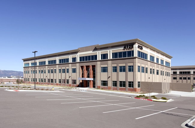
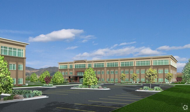
Property Record
4105 Briargate Pkwy, Colorado Springs, CO 80920
NEARBY LISTINGS FOR SALE OR LEASE
Property Detail
4105 Briargate Pkwy
Colorado Springs, CO
Briargate Parkway Medical Campus Fil No1
62352-10-009
IMP ONLY LOCATED ON LOT 1 BRIARGATE PKWY MEDICAL CAMPUS FIL NO 1
Miscellaneous
El Paso
X
Colorado
08041C0509G
1
2024
0.03 AC
2025
Northeast
007103
Colorado Springs
166,926 SF
DEMOGRAPHICS near 4105 Briargate Pkwy
1 Mile
3 Mile
5 Mile
2024 Total Population
13,076
81,046
183,090
2029 Population
13,771
85,477
192,255
Pop Growth 2024-2029
+ 5.32%
+ 5.47%
+ 5.01%
Average Age
38
37
38
2024 Total Households
4,463
29,027
67,818
HH Growth 2024-2029
+ 5.51%
+ 5.65%
+ 5.14%
Median Household Inc
$125,563
$108,714
$99,961
Avg Household Size
2.90
2.70
2.70
2024 Avg HH Vehicles
2.00
2.00
2.00
Median Home Value
$464,782
$451,014
$440,731
Median Year Built
1998
2000
1998
Nearby Places
- Restaurants
- Banks
- Shops
- Fitness
- Groceries
PUBLIC TRANSPORTATION
AIRPORT
City of Colorado Springs Municipal
DRIVE
WALK
Distance
City of Colorado Springs Municipal
24 min
13.6 mi
Freight Ports
Tulsa Port Of Catoosa
DRIVE
WALK
Distance
Tulsa Port Of Catoosa
732 min
688.6 mi
SALE & LEASE HISTORY
LISTING DATE
SALE/LEASE

Jun 28, 2022
For Lease
Nearby Properties
Address
Land Use
TOTAL SIZE
Lot Size
Zoning
Address
Land Use
TOTAL SIZE
Lot Size
Zoning
1,129,761 SF
32.88 AC
MX-M HR AO
Address
Land Use
TOTAL SIZE
Lot Size
Zoning
361,165 SF
59.11 AC
PDZ
Address
Land Use
TOTAL SIZE
Lot Size
Zoning
261,339 SF
10.42 AC
MX-M CU
Address
Land Use
TOTAL SIZE
Lot Size
Zoning
356,093 SF
16.27 AC
R-5 AO SS
Address
Land Use
TOTAL SIZE
Lot Size
Zoning
257,140 SF
30.17 AC
MX-N/CR MX
Address
Land Use
TOTAL SIZE
Lot Size
Zoning
121,820 SF
14.73 AC
BP
Address
Land Use
TOTAL SIZE
Lot Size
Zoning
187,841 SF
40.33 AC
A
Address
Land Use
TOTAL SIZE
Lot Size
Zoning
95,337 SF
49.29 AC
BP
Address
Land Use
TOTAL SIZE
Lot Size
Zoning
103,166 SF
8.88 AC
BP
Address
Land Use
TOTAL SIZE
Lot Size
Zoning
82,316 SF
4.08 AC
R-5/CR SS
Address
Land Use
TOTAL SIZE
Lot Size
Zoning
56,290 SF
6.55 AC
A/CR
Address
Land Use
TOTAL SIZE
Lot Size
Zoning
43,033 SF
17 AC
MX-M AO
Address
Land Use
TOTAL SIZE
Lot Size
Zoning
114,474 SF
12.95 AC
BP
Address
Land Use
TOTAL SIZE
Lot Size
Zoning
480 SF
11 AC
A UV
Address
Land Use
TOTAL SIZE
Lot Size
Zoning
1,251,233 SF
17.63 AC
BP/CR HR
Address
Land Use
TOTAL SIZE
Lot Size
Zoning
58,774 SF
5 AC
BP
Address
Land Use
TOTAL SIZE
Lot Size
Zoning
41,117 SF
5.04 AC
MX-M
Address
Land Use
TOTAL SIZE
Lot Size
Zoning
64,928 SF
31.47 AC
A
Address
Land Use
TOTAL SIZE
Lot Size
Zoning
391,914 SF
3.13 AC
PDZ
Address
Land Use
TOTAL SIZE
Lot Size
Zoning
35,862 SF
5.95 AC
MX-N
Address
Land Use
TOTAL SIZE
Lot Size
Zoning
211,974 SF
25.15 AC
BP CU
Address
Land Use
TOTAL SIZE
Lot Size
Zoning
76,138 SF
4.84 AC
BP
Address
Land Use
TOTAL SIZE
Lot Size
Zoning
48,673 SF
5.51 AC
R-5 P
Address
Land Use
TOTAL SIZE
Lot Size
Zoning
45,141 SF
6.97 AC
R-5/CR
Address
Land Use
TOTAL SIZE
Lot Size
Zoning
50,471 SF
7.28 AC
BP
Address
Land Use
TOTAL SIZE
Lot Size
Zoning
47,313 SF
11.15 AC
MX-N
Address
Land Use
TOTAL SIZE
Lot Size
Zoning
25,194 SF
4 AC
R-5 P
Address
Land Use
TOTAL SIZE
Lot Size
Zoning
14,866 SF
12.71 AC
A
Address
Land Use
TOTAL SIZE
Lot Size
Zoning
121,372 SF
59.10 AC
Address
Land Use
TOTAL SIZE
Lot Size
Zoning
241,088 SF
10.03 AC
BP HR
The World's #1 Commercial Real Estate Marketplace
Connect with us
© 2025 CoStar Group
The information above has been obtained from sources believed reliable. While we do not doubt its accuracy we have not verified it and make no guarantee, warranty or representation about it. It is your responsibility to independently confirm its accuracy and completeness. Any projections, opinions, assumptions, or estimates used are for example only and do not represent the current or future performance of the property. The value of this transaction to you depends on tax and other factors which should be evaluated by your tax, financial, and legal advisors. You and your advisors should conduct a careful, independent investigation of the property to determine to your satisfaction the suitability of the property for your needs.