Property Record
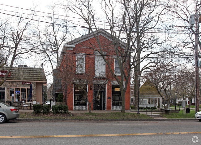
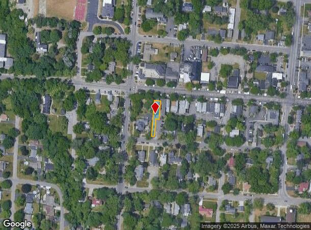
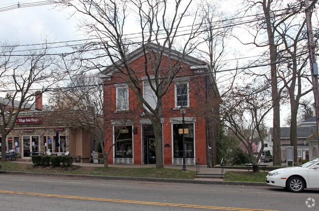
411 Center St, Lewiston, NY 14092
NEARBY LISTINGS FOR SALE OR LEASE
-
-
No Photo
-
View all Lewiston listings for sale on LoopNet.com
Property Detail
411 Center St
292401-101-010-0003-055-000
610202 LT 252 BK00
Commercialofficeresidentialmixeduse
Niagara
X
New York
36063C0166F
55.000
2025
0.16 AC
2024
Outlying Niagara County
024401
Buffalo/Niagara Falls
2,600 SF
Buffalo-Cheektowaga-Niagara Falls, NY
DEMOGRAPHICS near 411 Center St
1 Mile
3 Mile
5 Mile
2024 Total Population
4,203
13,002
35,018
2029 Population
4,169
12,905
34,796
Pop Growth 2024-2029
(0.81%)
(0.75%)
(0.63%)
Average Age
48
44
42
2024 Total Households
2,003
5,271
14,607
HH Growth 2024-2029
(0.80%)
(0.74%)
(0.64%)
Median Household Inc
$71,688
$71,401
$56,673
Avg Household Size
2.10
2.20
2.20
2024 Avg HH Vehicles
2.00
2.00
2.00
Median Home Value
$256,682
$255,196
$178,549
Median Year Built
1961
1967
1955
Nearby Places
- Restaurants
- Banks
- Shops
- Fitness
- Groceries
PUBLIC TRANSPORTATION
COMMUTER RAIL
Niagara Falls Station (Toronto - New York - VIA Rail)
DRIVE
WALK
Distance
Niagara Falls Station (Toronto - New York - VIA Rail)
9 min
5.7 mi
Niagara Falls Amtrak Station (Empire Service - Amtrak, Maple Leaf - Amtrak)
DRIVE
WALK
Distance
Niagara Falls Amtrak Station (Empire Service - Amtrak, Maple Leaf - Amtrak)
10 min
5.7 mi
AIRPORT
Niagara Falls International
DRIVE
WALK
Distance
Niagara Falls International
16 min
9.2 mi
Buffalo Niagara International
DRIVE
WALK
Distance
Buffalo Niagara International
43 min
29.8 mi
Freight Ports
Port of Toledo
DRIVE
WALK
Distance
Port of Toledo
367 min
299.4 mi
Nearby Properties
Address
Land Use
TOTAL SIZE
Lot Size
Zoning
Address
Land Use
TOTAL SIZE
Lot Size
Zoning
28,080 SF
2,888.10 AC
Address
Land Use
TOTAL SIZE
Lot Size
Zoning
137,958 SF
1 AC
Address
Land Use
TOTAL SIZE
Lot Size
Zoning
23,280 SF
163.20 AC
Address
Land Use
TOTAL SIZE
Lot Size
Zoning
167,976 SF
18.60 AC
Address
Land Use
TOTAL SIZE
Lot Size
Zoning
48.80 AC
Address
Land Use
TOTAL SIZE
Lot Size
Zoning
35.80 AC
Address
Land Use
TOTAL SIZE
Lot Size
Zoning
11,939 SF
45.20 AC
Address
Land Use
TOTAL SIZE
Lot Size
Zoning
140,466 SF
103.40 AC
Address
Land Use
TOTAL SIZE
Lot Size
Zoning
351.80 AC
R1
Address
Land Use
TOTAL SIZE
Lot Size
Zoning
123,682 SF
3.30 AC
Address
Land Use
TOTAL SIZE
Lot Size
Zoning
28,000 SF
21.20 AC
Address
Land Use
TOTAL SIZE
Lot Size
Zoning
10,960 SF
10.30 AC
R3-A
Address
Land Use
TOTAL SIZE
Lot Size
Zoning
28,000 SF
5.10 AC
Address
Land Use
TOTAL SIZE
Lot Size
Zoning
12,140 SF
19 AC
R1
Address
Land Use
TOTAL SIZE
Lot Size
Zoning
50,421 SF
4 AC
Address
Land Use
TOTAL SIZE
Lot Size
Zoning
31,180 SF
2.10 AC
Address
Land Use
TOTAL SIZE
Lot Size
Zoning
37,604 SF
159.90 AC
Address
Land Use
TOTAL SIZE
Lot Size
Zoning
11.10 AC
Address
Land Use
TOTAL SIZE
Lot Size
Zoning
1,683 SF
2.20 AC
Address
Land Use
TOTAL SIZE
Lot Size
Zoning
1,674 SF
1.70 AC
Address
Land Use
TOTAL SIZE
Lot Size
Zoning
16,640 SF
5.86 AC
Address
Land Use
TOTAL SIZE
Lot Size
Zoning
42,750 SF
0.90 AC
B1
Address
Land Use
TOTAL SIZE
Lot Size
Zoning
23,184 SF
5.80 AC
Address
Land Use
TOTAL SIZE
Lot Size
Zoning
9,620 SF
251.18 AC
Address
Land Use
TOTAL SIZE
Lot Size
Zoning
25 AC
Address
Land Use
TOTAL SIZE
Lot Size
Zoning
2,100 SF
138.70 AC
Address
Land Use
TOTAL SIZE
Lot Size
Zoning
23,184 SF
7.90 AC
Address
Land Use
TOTAL SIZE
Lot Size
Zoning
37,120 SF
1.50 AC
Address
Land Use
TOTAL SIZE
Lot Size
Zoning
15,118 SF
4.30 AC
Address
Land Use
TOTAL SIZE
Lot Size
Zoning
16,640 SF
4.15 AC
The World's #1 Commercial Real Estate Marketplace
Connect with us
© 2025 CoStar Group
The information above has been obtained from sources believed reliable. While we do not doubt its accuracy we have not verified it and make no guarantee, warranty or representation about it. It is your responsibility to independently confirm its accuracy and completeness. Any projections, opinions, assumptions, or estimates used are for example only and do not represent the current or future performance of the property. The value of this transaction to you depends on tax and other factors which should be evaluated by your tax, financial, and legal advisors. You and your advisors should conduct a careful, independent investigation of the property to determine to your satisfaction the suitability of the property for your needs.