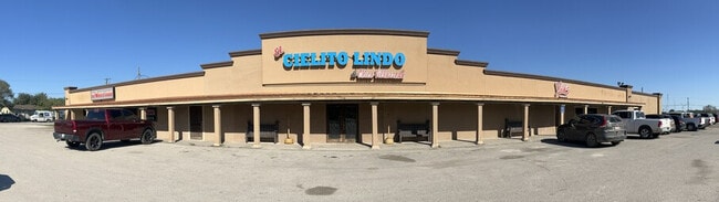
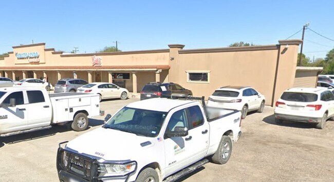
Property Record
405 E Magnolia St, Mathis, TX 78368
Property Detail
405 E Magnolia St
1039343
VILLARREAL DIVISION TR B
Commercialnec
SAN PATRICIO
B and X Area of moderate flood hazard, usually the area between the limits of the 100-year and 500-year floods.
Texas
2024
0.21 AC
2025
West San Patricio Cnty
011300
Corpus Christi
7,924 SF
Corpus Christi, TX
NEARBY LISTINGS FOR SALE OR LEASE
-
-
View all Mathis listings for sale on LoopNet.com
DEMOGRAPHICS near 405 E Magnolia St
1 mile
3 mile
5 mile
2025 Total Population
4,382
6,459
8,007
2030 Population
4,591
6,752
8,358
Pop Growth 2025-2030
+ 4.77%
+ 4.54%
+ 4.38%
Average Age
38
39
40
2025 Total Households
1,509
2,279
2,876
HH Growth 2025-2030
+ 4.57%
+ 4.34%
+ 4.24%
Median Household Inc
$29,526
$30,785
$33,088
Avg Household Size
2.80
2.80
2.70
2025 Avg HH Vehicles
1.00
1.00
2.00
Median Home Value
$67,422
$79,429
$87,350
Median Year Built
1973
1975
1977
Nearby Places
Map Layers
Map Styles
 Street
 Aerial
Transit
 Traffic
 Biking
Places
Listings with unknown addresses are not visible on the map
- Restaurants
- Banks
- Shops
- Fitness
- Groceries
PUBLIC TRANSPORTATION
AIRPORT
Corpus Christi International
Drive
Walk
Distance
Corpus Christi International
41 min
35.5 mi
Freight Ports
Port of Corpus Christi
Drive
Walk
Distance
Port of Corpus Christi
40 min
36.2 mi
SALE & LEASE HISTORY
LISTING DATE
SALE/LEASE

Jun 18, 2025
For Sale
Jan 30, 2023
For Sale
Apr 04, 2023
For Lease
Nearby Properties
Address
Land Use
TOTAL SIZE
Lot Size
Zoning
Address
Land Use
TOTAL SIZE
Lot Size
Zoning
43,950 SF
0.26 AC
Address
Land Use
TOTAL SIZE
Lot Size
Zoning
57,440 SF
17.20 AC
Address
Land Use
TOTAL SIZE
Lot Size
Zoning
7,320 SF
5.02 AC
Address
Land Use
TOTAL SIZE
Lot Size
Zoning
26,384 SF
2.75 AC
Address
Land Use
TOTAL SIZE
Lot Size
Zoning
9,842 SF
8.76 AC
Address
Land Use
TOTAL SIZE
Lot Size
Zoning
17,351 SF
22.05 AC
Address
Land Use
TOTAL SIZE
Lot Size
Zoning
606.01 AC
Address
Land Use
TOTAL SIZE
Lot Size
Zoning
64,036 SF
4.54 AC
Address
Land Use
TOTAL SIZE
Lot Size
Zoning
102 SF
92.78 AC
Address
Land Use
TOTAL SIZE
Lot Size
Zoning
9,214 SF
0.31 AC
Address
Land Use
TOTAL SIZE
Lot Size
Zoning
6,240 SF
1.01 AC
Address
Land Use
TOTAL SIZE
Lot Size
Zoning
6,198 SF
2.31 AC
Address
Land Use
TOTAL SIZE
Lot Size
Zoning
46,720 SF
3.38 AC
Address
Land Use
TOTAL SIZE
Lot Size
Zoning
11,639 SF
6 AC
Address
Land Use
TOTAL SIZE
Lot Size
Zoning
7,793 SF
2 AC
Address
Land Use
TOTAL SIZE
Lot Size
Zoning
230.60 AC
Address
Land Use
TOTAL SIZE
Lot Size
Zoning
8,642 SF
5.31 AC
Address
Land Use
TOTAL SIZE
Lot Size
Zoning
9.43 AC
Address
Land Use
TOTAL SIZE
Lot Size
Zoning
10,395 SF
2 AC
Address
Land Use
TOTAL SIZE
Lot Size
Zoning
38,176 SF
3.07 AC
Address
Land Use
TOTAL SIZE
Lot Size
Zoning
8,788 SF
1.02 AC
Address
Land Use
TOTAL SIZE
Lot Size
Zoning
8,586 SF
0.98 AC
Address
Land Use
TOTAL SIZE
Lot Size
Zoning
26,772 SF
1.12 AC
Address
Land Use
TOTAL SIZE
Lot Size
Zoning
6,876 SF
0.52 AC
Address
Land Use
TOTAL SIZE
Lot Size
Zoning
11,896 SF
1.34 AC
Address
Land Use
TOTAL SIZE
Lot Size
Zoning
14,261 SF
1.77 AC
Address
Land Use
TOTAL SIZE
Lot Size
Zoning
3,870 SF
0.48 AC
Address
Land Use
TOTAL SIZE
Lot Size
Zoning
Address
Land Use
TOTAL SIZE
Lot Size
Zoning
3,332 SF
0.49 AC
Address
Land Use
TOTAL SIZE
Lot Size
Zoning
2,380 SF
278.44 AC
The World's #1 Commercial Real Estate Marketplace
Connect with us
© 2026 CoStar Group
The information above has been obtained from sources believed reliable. While we do not doubt its accuracy we have not verified it and make no guarantee, warranty or representation about it. It is your responsibility to independently confirm its accuracy and completeness. Any projections, opinions, assumptions, or estimates used are for example only and do not represent the current or future performance of the property. The value of this transaction to you depends on tax and other factors which should be evaluated by your tax, financial, and legal advisors. You and your advisors should conduct a careful, independent investigation of the property to determine to your satisfaction the suitability of the property for your needs.