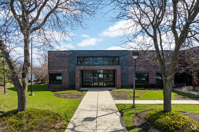
Property Record
411 Kingston Ct, Mount Prospect, IL 60056


NEARBY LISTINGS FOR SALE OR LEASE
Property Detail
411 Kingston Ct
Chicago-Naperville-Elgin, IL-IN
Kensington Center Resub Twentyfive
03-35-200-052-0000
(KENSINGTON) (CENTER) RESUB (TWENTYFIVE) IN PT OF THE NE SEC 35-42-11
Industrialgeneral
Cook
X
Illinois
17031C0208J
4
2023
3.28 AC
2025
Northwest Cook
802702
Chicago
42,075 SF
DEMOGRAPHICS near 411 Kingston Ct
1 mile
3 mile
5 mile
2024 Total Population
12,038
117,123
335,148
2029 Population
11,660
113,861
325,382
Pop Growth 2024-2029
(3.14%)
(2.79%)
(2.91%)
Average Age
44
43
43
2024 Total Households
4,359
46,016
128,368
HH Growth 2024-2029
(3.53%)
(3.09%)
(3.21%)
Median Household Inc
$110,505
$87,772
$87,440
Avg Household Size
2.70
2.50
2.50
2024 Avg HH Vehicles
2.00
2.00
2.00
Median Home Value
$376,352
$333,984
$347,409
Median Year Built
1966
1970
1971
Nearby Places
Map Layers
Map Styles
 Street
 Aerial
Transit
 Traffic
 Biking
Places
Listings with unknown addresses are not visible on the map
- Restaurants
- Banks
- Shops
- Fitness
- Groceries
PUBLIC TRANSPORTATION
COMMUTER RAIL
Prospect Heights Station (North Central Service - Northeast Illinois Regional Commuter Railroad (Metra))
Drive
Walk
Distance
Prospect Heights Station (North Central Service - Northeast Illinois Regional Commuter Railroad (Metra))
4 min
1.7 mi
Mount Prospect Station (Union Pacific Northwest Line - Northeast Illinois Regional Commuter Railroad (Metra))
Drive
Walk
Distance
Mount Prospect Station (Union Pacific Northwest Line - Northeast Illinois Regional Commuter Railroad (Metra))
7 min
2.8 mi
AIRPORT
Chicago O'Hare International
Drive
Walk
Distance
Chicago O'Hare International
18 min
9.8 mi
Chicago Midway International
Drive
Walk
Distance
Chicago Midway International
47 min
25.5 mi
Freight Ports
Port Milwaukee
Drive
Walk
Distance
Port Milwaukee
86 min
71.0 mi
Nearby Properties
Address
Land Use
TOTAL SIZE
Lot Size
Zoning
Address
Land Use
TOTAL SIZE
Lot Size
Zoning
6.53 AC
Address
Land Use
TOTAL SIZE
Lot Size
Zoning
22.72 AC
Address
Land Use
TOTAL SIZE
Lot Size
Zoning
20.79 AC
Address
Land Use
TOTAL SIZE
Lot Size
Zoning
206,160 SF
9.44 AC
Address
Land Use
TOTAL SIZE
Lot Size
Zoning
Address
Land Use
TOTAL SIZE
Lot Size
Zoning
690,195 SF
39.48 AC
Address
Land Use
TOTAL SIZE
Lot Size
Zoning
234,337 SF
23.59 AC
Address
Land Use
TOTAL SIZE
Lot Size
Zoning
449,568 SF
22.73 AC
Address
Land Use
TOTAL SIZE
Lot Size
Zoning
642,049 SF
33.14 AC
Address
Land Use
TOTAL SIZE
Lot Size
Zoning
405,484 SF
Address
Land Use
TOTAL SIZE
Lot Size
Zoning
Address
Land Use
TOTAL SIZE
Lot Size
Zoning
667,821 SF
20.55 AC
Address
Land Use
TOTAL SIZE
Lot Size
Zoning
146,650 SF
8.98 AC
Address
Land Use
TOTAL SIZE
Lot Size
Zoning
262,533 SF
32.21 AC
Address
Land Use
TOTAL SIZE
Lot Size
Zoning
489,538 SF
5.94 AC
Address
Land Use
TOTAL SIZE
Lot Size
Zoning
4.80 AC
Address
Land Use
TOTAL SIZE
Lot Size
Zoning
10,404 SF
45.11 AC
Address
Land Use
TOTAL SIZE
Lot Size
Zoning
Address
Land Use
TOTAL SIZE
Lot Size
Zoning
72,916 SF
5.69 AC
Address
Land Use
TOTAL SIZE
Lot Size
Zoning
65,401 SF
5.05 AC
Address
Land Use
TOTAL SIZE
Lot Size
Zoning
186,173 SF
5.86 AC
Address
Land Use
TOTAL SIZE
Lot Size
Zoning
12.53 AC
Address
Land Use
TOTAL SIZE
Lot Size
Zoning
143,002 SF
14.58 AC
Address
Land Use
TOTAL SIZE
Lot Size
Zoning
312,281 SF
11.66 AC
Address
Land Use
TOTAL SIZE
Lot Size
Zoning
197,191 SF
7.20 AC
Address
Land Use
TOTAL SIZE
Lot Size
Zoning
274,289 SF
1.56 AC
Address
Land Use
TOTAL SIZE
Lot Size
Zoning
31.61 AC
Address
Land Use
TOTAL SIZE
Lot Size
Zoning
Address
Land Use
TOTAL SIZE
Lot Size
Zoning
161,035 SF
13.57 AC
Address
Land Use
TOTAL SIZE
Lot Size
Zoning
The World's #1 Commercial Real Estate Marketplace
Connect with us
© 2026 CoStar Group
The information above has been obtained from sources believed reliable. While we do not doubt its accuracy we have not verified it and make no guarantee, warranty or representation about it. It is your responsibility to independently confirm its accuracy and completeness. Any projections, opinions, assumptions, or estimates used are for example only and do not represent the current or future performance of the property. The value of this transaction to you depends on tax and other factors which should be evaluated by your tax, financial, and legal advisors. You and your advisors should conduct a careful, independent investigation of the property to determine to your satisfaction the suitability of the property for your needs.