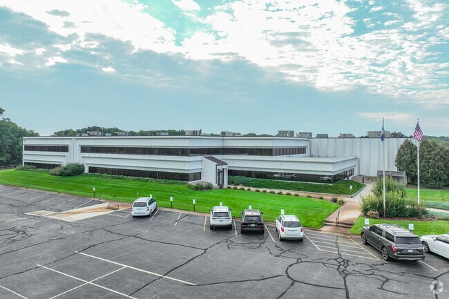
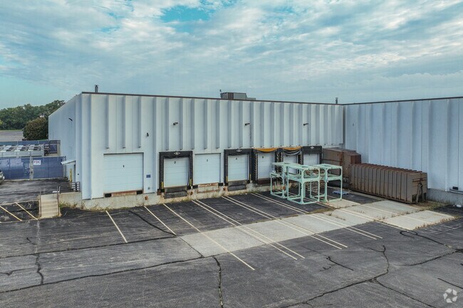
Property Record
4110 Clearwater Rd, Saint Cloud, MN 56301

Property Detail
4110 Clearwater Rd
82.46161.0059
LOT 1 & THAT PART OF LOT 2 LYING W OF FOLL LN: BEG 51.51' E OF NW COR OF LOT 2 - S4D W 100' - S15D E 197' - S4D E 108' - S6D
Industrialgeneral
Stearns
PUD15
Minnesota
B and X Area of moderate flood hazard, usually the area between the limits of the 100-year and 500-year floods.
1-2
2026
13.78 AC
2025
Stearns County
011400
Minneapolis/St Paul
121,660 SF
St. Cloud, MN
NEARBY LISTINGS FOR SALE OR LEASE
DEMOGRAPHICS near 4110 Clearwater Rd
1 mile
3 mile
5 mile
2025 Total Population
1,765
14,497
60,045
2030 Population
1,815
15,146
62,313
Pop Growth 2025-2030
+ 2.83%
+ 4.48%
+ 3.78%
Average Age
36
40
36
2025 Total Households
767
5,412
22,928
HH Growth 2025-2030
+ 2.87%
+ 4.43%
+ 3.87%
Median Household Inc
$74,676
$81,222
$61,873
Avg Household Size
2.30
2.40
2.40
2025 Avg HH Vehicles
2.00
2.00
2.00
Median Home Value
$303,883
$332,239
$250,124
Median Year Built
2003
1995
1981
Nearby Places
Map Layers
Map Styles
 Street
 Aerial
Layers
 Traffic
 Biking
Places
Listings with unknown addresses are not visible on the map
- Restaurants
- Banks
- Shops
- Fitness
- Groceries
PUBLIC TRANSPORTATION
COMMUTER RAIL
St. Cloud Amtrak Station (Empire Builder - Amtrak)
Drive
Walk
Distance
St. Cloud Amtrak Station (Empire Builder - Amtrak)
12 min
5.7 mi
Freight Ports
Port Milwaukee
Drive
Walk
Distance
Port Milwaukee
441 min
399.6 mi
Nearby Properties
Address
Land Use
TOTAL SIZE
Lot Size
Zoning
Address
Land Use
TOTAL SIZE
Lot Size
Zoning
278,850 SF
20.83 AC
Address
Land Use
TOTAL SIZE
Lot Size
Zoning
15.77 AC
Address
Land Use
TOTAL SIZE
Lot Size
Zoning
24.47 AC
Address
Land Use
TOTAL SIZE
Lot Size
Zoning
357,302 SF
59.30 AC
I3
Address
Land Use
TOTAL SIZE
Lot Size
Zoning
101,460 SF
54.63 AC
I3
Address
Land Use
TOTAL SIZE
Lot Size
Zoning
Address
Land Use
TOTAL SIZE
Lot Size
Zoning
314,315 SF
49.58 AC
I3
Address
Land Use
TOTAL SIZE
Lot Size
Zoning
13.37 AC
Address
Land Use
TOTAL SIZE
Lot Size
Zoning
75,620 SF
16.80 AC
I3
Address
Land Use
TOTAL SIZE
Lot Size
Zoning
79,223 SF
15.58 AC
C5
Address
Land Use
TOTAL SIZE
Lot Size
Zoning
249,445 SF
25.13 AC
I3
Address
Land Use
TOTAL SIZE
Lot Size
Zoning
4.57 AC
Address
Land Use
TOTAL SIZE
Lot Size
Zoning
77,434 SF
7.21 AC
C5
Address
Land Use
TOTAL SIZE
Lot Size
Zoning
6.98 AC
Address
Land Use
TOTAL SIZE
Lot Size
Zoning
15.35 AC
Address
Land Use
TOTAL SIZE
Lot Size
Zoning
55,736 SF
4.60 AC
I1
Address
Land Use
TOTAL SIZE
Lot Size
Zoning
43,250 SF
11.94 AC
Address
Land Use
TOTAL SIZE
Lot Size
Zoning
55,641 SF
18.77 AC
Address
Land Use
TOTAL SIZE
Lot Size
Zoning
169,920 SF
11.19 AC
PUD15
Address
Land Use
TOTAL SIZE
Lot Size
Zoning
74,354 SF
8.71 AC
I3
Address
Land Use
TOTAL SIZE
Lot Size
Zoning
36,560 SF
5.55 AC
R5
Address
Land Use
TOTAL SIZE
Lot Size
Zoning
87,813 SF
3.73 AC
PUD14
Address
Land Use
TOTAL SIZE
Lot Size
Zoning
57,111 SF
5.69 AC
I3
Address
Land Use
TOTAL SIZE
Lot Size
Zoning
17.94 AC
Address
Land Use
TOTAL SIZE
Lot Size
Zoning
Address
Land Use
TOTAL SIZE
Lot Size
Zoning
67,210 SF
4.55 AC
PUD34
Address
Land Use
TOTAL SIZE
Lot Size
Zoning
60,034 SF
7.73 AC
Address
Land Use
TOTAL SIZE
Lot Size
Zoning
66,568 SF
2.81 AC
PUD34
Address
Land Use
TOTAL SIZE
Lot Size
Zoning
69,034 SF
3.65 AC
PUD34
Address
Land Use
TOTAL SIZE
Lot Size
Zoning
137,685 SF
8.82 AC
I3
The World's #1 Commercial Real Estate Marketplace
Connect with us
© 2026 CoStar Group
The information above has been obtained from sources believed reliable. While we do not doubt its accuracy we have not verified it and make no guarantee, warranty or representation about it. It is your responsibility to independently confirm its accuracy and completeness. Any projections, opinions, assumptions, or estimates used are for example only and do not represent the current or future performance of the property. The value of this transaction to you depends on tax and other factors which should be evaluated by your tax, financial, and legal advisors. You and your advisors should conduct a careful, independent investigation of the property to determine to your satisfaction the suitability of the property for your needs.