Property Record
4110 E Trent Ave, Spokane, WA 99202

NEARBY LISTINGS FOR SALE OR LEASE
Property Detail
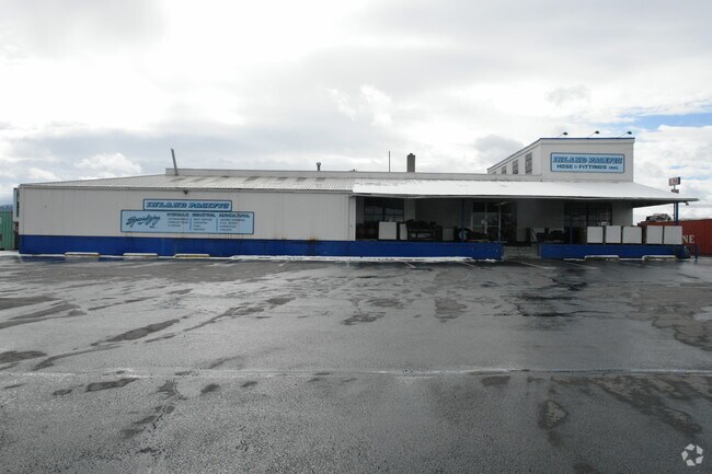
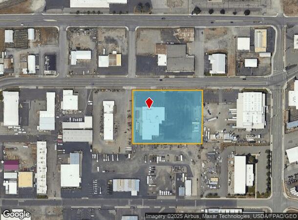
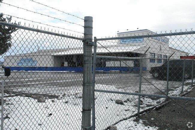
4110 E Trent Ave
Spokane-Spokane Valley, WA
East Side Syndicate
35151.1201
EAST SIDE SYNDICATE L1TO12 B197 INC VAC 37.5FT STP W OF&ADJ L6&7&INC VAC 37.5FT STP E OF&ADJ L1&12&INC VAC 37.5FT ST P S OF&ADJ L7TO12&ADJ STPS
Storebuilding
Spokane
X
Washington
53063C0561D
6,7
2025
2.48 AC
2025
SE North Metro
014500
Spokane
18,016 SF
DEMOGRAPHICS near 4110 E Trent Ave
1 mile
3 mile
5 mile
2024 Total Population
5,249
86,652
246,250
2029 Population
5,562
92,221
262,025
Pop Growth 2024-2029
+ 5.96%
+ 6.43%
+ 6.41%
Average Age
36
38
39
2024 Total Households
2,124
33,411
102,979
HH Growth 2024-2029
+ 6.03%
+ 6.65%
+ 6.68%
Median Household Inc
$59,763
$55,668
$57,580
Avg Household Size
2.40
2.40
2.30
2024 Avg HH Vehicles
2.00
2.00
2.00
Median Home Value
$236,747
$262,223
$310,527
Median Year Built
1976
1961
1966
Nearby Places
Map Layers
Map Styles
 Street
 Aerial
Transit
 Traffic
 Biking
Places
Listings with unknown addresses are not visible on the map
- Restaurants
- Banks
- Shops
- Fitness
- Groceries
PUBLIC TRANSPORTATION
COMMUTER RAIL
Spokane (Empire Builder - Amtrak)
Drive
Walk
Distance
Spokane (Empire Builder - Amtrak)
9 min
3.6 mi
AIRPORT
Spokane International
Drive
Walk
Distance
Spokane International
17 min
10.4 mi
Freight Ports
Port of Everett
Drive
Walk
Distance
Port of Everett
344 min
305.9 mi
Nearby Properties
Address
Land Use
TOTAL SIZE
Lot Size
Zoning
Address
Land Use
TOTAL SIZE
Lot Size
Zoning
481,348 SF
17.09 AC
DTU
Address
Land Use
TOTAL SIZE
Lot Size
Zoning
629,722 SF
26.28 AC
RHD
Address
Land Use
TOTAL SIZE
Lot Size
Zoning
917,113 SF
100.67 AC
LI
Address
Land Use
TOTAL SIZE
Lot Size
Zoning
365,804 SF
16.13 AC
RSF
Address
Land Use
TOTAL SIZE
Lot Size
Zoning
427,054 SF
16.60 AC
LI
Address
Land Use
TOTAL SIZE
Lot Size
Zoning
386,885 SF
22.81 AC
RSF
Address
Land Use
TOTAL SIZE
Lot Size
Zoning
251,542 SF
5.78 AC
DTG
Address
Land Use
TOTAL SIZE
Lot Size
Zoning
310,606 SF
27.56 AC
RMF
Address
Land Use
TOTAL SIZE
Lot Size
Zoning
180,822 SF
16.11 AC
CC1
Address
Land Use
TOTAL SIZE
Lot Size
Zoning
379,678 SF
20.64 AC
LI
Address
Land Use
TOTAL SIZE
Lot Size
Zoning
112,634 SF
3.87 AC
OR
Address
Land Use
TOTAL SIZE
Lot Size
Zoning
137,503 SF
17.31 AC
GC
Address
Land Use
TOTAL SIZE
Lot Size
Zoning
290,380 SF
2.11 AC
CA3
Address
Land Use
TOTAL SIZE
Lot Size
Zoning
107,240 SF
1.54 AC
CC1
Address
Land Use
TOTAL SIZE
Lot Size
Zoning
378,750 SF
17.38 AC
R-2
Address
Land Use
TOTAL SIZE
Lot Size
Zoning
91,310 SF
2.34 AC
Address
Land Use
TOTAL SIZE
Lot Size
Zoning
108,237 SF
3.48 AC
LI
Address
Land Use
TOTAL SIZE
Lot Size
Zoning
58,522 SF
19.91 AC
HI
Address
Land Use
TOTAL SIZE
Lot Size
Zoning
138,840 SF
2.79 AC
DTU
Address
Land Use
TOTAL SIZE
Lot Size
Zoning
117,687 SF
1.21 AC
GC
Address
Land Use
TOTAL SIZE
Lot Size
Zoning
134,806 SF
7.79 AC
RMF
Address
Land Use
TOTAL SIZE
Lot Size
Zoning
155,133 SF
3.76 AC
RHD
Address
Land Use
TOTAL SIZE
Lot Size
Zoning
41,890 SF
2.11 AC
OR
Address
Land Use
TOTAL SIZE
Lot Size
Zoning
114,600 SF
0.87 AC
CB
Address
Land Use
TOTAL SIZE
Lot Size
Zoning
77,694 SF
4.63 AC
RHD
Address
Land Use
TOTAL SIZE
Lot Size
Zoning
102,142 SF
1.03 AC
GC
Address
Land Use
TOTAL SIZE
Lot Size
Zoning
95,030 SF
3.51 AC
CC1
Address
Land Use
TOTAL SIZE
Lot Size
Zoning
68,887 SF
0.86 AC
DTU
Address
Land Use
TOTAL SIZE
Lot Size
Zoning
160,810 SF
25.18 AC
RMF
Address
Land Use
TOTAL SIZE
Lot Size
Zoning
96,424 SF
9.04 AC
I-1
The World's #1 Commercial Real Estate Marketplace
Connect with us
© 2026 CoStar Group
The information above has been obtained from sources believed reliable. While we do not doubt its accuracy we have not verified it and make no guarantee, warranty or representation about it. It is your responsibility to independently confirm its accuracy and completeness. Any projections, opinions, assumptions, or estimates used are for example only and do not represent the current or future performance of the property. The value of this transaction to you depends on tax and other factors which should be evaluated by your tax, financial, and legal advisors. You and your advisors should conduct a careful, independent investigation of the property to determine to your satisfaction the suitability of the property for your needs.