Property Record
4110 N Lamb Blvd, Las Vegas, NV 89115

NEARBY LISTINGS FOR SALE OR LEASE
Property Detail
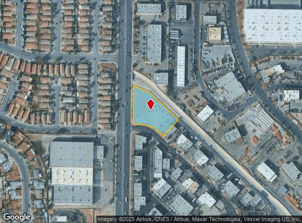
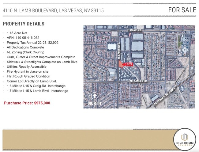
4110 N Lamb Blvd
Las Vegas-Henderson-Paradise, NV
Collins Business Park Phase 2
140-05-416-052
COLLINS BUSINESS PARK PHASE 2 PLAT BOOK 73 PAGE 40 PT LOT 3 BLOCK 1
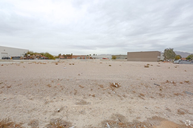
Vacantlandnec
Clark
X
Nevada
32003C2177F
3
2025
1.15 AC
2025
North Las Vegas
004712
Las Vegas
DEMOGRAPHICS near 4110 N Lamb Blvd
1 Mile
3 Mile
5 Mile
2024 Total Population
23,302
117,777
340,882
2029 Population
24,926
126,134
365,703
Pop Growth 2024-2029
+ 6.97%
+ 7.10%
+ 7.28%
Average Age
32
33
34
2024 Total Households
7,076
35,644
103,668
HH Growth 2024-2029
+ 7.15%
+ 7.07%
+ 7.31%
Median Household Inc
$44,081
$47,624
$49,777
Avg Household Size
3.20
3.20
3.10
2024 Avg HH Vehicles
2.00
2.00
2.00
Median Home Value
$244,866
$266,074
$271,476
Median Year Built
1991
1993
1993
Nearby Places
Map Layers
Map Styles
 Street
 Aerial
- Restaurants
- Banks
- Shops
- Fitness
- Groceries
PUBLIC TRANSPORTATION
AIRPORT
Harry Reid International
DRIVE
WALK
Distance
Harry Reid International
24 min
15.7 mi
Boulder City Municipal
DRIVE
WALK
Distance
Boulder City Municipal
41 min
28.7 mi
Freight Ports
Port of Long Beach
DRIVE
WALK
Distance
Port of Long Beach
325 min
291.1 mi
SALE & LEASE HISTORY
LISTING DATE
SALE/LEASE

Jan 04, 2023
For Sale
Aug 16, 2024
For Sale
Apr 14, 2019
For Sale
Nearby Properties
Address
Land Use
TOTAL SIZE
Lot Size
Zoning
Address
Land Use
TOTAL SIZE
Lot Size
Zoning
1,767,948 SF
142.04 AC
Address
Land Use
TOTAL SIZE
Lot Size
Zoning
252,005 SF
27.94 AC
C3
Address
Land Use
TOTAL SIZE
Lot Size
Zoning
1,102,891 SF
84.43 AC
Address
Land Use
TOTAL SIZE
Lot Size
Zoning
798,660 SF
37.86 AC
M2
Address
Land Use
TOTAL SIZE
Lot Size
Zoning
813,120 SF
38.20 AC
Address
Land Use
TOTAL SIZE
Lot Size
Zoning
656,250 SF
29.11 AC
Address
Land Use
TOTAL SIZE
Lot Size
Zoning
747,196 SF
40.03 AC
Address
Land Use
TOTAL SIZE
Lot Size
Zoning
632,224 SF
31.23 AC
Address
Land Use
TOTAL SIZE
Lot Size
Zoning
681,792 SF
29.65 AC
Address
Land Use
TOTAL SIZE
Lot Size
Zoning
621,824 SF
32.27 AC
Address
Land Use
TOTAL SIZE
Lot Size
Zoning
677,768 SF
31.52 AC
Address
Land Use
TOTAL SIZE
Lot Size
Zoning
696,064 SF
29.08 AC
Address
Land Use
TOTAL SIZE
Lot Size
Zoning
15,566 SF
48.39 AC
R4
Address
Land Use
TOTAL SIZE
Lot Size
Zoning
602,609 SF
27.33 AC
M2
Address
Land Use
TOTAL SIZE
Lot Size
Zoning
570,810 SF
29.73 AC
Address
Land Use
TOTAL SIZE
Lot Size
Zoning
625,804 SF
27.23 AC
Address
Land Use
TOTAL SIZE
Lot Size
Zoning
617,670 SF
27.90 AC
M2
Address
Land Use
TOTAL SIZE
Lot Size
Zoning
720,000 SF
25.07 AC
Address
Land Use
TOTAL SIZE
Lot Size
Zoning
3,735 SF
17.69 AC
R3
Address
Land Use
TOTAL SIZE
Lot Size
Zoning
546,249 SF
28.58 AC
Address
Land Use
TOTAL SIZE
Lot Size
Zoning
152,520 SF
42.31 AC
M2
Address
Land Use
TOTAL SIZE
Lot Size
Zoning
463,680 SF
13.81 AC
Address
Land Use
TOTAL SIZE
Lot Size
Zoning
376,264 SF
19 AC
Address
Land Use
TOTAL SIZE
Lot Size
Zoning
504,501 SF
23.08 AC
M2
Address
Land Use
TOTAL SIZE
Lot Size
Zoning
513,240 SF
24.86 AC
M2
Address
Land Use
TOTAL SIZE
Lot Size
Zoning
350,494 SF
18.86 AC
RU
Address
Land Use
TOTAL SIZE
Lot Size
Zoning
338,650 SF
18.14 AC
M2
Address
Land Use
TOTAL SIZE
Lot Size
Zoning
182,885 SF
28.22 AC
The World's #1 Commercial Real Estate Marketplace
Connect with us
© 2025 CoStar Group
The information above has been obtained from sources believed reliable. While we do not doubt its accuracy we have not verified it and make no guarantee, warranty or representation about it. It is your responsibility to independently confirm its accuracy and completeness. Any projections, opinions, assumptions, or estimates used are for example only and do not represent the current or future performance of the property. The value of this transaction to you depends on tax and other factors which should be evaluated by your tax, financial, and legal advisors. You and your advisors should conduct a careful, independent investigation of the property to determine to your satisfaction the suitability of the property for your needs.