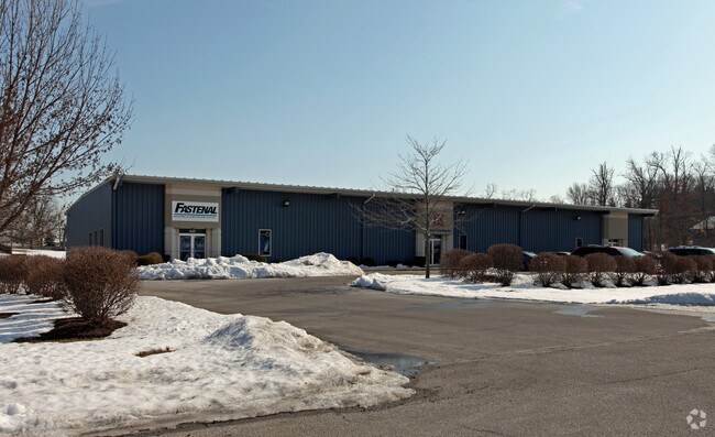
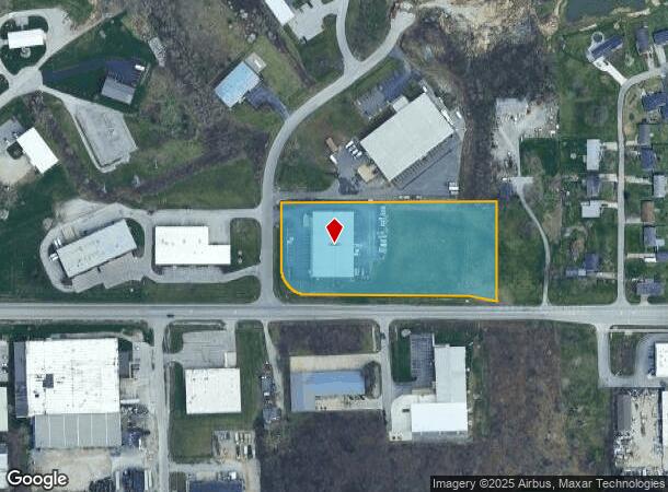
Property Record
4105 Engleton Dr, Fort Wayne, IN 46804
NEARBY LISTINGS FOR SALE OR LEASE
Property Detail
4105 Engleton Dr
Fort Wayne, IN
Engle Ridge North
02-12-17-477-003.000-074
ENGLE RIDGE NORTH LOT N
Warehouse
Allen
X
Indiana
18003C0290G
n
2024
33.40 AC
2025
South Fort Wayne
011502
Fort Wayne
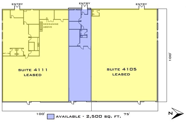
17,500 SF
DEMOGRAPHICS near 4105 Engleton Dr
1 Mile
3 Mile
5 Mile
2024 Total Population
1,818
45,147
146,919
2029 Population
1,873
47,050
153,755
Pop Growth 2024-2029
+ 3.03%
+ 4.22%
+ 4.65%
Average Age
41
38
37
2024 Total Households
797
19,564
60,075
HH Growth 2024-2029
+ 3.01%
+ 4.21%
+ 4.74%
Median Household Inc
$63,546
$52,614
$49,881
Avg Household Size
2.20
2.20
2.30
2024 Avg HH Vehicles
2.00
2.00
2.00
Median Home Value
$138,485
$141,034
$142,595
Median Year Built
1958
1957
1963
Nearby Places
Map Layers
Map Styles
 Street
 Aerial
- Restaurants
- Banks
- Shops
- Fitness
- Groceries
PUBLIC TRANSPORTATION
AIRPORT
Fort Wayne International
DRIVE
WALK
Distance
Fort Wayne International
10 min
6.7 mi
Freight Ports
Port of Baltimore
DRIVE
WALK
Distance
Port of Baltimore
1 min
470.2 mi
SALE & LEASE HISTORY
LISTING DATE
SALE/LEASE

Sep 25, 2016
For Lease
Nov 16, 2021
For Lease
Nearby Properties
Address
Land Use
TOTAL SIZE
Lot Size
Zoning
Address
Land Use
TOTAL SIZE
Lot Size
Zoning
787,824 SF
566.90 AC
Address
Land Use
TOTAL SIZE
Lot Size
Zoning
725,686 SF
9.45 AC
Address
Land Use
TOTAL SIZE
Lot Size
Zoning
350,680 SF
338.50 AC
Address
Land Use
TOTAL SIZE
Lot Size
Zoning
419,017 SF
40.40 AC
Address
Land Use
TOTAL SIZE
Lot Size
Zoning
337,548 SF
391.70 AC
Address
Land Use
TOTAL SIZE
Lot Size
Zoning
703,208 SF
418.95 AC
Address
Land Use
TOTAL SIZE
Lot Size
Zoning
228,567 SF
11.46 AC
Address
Land Use
TOTAL SIZE
Lot Size
Zoning
21.20 AC
Address
Land Use
TOTAL SIZE
Lot Size
Zoning
39,130 SF
61.35 AC
Address
Land Use
TOTAL SIZE
Lot Size
Zoning
24,396 SF
46 AC
Address
Land Use
TOTAL SIZE
Lot Size
Zoning
55,993 SF
26.62 AC
Address
Land Use
TOTAL SIZE
Lot Size
Zoning
143,804 SF
188.80 AC
Address
Land Use
TOTAL SIZE
Lot Size
Zoning
112,234 SF
167.60 AC
Address
Land Use
TOTAL SIZE
Lot Size
Zoning
140,400 SF
118.80 AC
Address
Land Use
TOTAL SIZE
Lot Size
Zoning
248,636 SF
442.40 AC
Address
Land Use
TOTAL SIZE
Lot Size
Zoning
276,392 SF
18.97 AC
Address
Land Use
TOTAL SIZE
Lot Size
Zoning
352,058 SF
142.10 AC
Address
Land Use
TOTAL SIZE
Lot Size
Zoning
195,065 SF
134.91 AC
Address
Land Use
TOTAL SIZE
Lot Size
Zoning
150,600 SF
203.60 AC
Address
Land Use
TOTAL SIZE
Lot Size
Zoning
174,432 SF
352.90 AC
Address
Land Use
TOTAL SIZE
Lot Size
Zoning
92,980 SF
162.24 AC
Address
Land Use
TOTAL SIZE
Lot Size
Zoning
221,088 SF
426.90 AC
Address
Land Use
TOTAL SIZE
Lot Size
Zoning
67,749 SF
140.70 AC
Address
Land Use
TOTAL SIZE
Lot Size
Zoning
213,793 SF
205.74 AC
Address
Land Use
TOTAL SIZE
Lot Size
Zoning
71,290 SF
238.01 AC
Address
Land Use
TOTAL SIZE
Lot Size
Zoning
43,122 SF
11.44 AC
Address
Land Use
TOTAL SIZE
Lot Size
Zoning
233,424 SF
16.75 AC
Address
Land Use
TOTAL SIZE
Lot Size
Zoning
58,825 SF
8.84 AC
Address
Land Use
TOTAL SIZE
Lot Size
Zoning
47,010 SF
8.90 AC
Address
Land Use
TOTAL SIZE
Lot Size
Zoning
79,099 SF
204.80 AC
The World's #1 Commercial Real Estate Marketplace
Connect with us
© 2026 CoStar Group
The information above has been obtained from sources believed reliable. While we do not doubt its accuracy we have not verified it and make no guarantee, warranty or representation about it. It is your responsibility to independently confirm its accuracy and completeness. Any projections, opinions, assumptions, or estimates used are for example only and do not represent the current or future performance of the property. The value of this transaction to you depends on tax and other factors which should be evaluated by your tax, financial, and legal advisors. You and your advisors should conduct a careful, independent investigation of the property to determine to your satisfaction the suitability of the property for your needs.