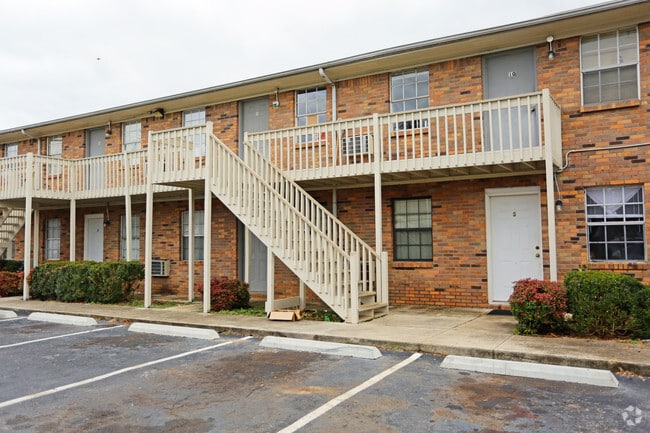
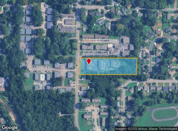
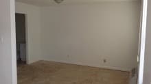
Property Record
4111 Newson Rd Sw, Huntsville, AL 35805
NEARBY LISTINGS FOR SALE OR LEASE
Property Detail
4111 Newson Rd Sw
Huntsville, AL
A W Newson & Ed Penny Merrimac
17-05-15-2-004-092.000
SEC 15 T4S R1W BEG AT A PT ON E MAR OF A 40 FT R/O/W FOR NEWSON RD & BEING S 283.83 FT FR THE NW COR OF LOT 6 OF THE A W NESO
Quadruplex
Madison
X
Alabama
01089C0328F
6
2025
2.63 AC
2025
West Huntsville
002400
Huntsville
4,545 SF
DEMOGRAPHICS near 4111 Newson Rd Sw
1 Mile
3 Mile
5 Mile
2024 Total Population
10,668
44,207
102,361
2029 Population
11,869
49,004
113,683
Pop Growth 2024-2029
+ 11.26%
+ 10.85%
+ 11.06%
Average Age
35
37
39
2024 Total Households
4,325
19,384
46,256
HH Growth 2024-2029
+ 11.68%
+ 11.40%
+ 11.58%
Median Household Inc
$32,362
$42,584
$52,368
Avg Household Size
2.30
2.00
2.00
2024 Avg HH Vehicles
2.00
2.00
2.00
Median Home Value
$75,193
$156,064
$234,162
Median Year Built
1971
1972
1973
Nearby Places
- Restaurants
- Banks
- Shops
- Fitness
- Groceries
PUBLIC TRANSPORTATION
AIRPORT
Huntsville International-Carl T Jones Field
DRIVE
WALK
Distance
Huntsville International-Carl T Jones Field
22 min
14.0 mi
Freight Ports
Port of Mobile
DRIVE
WALK
Distance
Port of Mobile
390 min
355.2 mi
SALE & LEASE HISTORY
LISTING DATE
SALE/LEASE

Aug 14, 2018
For Sale
Aug 14, 2017
For Sale
Nearby Properties
Address
Land Use
TOTAL SIZE
Lot Size
Zoning
Address
Land Use
TOTAL SIZE
Lot Size
Zoning
91,060 SF
8.37 AC
Address
Land Use
TOTAL SIZE
Lot Size
Zoning
208,719 SF
26.55 AC
Address
Land Use
TOTAL SIZE
Lot Size
Zoning
5,577 SF
12.72 AC
Address
Land Use
TOTAL SIZE
Lot Size
Zoning
76,442 SF
Address
Land Use
TOTAL SIZE
Lot Size
Zoning
184,300 SF
23 AC
Address
Land Use
TOTAL SIZE
Lot Size
Zoning
56,426 SF
13.78 AC
Address
Land Use
TOTAL SIZE
Lot Size
Zoning
0.77 AC
Address
Land Use
TOTAL SIZE
Lot Size
Zoning
78,492 SF
Address
Land Use
TOTAL SIZE
Lot Size
Zoning
25,619 SF
Address
Land Use
TOTAL SIZE
Lot Size
Zoning
4,379 SF
18 AC
Address
Land Use
TOTAL SIZE
Lot Size
Zoning
25,619 SF
Address
Land Use
TOTAL SIZE
Lot Size
Zoning
25,619 SF
Address
Land Use
TOTAL SIZE
Lot Size
Zoning
61,559 SF
5.15 AC
Address
Land Use
TOTAL SIZE
Lot Size
Zoning
47,696 SF
1.63 AC
Address
Land Use
TOTAL SIZE
Lot Size
Zoning
76,079 SF
12.71 AC
Address
Land Use
TOTAL SIZE
Lot Size
Zoning
61,712 SF
0.01 AC
Address
Land Use
TOTAL SIZE
Lot Size
Zoning
14,630 SF
13.44 AC
Address
Land Use
TOTAL SIZE
Lot Size
Zoning
57,286 SF
7.30 AC
Address
Land Use
TOTAL SIZE
Lot Size
Zoning
58,809 SF
9.90 AC
Address
Land Use
TOTAL SIZE
Lot Size
Zoning
64,650 SF
2 AC
Address
Land Use
TOTAL SIZE
Lot Size
Zoning
25,619 SF
Address
Land Use
TOTAL SIZE
Lot Size
Zoning
56,100 SF
63.13 AC
Address
Land Use
TOTAL SIZE
Lot Size
Zoning
15,121 SF
1.73 AC
Address
Land Use
TOTAL SIZE
Lot Size
Zoning
Address
Land Use
TOTAL SIZE
Lot Size
Zoning
42,231 SF
6.69 AC
Address
Land Use
TOTAL SIZE
Lot Size
Zoning
31,946 SF
16.67 AC
Address
Land Use
TOTAL SIZE
Lot Size
Zoning
50,400 SF
14 AC
Address
Land Use
TOTAL SIZE
Lot Size
Zoning
1,540 SF
20.65 AC
Address
Land Use
TOTAL SIZE
Lot Size
Zoning
19,360 SF
6.24 AC
Address
Land Use
TOTAL SIZE
Lot Size
Zoning
31,775 SF
3.89 AC
The World's #1 Commercial Real Estate Marketplace
Connect with us
© 2025 CoStar Group
The information above has been obtained from sources believed reliable. While we do not doubt its accuracy we have not verified it and make no guarantee, warranty or representation about it. It is your responsibility to independently confirm its accuracy and completeness. Any projections, opinions, assumptions, or estimates used are for example only and do not represent the current or future performance of the property. The value of this transaction to you depends on tax and other factors which should be evaluated by your tax, financial, and legal advisors. You and your advisors should conduct a careful, independent investigation of the property to determine to your satisfaction the suitability of the property for your needs.