Property Record
4111 Wincove Dr, Groveport, OH 43125

NEARBY LISTINGS FOR SALE OR LEASE
Property Detail
4111 Wincove Dr
010-271293
Congress Lands
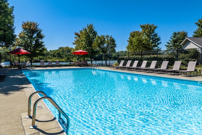
Apartment
WINCHESTER RD R21 T11 S10 22.801 ACRES
AE
Franklin
39045C0025G
Ohio
2024
22.80 AC
2024
Winchester
010201
Columbus
12,912 SF
Columbus, OH
DEMOGRAPHICS near 4111 Wincove Dr
1 Mile
3 Mile
5 Mile
2024 Total Population
4,892
58,035
170,886
2029 Population
4,858
58,108
172,222
Pop Growth 2024-2029
(0.70%)
+ 0.13%
+ 0.78%
Average Age
43
37
37
2024 Total Households
2,255
23,604
67,766
HH Growth 2024-2029
(0.80%)
+ 0.03%
+ 0.68%
Median Household Inc
$63,393
$55,063
$55,627
Avg Household Size
2.10
2.40
2.40
2024 Avg HH Vehicles
2.00
2.00
2.00
Median Home Value
$172,173
$153,863
$167,567
Median Year Built
1981
1983
1978
Nearby Places
Map Layers
Map Styles
 Street
 Aerial
- Restaurants
- Banks
- Shops
- Fitness
- Groceries
PUBLIC TRANSPORTATION
AIRPORT
Rickenbacker International
DRIVE
WALK
Distance
Rickenbacker International
16 min
8.1 mi
John Glenn Columbus International
DRIVE
WALK
Distance
John Glenn Columbus International
20 min
11.2 mi
Freight Ports
Port of Toledo
DRIVE
WALK
Distance
Port of Toledo
199 min
159.4 mi
Nearby Properties
Address
Land Use
TOTAL SIZE
Lot Size
Zoning
Address
Land Use
TOTAL SIZE
Lot Size
Zoning
471,215 SF
49.74 AC
Address
Land Use
TOTAL SIZE
Lot Size
Zoning
553,548 SF
46.23 AC
Address
Land Use
TOTAL SIZE
Lot Size
Zoning
230,994 SF
23.82 AC
Address
Land Use
TOTAL SIZE
Lot Size
Zoning
307,190 SF
55.18 AC
Address
Land Use
TOTAL SIZE
Lot Size
Zoning
181,204 SF
22.90 AC
Address
Land Use
TOTAL SIZE
Lot Size
Zoning
68,492 SF
23.63 AC
Address
Land Use
TOTAL SIZE
Lot Size
Zoning
250,174 SF
178.12 AC
Address
Land Use
TOTAL SIZE
Lot Size
Zoning
528,750 SF
42.14 AC
Address
Land Use
TOTAL SIZE
Lot Size
Zoning
446,160 SF
91.12 AC
Address
Land Use
TOTAL SIZE
Lot Size
Zoning
46,340 SF
10.58 AC
Address
Land Use
TOTAL SIZE
Lot Size
Zoning
446,160 SF
22.71 AC
Address
Land Use
TOTAL SIZE
Lot Size
Zoning
107,200 SF
24.72 AC
Address
Land Use
TOTAL SIZE
Lot Size
Zoning
122,938 SF
29.37 AC
Address
Land Use
TOTAL SIZE
Lot Size
Zoning
69,070 SF
20.06 AC
Address
Land Use
TOTAL SIZE
Lot Size
Zoning
29,311 SF
24.95 AC
Address
Land Use
TOTAL SIZE
Lot Size
Zoning
159,719 SF
36.24 AC
Address
Land Use
TOTAL SIZE
Lot Size
Zoning
33,230 SF
28.79 AC
Address
Land Use
TOTAL SIZE
Lot Size
Zoning
175,313 SF
27.10 AC
Address
Land Use
TOTAL SIZE
Lot Size
Zoning
324,000 SF
20.91 AC
Address
Land Use
TOTAL SIZE
Lot Size
Zoning
115,095 SF
14.02 AC
Address
Land Use
TOTAL SIZE
Lot Size
Zoning
259,616 SF
23.54 AC
Address
Land Use
TOTAL SIZE
Lot Size
Zoning
22,368 SF
23.08 AC
Address
Land Use
TOTAL SIZE
Lot Size
Zoning
29,569 SF
25.30 AC
Address
Land Use
TOTAL SIZE
Lot Size
Zoning
70,192 SF
20.22 AC
Address
Land Use
TOTAL SIZE
Lot Size
Zoning
569,216 SF
42.86 AC
Address
Land Use
TOTAL SIZE
Lot Size
Zoning
87,037 SF
20.32 AC
Address
Land Use
TOTAL SIZE
Lot Size
Zoning
335,414 SF
19.53 AC
Address
Land Use
TOTAL SIZE
Lot Size
Zoning
66,617 SF
78.33 AC
Address
Land Use
TOTAL SIZE
Lot Size
Zoning
31,968 SF
17.68 AC
Address
Land Use
TOTAL SIZE
Lot Size
Zoning
271,500 SF
15.78 AC
The World's #1 Commercial Real Estate Marketplace
Connect with us
© 2026 CoStar Group
The information above has been obtained from sources believed reliable. While we do not doubt its accuracy we have not verified it and make no guarantee, warranty or representation about it. It is your responsibility to independently confirm its accuracy and completeness. Any projections, opinions, assumptions, or estimates used are for example only and do not represent the current or future performance of the property. The value of this transaction to you depends on tax and other factors which should be evaluated by your tax, financial, and legal advisors. You and your advisors should conduct a careful, independent investigation of the property to determine to your satisfaction the suitability of the property for your needs.