Property Record
4115 E Nc 54 Hwy E, Durham, NC 27713


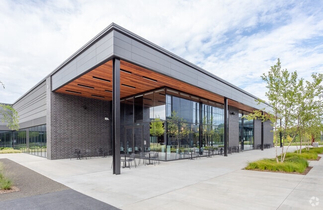
Property Detail
4115 E Nc 54 Hwy E
228752
PROP-PARK POINT/LT#03 PL:000203-000285
Scientificpharmaceuticalmedicalresearchfacility
DURHAM
SRP
North Carolina
B and X Area of moderate flood hazard, usually the area between the limits of the 100-year and 500-year floods.
3
2025
41.03 AC
2025
Research Triangle
980100
Raleigh/Durham
300,042 SF
Durham-Chapel Hill, NC
NEARBY LISTINGS FOR SALE OR LEASE
DEMOGRAPHICS near 4115 E Nc 54 Hwy E
1 mile
3 mile
5 mile
2025 Total Population
4,127
29,463
136,804
2030 Population
4,439
31,867
147,151
Pop Growth 2025-2030
+ 7.56%
+ 8.16%
+ 7.56%
Average Age
35
37
37
2025 Total Households
2,162
13,535
58,929
HH Growth 2025-2030
+ 7.72%
+ 8.46%
+ 7.80%
Median Household Inc
$87,185
$98,052
$112,546
Avg Household Size
1.90
2.20
2.30
2025 Avg HH Vehicles
1.00
2.00
2.00
Median Home Value
$377,914
$488,195
$473,741
Median Year Built
2011
2010
2008
Nearby Places
Map Layers
Map Styles
 Street
 Aerial
Transit
 Traffic
 Biking
Places
Listings with unknown addresses are not visible on the map
- Restaurants
- Banks
- Shops
- Fitness
- Groceries
PUBLIC TRANSPORTATION
COMMUTER RAIL
Cary Station (Piedmont - North Carolina by Train (NC Train))
Drive
Walk
Distance
Cary Station (Piedmont - North Carolina by Train (NC Train))
16 min
8.8 mi
AIRPORT
Raleigh-Durham International
Drive
Walk
Distance
Raleigh-Durham International
12 min
5.6 mi
Freight Ports
Port of Wilmington
Drive
Walk
Distance
Port of Wilmington
172 min
149.7 mi
Nearby Properties
Address
Land Use
TOTAL SIZE
Lot Size
Zoning
Address
Land Use
TOTAL SIZE
Lot Size
Zoning
2,436,024 SF
SRP
Address
Land Use
TOTAL SIZE
Lot Size
Zoning
896,802 SF
86.14 AC
RA
Address
Land Use
TOTAL SIZE
Lot Size
Zoning
1,272,163 SF
117.61 AC
OI,SRP
Address
Land Use
TOTAL SIZE
Lot Size
Zoning
1,378,965 SF
183.46 AC
SRP
Address
Land Use
TOTAL SIZE
Lot Size
Zoning
868,283 SF
56.23 AC
SRP
Address
Land Use
TOTAL SIZE
Lot Size
Zoning
237,537 SF
24.60 AC
C-BAC
Address
Land Use
TOTAL SIZE
Lot Size
Zoning
491,701 SF
124.48 AC
SRP
Address
Land Use
TOTAL SIZE
Lot Size
Zoning
507,119 SF
118.85 AC
SRP
Address
Land Use
TOTAL SIZE
Lot Size
Zoning
799,818 SF
84.58 AC
IL
Address
Land Use
TOTAL SIZE
Lot Size
Zoning
168,660 SF
15.49 AC
CG(D)
Address
Land Use
TOTAL SIZE
Lot Size
Zoning
444,254 SF
58.71 AC
SRP
Address
Land Use
TOTAL SIZE
Lot Size
Zoning
8,418 SF
22.17 AC
MU(D)
Address
Land Use
TOTAL SIZE
Lot Size
Zoning
122,544 SF
8.04 AC
MU(D)
Address
Land Use
TOTAL SIZE
Lot Size
Zoning
624,324 SF
81.65 AC
RA
Address
Land Use
TOTAL SIZE
Lot Size
Zoning
15,252 SF
29.36 AC
RS-M
Address
Land Use
TOTAL SIZE
Lot Size
Zoning
627,566 SF
37.83 AC
RA
Address
Land Use
TOTAL SIZE
Lot Size
Zoning
449,992 SF
25.16 AC
IP
Address
Land Use
TOTAL SIZE
Lot Size
Zoning
597,624 SF
53.04 AC
RA
Address
Land Use
TOTAL SIZE
Lot Size
Zoning
47,376 SF
11.86 AC
OI(D)
Address
Land Use
TOTAL SIZE
Lot Size
Zoning
319,275 SF
50.52 AC
SRP
Address
Land Use
TOTAL SIZE
Lot Size
Zoning
353,339 SF
25.95 AC
SRP
Address
Land Use
TOTAL SIZE
Lot Size
Zoning
2.82 AC
SRP-C
Address
Land Use
TOTAL SIZE
Lot Size
Zoning
441,280 SF
48.43 AC
IL
Address
Land Use
TOTAL SIZE
Lot Size
Zoning
529,439 SF
29.84 AC
IL
Address
Land Use
TOTAL SIZE
Lot Size
Zoning
172,116 SF
56.06 AC
C-OI
Address
Land Use
TOTAL SIZE
Lot Size
Zoning
298,457 SF
35.55 AC
RAC
Address
Land Use
TOTAL SIZE
Lot Size
Zoning
21.83 AC
OI
Address
Land Use
TOTAL SIZE
Lot Size
Zoning
463,340 SF
12.38 AC
OI
Address
Land Use
TOTAL SIZE
Lot Size
Zoning
555,485 SF
34.84 AC
SRP
The World's #1 Commercial Real Estate Marketplace
Connect with us
© 2026 CoStar Group
The information above has been obtained from sources believed reliable. While we do not doubt its accuracy we have not verified it and make no guarantee, warranty or representation about it. It is your responsibility to independently confirm its accuracy and completeness. Any projections, opinions, assumptions, or estimates used are for example only and do not represent the current or future performance of the property. The value of this transaction to you depends on tax and other factors which should be evaluated by your tax, financial, and legal advisors. You and your advisors should conduct a careful, independent investigation of the property to determine to your satisfaction the suitability of the property for your needs.