Property Record
4117 S Pine Ave, Ocala, FL 34480


Save to a Folder
{{folder.Name}}
{{folder.ListingIds.length}} Properties
{{folder.ListingIds.length}} Property
Create a New Folder
Property Detail
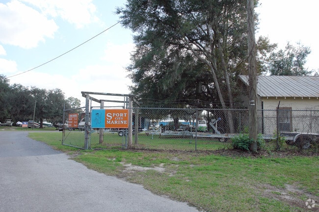
4117 S Pine Ave
31231-000-00
SEC 33 TWP 15 RGE 22 COM SE COR NW 1/4 N 1519.92 FT TO POB S 71-21-30 W 715.45 FT TO E RWY US 441 TH NW`LY ALONG RWY 364.43 FT N 62DEG 48`35E 187.7 FT N 27DEG11`W 46.00 FT N 69DEG30`30W 39.21 FT N 62DEG50`20E 82.44 FT S 69DEG29`E 754.47 FT TH S 10.51
Vehiclerentalsvehiclesales
MARION
M1
Florida
B and X Area of moderate flood hazard, usually the area between the limits of the 100-year and 500-year floods.
4.82 AC
2025
Outlying Marion County
2025
Ocala
002302
Ocala, FL
30,929 SF
NEARBY LISTINGS FOR SALE OR LEASE
DEMOGRAPHICS near 4117 S Pine Ave
1 mile
3 mile
5 mile
2025 Total Population
5,761
35,087
104,615
2030 Population
6,449
39,297
117,352
Pop Growth 2025-2030
+ 11.94%
+ 12.00%
+ 12.18%
Average Age
44
41
40
2025 Total Households
2,318
14,101
41,513
HH Growth 2025-2030
+ 12.47%
+ 12.31%
+ 12.52%
Median Household Inc
$65,939
$69,697
$60,869
Avg Household Size
2.30
2.40
2.40
2025 Avg HH Vehicles
2.00
2.00
2.00
Median Home Value
$327,631
$343,942
$279,548
Median Year Built
1987
1984
1985
Nearby Places
Map Layers
Map Styles
 Street
 Aerial
Layers
 Traffic
 Biking
Places
Listings with unknown addresses are not visible on the map
- Restaurants
- Banks
- Shops
- Fitness
- Groceries
Nearby Properties
Address
Land Use
TOTAL SIZE
Lot Size
Zoning
Address
Land Use
TOTAL SIZE
Lot Size
Zoning
207,950 SF
14.08 AC
INST
Address
Land Use
TOTAL SIZE
Lot Size
Zoning
331,687 SF
11.66 AC
INST
Address
Land Use
TOTAL SIZE
Lot Size
Zoning
189,025 SF
35.42 AC
PD08
Address
Land Use
TOTAL SIZE
Lot Size
Zoning
211,884 SF
80 AC
GU
Address
Land Use
TOTAL SIZE
Lot Size
Zoning
178,015 SF
18.28 AC
PD07
Address
Land Use
TOTAL SIZE
Lot Size
Zoning
88,462 SF
31.76 AC
INST
Address
Land Use
TOTAL SIZE
Lot Size
Zoning
89,719 SF
15.16 AC
PD12
Address
Land Use
TOTAL SIZE
Lot Size
Zoning
30,274 SF
3.94 AC
FBC
Address
Land Use
TOTAL SIZE
Lot Size
Zoning
56,484 SF
12.50 AC
PD14
Address
Land Use
TOTAL SIZE
Lot Size
Zoning
111,395 SF
13 AC
B2
Address
Land Use
TOTAL SIZE
Lot Size
Zoning
180,334 SF
24.29 AC
INST
Address
Land Use
TOTAL SIZE
Lot Size
Zoning
101,892 SF
16.81 AC
INST
Address
Land Use
TOTAL SIZE
Lot Size
Zoning
95,552 SF
11.31 AC
SC
Address
Land Use
TOTAL SIZE
Lot Size
Zoning
5,815 SF
186.33 AC
GU
Address
Land Use
TOTAL SIZE
Lot Size
Zoning
71,065 SF
12.01 AC
B2
Address
Land Use
TOTAL SIZE
Lot Size
Zoning
95,964 SF
15.51 AC
M1
Address
Land Use
TOTAL SIZE
Lot Size
Zoning
49,963 SF
9.84 AC
PD14
Address
Land Use
TOTAL SIZE
Lot Size
Zoning
26,801 SF
5.66 AC
FBC
Address
Land Use
TOTAL SIZE
Lot Size
Zoning
107,993 SF
66.76 AC
GU
Address
Land Use
TOTAL SIZE
Lot Size
Zoning
121,462 SF
10.92 AC
B2
Address
Land Use
TOTAL SIZE
Lot Size
Zoning
40,049 SF
1.06 AC
FBC
Address
Land Use
TOTAL SIZE
Lot Size
Zoning
58,040 SF
10.24 AC
INST
Address
Land Use
TOTAL SIZE
Lot Size
Zoning
82,124 SF
20 AC
A1
Address
Land Use
TOTAL SIZE
Lot Size
Zoning
104,732 SF
6.38 AC
M1
Address
Land Use
TOTAL SIZE
Lot Size
Zoning
48,056 SF
9.02 AC
R3
Address
Land Use
TOTAL SIZE
Lot Size
Zoning
50,369 SF
6.99 AC
B2
Address
Land Use
TOTAL SIZE
Lot Size
Zoning
46,008 SF
10.25 AC
R3
Address
Land Use
TOTAL SIZE
Lot Size
Zoning
70,325 SF
11.62 AC
PD14
Address
Land Use
TOTAL SIZE
Lot Size
Zoning
34,531 SF
3.13 AC
R3
Address
Land Use
TOTAL SIZE
Lot Size
Zoning
390,591 SF
30.62 AC
M2
The World's #1 Commercial Real Estate Marketplace
Connect with us
© 2026 CoStar Group
The information above has been obtained from sources believed reliable. While we do not doubt its accuracy we have not verified it and make no guarantee, warranty or representation about it. It is your responsibility to independently confirm its accuracy and completeness. Any projections, opinions, assumptions, or estimates used are for example only and do not represent the current or future performance of the property. The value of this transaction to you depends on tax and other factors which should be evaluated by your tax, financial, and legal advisors. You and your advisors should conduct a careful, independent investigation of the property to determine to your satisfaction the suitability of the property for your needs.