Property Record
4117 Highway 33, West Bend, WI 53095

Property Detail
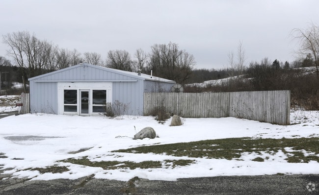
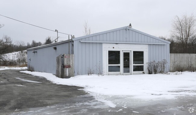
4117 Highway 33
Milwaukee-Waukesha, WI
PT OF NE NE+PT LOT 1 CSM 5908 DOC 1075064+1150833 (HWY V1296 P639)
T13-0080310
Washington
Commercialacreage
Wisconsin
B and X Area of moderate flood hazard, usually the area between the limits of the 100-year and 500-year floods.
1
2025
5 AC
2025
North Washington
420108
Milwaukee/Madison
NEARBY LISTINGS FOR SALE OR LEASE
DEMOGRAPHICS near 4117 Highway 33
1 mile
3 mile
5 mile
2025 Total Population
1,207
19,505
44,101
2030 Population
1,227
19,811
44,686
Pop Growth 2025-2030
+ 1.66%
+ 1.57%
+ 1.33%
Average Age
44
44
44
2025 Total Households
511
8,559
18,652
HH Growth 2025-2030
+ 1.76%
+ 1.58%
+ 1.37%
Median Household Inc
$100,195
$77,686
$83,307
Avg Household Size
2.30
2.20
2.30
2025 Avg HH Vehicles
2.00
2.00
2.00
Median Home Value
$317,175
$292,047
$300,381
Median Year Built
1992
1976
1977
Nearby Places
Map Layers
Map Styles
 Street
 Aerial
Layers
 Traffic
 Biking
Places
Listings with unknown addresses are not visible on the map
- Restaurants
- Banks
- Shops
- Fitness
- Groceries
PUBLIC TRANSPORTATION
AIRPORT
General Mitchell International
Drive
Walk
Distance
General Mitchell International
61 min
45.3 mi
Freight Ports
Port Milwaukee
Drive
Walk
Distance
Port Milwaukee
55 min
41.5 mi
Nearby Properties
Address
Land Use
TOTAL SIZE
Lot Size
Zoning
Address
Land Use
TOTAL SIZE
Lot Size
Zoning
141,874 SF
116.53 AC
Address
Land Use
TOTAL SIZE
Lot Size
Zoning
5,600 SF
10.11 AC
Address
Land Use
TOTAL SIZE
Lot Size
Zoning
190,000 SF
64.03 AC
Address
Land Use
TOTAL SIZE
Lot Size
Zoning
62,974 SF
6.25 AC
Address
Land Use
TOTAL SIZE
Lot Size
Zoning
36,915 SF
11.79 AC
Address
Land Use
TOTAL SIZE
Lot Size
Zoning
1,620 SF
39.56 AC
Address
Land Use
TOTAL SIZE
Lot Size
Zoning
Address
Land Use
TOTAL SIZE
Lot Size
Zoning
Address
Land Use
TOTAL SIZE
Lot Size
Zoning
50,096 SF
8.91 AC
Address
Land Use
TOTAL SIZE
Lot Size
Zoning
3,404 SF
49.06 AC
Address
Land Use
TOTAL SIZE
Lot Size
Zoning
17.53 AC
Address
Land Use
TOTAL SIZE
Lot Size
Zoning
65,350 SF
5.92 AC
Address
Land Use
TOTAL SIZE
Lot Size
Zoning
78,372 SF
1.49 AC
Address
Land Use
TOTAL SIZE
Lot Size
Zoning
Address
Land Use
TOTAL SIZE
Lot Size
Zoning
9,085 SF
3.19 AC
Address
Land Use
TOTAL SIZE
Lot Size
Zoning
28,184 SF
16.52 AC
Address
Land Use
TOTAL SIZE
Lot Size
Zoning
66,378 SF
10.06 AC
Address
Land Use
TOTAL SIZE
Lot Size
Zoning
56,204 SF
2.29 AC
Address
Land Use
TOTAL SIZE
Lot Size
Zoning
5.73 AC
Address
Land Use
TOTAL SIZE
Lot Size
Zoning
23,744 SF
4.64 AC
Address
Land Use
TOTAL SIZE
Lot Size
Zoning
4,219 SF
5.33 AC
Address
Land Use
TOTAL SIZE
Lot Size
Zoning
29,760 SF
3.32 AC
Address
Land Use
TOTAL SIZE
Lot Size
Zoning
46,464 SF
2.93 AC
Address
Land Use
TOTAL SIZE
Lot Size
Zoning
21,624 SF
9.79 AC
Address
Land Use
TOTAL SIZE
Lot Size
Zoning
28,084 SF
4.31 AC
Address
Land Use
TOTAL SIZE
Lot Size
Zoning
11,524 SF
3.31 AC
Address
Land Use
TOTAL SIZE
Lot Size
Zoning
2.45 AC
Address
Land Use
TOTAL SIZE
Lot Size
Zoning
23,752 SF
1.40 AC
Address
Land Use
TOTAL SIZE
Lot Size
Zoning
25,417 SF
4.47 AC
Address
Land Use
TOTAL SIZE
Lot Size
Zoning
4.53 AC
The World's #1 Commercial Real Estate Marketplace
Connect with us
© 2026 CoStar Group
The information above has been obtained from sources believed reliable. While we do not doubt its accuracy we have not verified it and make no guarantee, warranty or representation about it. It is your responsibility to independently confirm its accuracy and completeness. Any projections, opinions, assumptions, or estimates used are for example only and do not represent the current or future performance of the property. The value of this transaction to you depends on tax and other factors which should be evaluated by your tax, financial, and legal advisors. You and your advisors should conduct a careful, independent investigation of the property to determine to your satisfaction the suitability of the property for your needs.