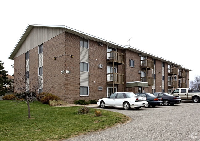
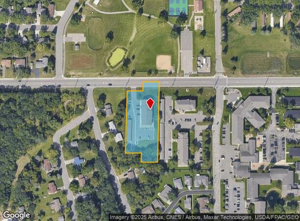
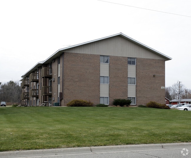
Property Record
412 1St St Ne, Sartell, MN 56377

NEARBY LISTINGS FOR SALE OR LEASE
-
-
View all Sartell listings for sale on LoopNet.com
Property Detail
412 1St St Ne
St. Cloud, MN
Oakridge Third Add
18.00030.00
SECT-15 TWP-036 RANGE-031 .94 AC PART OF NW1/4 NW1/4 COMM AT NE COR LOT 1 BLK 1 OAKRIDGE 3RD ADDN TH S 500 FT TH E 90.80 FT
Multifamilydwelling
Benton
X
Minnesota
27145C0627E
1
2025
0.94 AC
2025
Outlying Benton County
020206
Minneapolis/St Paul
DEMOGRAPHICS near 412 1St St Ne
1 Mile
3 Mile
5 Mile
2024 Total Population
5,204
37,388
84,322
2029 Population
5,198
38,185
86,429
Pop Growth 2024-2029
(0.12%)
+ 2.13%
+ 2.50%
Average Age
42
38
37
2024 Total Households
2,271
14,943
33,921
HH Growth 2024-2029
(0.09%)
+ 2.13%
+ 2.58%
Median Household Inc
$57,420
$63,916
$58,756
Avg Household Size
2.20
2.40
2.30
2024 Avg HH Vehicles
2.00
2.00
2.00
Median Home Value
$200,752
$226,283
$197,291
Median Year Built
1988
1991
1984
Nearby Places
Map Layers
Map Styles
 Street
 Aerial
- Restaurants
- Banks
- Shops
- Fitness
- Groceries
PUBLIC TRANSPORTATION
COMMUTER RAIL
DRIVE
WALK
Distance
9 min
5.3 mi
Nearby Properties
Address
Land Use
TOTAL SIZE
Lot Size
Zoning
Address
Land Use
TOTAL SIZE
Lot Size
Zoning
250,584 SF
77.75 AC
Address
Land Use
TOTAL SIZE
Lot Size
Zoning
183,964 SF
39.05 AC
Address
Land Use
TOTAL SIZE
Lot Size
Zoning
10,800 SF
24.94 AC
Address
Land Use
TOTAL SIZE
Lot Size
Zoning
11.82 AC
Address
Land Use
TOTAL SIZE
Lot Size
Zoning
30,096 SF
8.47 AC
Address
Land Use
TOTAL SIZE
Lot Size
Zoning
365,299 SF
28.68 AC
R1
Address
Land Use
TOTAL SIZE
Lot Size
Zoning
252,469 SF
35 AC
Address
Land Use
TOTAL SIZE
Lot Size
Zoning
10.46 AC
Address
Land Use
TOTAL SIZE
Lot Size
Zoning
149,778 SF
7.86 AC
Address
Land Use
TOTAL SIZE
Lot Size
Zoning
184,285 SF
13.37 AC
Address
Land Use
TOTAL SIZE
Lot Size
Zoning
88,000 SF
37.63 AC
Address
Land Use
TOTAL SIZE
Lot Size
Zoning
15.78 AC
Address
Land Use
TOTAL SIZE
Lot Size
Zoning
105,123 SF
36.87 AC
R1
Address
Land Use
TOTAL SIZE
Lot Size
Zoning
127,460 SF
5 AC
Address
Land Use
TOTAL SIZE
Lot Size
Zoning
25,608 SF
6.96 AC
R5
Address
Land Use
TOTAL SIZE
Lot Size
Zoning
36,393 SF
6.28 AC
Address
Land Use
TOTAL SIZE
Lot Size
Zoning
135,964 SF
57.06 AC
PUD28
Address
Land Use
TOTAL SIZE
Lot Size
Zoning
9.75 AC
Address
Land Use
TOTAL SIZE
Lot Size
Zoning
197,115 SF
18.23 AC
Address
Land Use
TOTAL SIZE
Lot Size
Zoning
18,554 SF
8.41 AC
Address
Land Use
TOTAL SIZE
Lot Size
Zoning
43,302 SF
5.67 AC
Address
Land Use
TOTAL SIZE
Lot Size
Zoning
3.89 AC
Address
Land Use
TOTAL SIZE
Lot Size
Zoning
10.96 AC
Address
Land Use
TOTAL SIZE
Lot Size
Zoning
22,425 SF
5.54 AC
Address
Land Use
TOTAL SIZE
Lot Size
Zoning
91,625 SF
7.02 AC
Address
Land Use
TOTAL SIZE
Lot Size
Zoning
27,984 SF
10.39 AC
Address
Land Use
TOTAL SIZE
Lot Size
Zoning
Address
Land Use
TOTAL SIZE
Lot Size
Zoning
81,500 SF
11.01 AC
Address
Land Use
TOTAL SIZE
Lot Size
Zoning
24,642 SF
5.40 AC
R5
The World's #1 Commercial Real Estate Marketplace
Connect with us
© 2026 CoStar Group
The information above has been obtained from sources believed reliable. While we do not doubt its accuracy we have not verified it and make no guarantee, warranty or representation about it. It is your responsibility to independently confirm its accuracy and completeness. Any projections, opinions, assumptions, or estimates used are for example only and do not represent the current or future performance of the property. The value of this transaction to you depends on tax and other factors which should be evaluated by your tax, financial, and legal advisors. You and your advisors should conduct a careful, independent investigation of the property to determine to your satisfaction the suitability of the property for your needs.