Property Record
412 A M Ellison Rd, Anderson, SC 29621
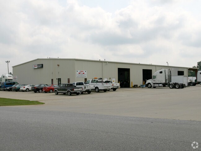

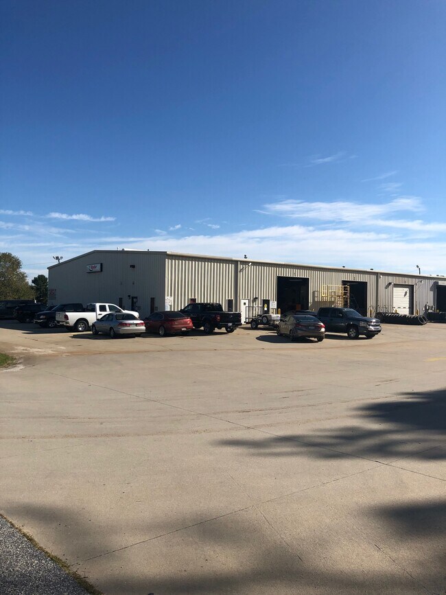
Property Detail
412 A M Ellison Rd
169-00-13-002
CP S 2951/7 PP 96/942 F 0000D 0000 PP 044/022 AM ELLISON RD 8.91AC
Commercialnec
Anderson
B and X Area of moderate flood hazard, usually the area between the limits of the 100-year and 500-year floods.
South Carolina
2025
8.91 AC
2025
Outlying Anderson Co
010501
Greenville/Spartanburg
12,149 SF
Greenville-Anderson-Greer, SC
NEARBY LISTINGS FOR SALE OR LEASE
DEMOGRAPHICS near 412 A M Ellison Rd
1 mile
3 mile
5 mile
2025 Total Population
244
7,405
23,738
2030 Population
257
7,816
25,007
Pop Growth 2025-2030
+ 5.33%
+ 5.55%
+ 5.35%
Average Age
41
41
41
2025 Total Households
87
2,658
8,752
HH Growth 2025-2030
+ 5.75%
+ 5.83%
+ 5.61%
Median Household Inc
$76,562
$100,774
$91,441
Avg Household Size
2.80
2.80
2.70
2025 Avg HH Vehicles
2.00
2.00
2.00
Median Home Value
$371,428
$420,862
$344,479
Median Year Built
2002
2003
1998
Nearby Places
Map Layers
Map Styles
 Street
 Aerial
Transit
 Traffic
 Biking
Places
Listings with unknown addresses are not visible on the map
- Restaurants
- Banks
- Shops
- Fitness
- Groceries
PUBLIC TRANSPORTATION
AIRPORT
Greenville Spartanburg International
Drive
Walk
Distance
Greenville Spartanburg International
42 min
32.0 mi
SALE & LEASE HISTORY
LISTING DATE
SALE/LEASE

Nov 03, 2020
For Sale
Nearby Properties
Address
Land Use
TOTAL SIZE
Lot Size
Zoning
Address
Land Use
TOTAL SIZE
Lot Size
Zoning
109.52 AC
Address
Land Use
TOTAL SIZE
Lot Size
Zoning
41.61 AC
Address
Land Use
TOTAL SIZE
Lot Size
Zoning
86.84 AC
Address
Land Use
TOTAL SIZE
Lot Size
Zoning
59.13 AC
Address
Land Use
TOTAL SIZE
Lot Size
Zoning
2,420 SF
48.50 AC
Address
Land Use
TOTAL SIZE
Lot Size
Zoning
29.70 AC
Address
Land Use
TOTAL SIZE
Lot Size
Zoning
6.12 AC
Address
Land Use
TOTAL SIZE
Lot Size
Zoning
91,455 SF
12 AC
Address
Land Use
TOTAL SIZE
Lot Size
Zoning
4.63 AC
Address
Land Use
TOTAL SIZE
Lot Size
Zoning
2,408 SF
3.89 AC
Address
Land Use
TOTAL SIZE
Lot Size
Zoning
46,659 SF
2 AC
Address
Land Use
TOTAL SIZE
Lot Size
Zoning
45,085 SF
6.96 AC
Address
Land Use
TOTAL SIZE
Lot Size
Zoning
1,768 SF
7.33 AC
Address
Land Use
TOTAL SIZE
Lot Size
Zoning
16.80 AC
Address
Land Use
TOTAL SIZE
Lot Size
Zoning
30,736 SF
3.05 AC
Address
Land Use
TOTAL SIZE
Lot Size
Zoning
5,248 SF
9.44 AC
Address
Land Use
TOTAL SIZE
Lot Size
Zoning
34,568 SF
1.85 AC
Address
Land Use
TOTAL SIZE
Lot Size
Zoning
3,835 SF
2.98 AC
Address
Land Use
TOTAL SIZE
Lot Size
Zoning
1,328 SF
11.31 AC
Address
Land Use
TOTAL SIZE
Lot Size
Zoning
41.95 AC
Address
Land Use
TOTAL SIZE
Lot Size
Zoning
15,435 SF
2.94 AC
Address
Land Use
TOTAL SIZE
Lot Size
Zoning
7,507 SF
7.73 AC
Address
Land Use
TOTAL SIZE
Lot Size
Zoning
33,876 SF
19.82 AC
Address
Land Use
TOTAL SIZE
Lot Size
Zoning
12.86 AC
Address
Land Use
TOTAL SIZE
Lot Size
Zoning
32,679 SF
15.75 AC
Address
Land Use
TOTAL SIZE
Lot Size
Zoning
1,884 SF
3.87 AC
Address
Land Use
TOTAL SIZE
Lot Size
Zoning
7,200 SF
3.70 AC
Address
Land Use
TOTAL SIZE
Lot Size
Zoning
943 SF
0.92 AC
The World's #1 Commercial Real Estate Marketplace
Connect with us
© 2026 CoStar Group
The information above has been obtained from sources believed reliable. While we do not doubt its accuracy we have not verified it and make no guarantee, warranty or representation about it. It is your responsibility to independently confirm its accuracy and completeness. Any projections, opinions, assumptions, or estimates used are for example only and do not represent the current or future performance of the property. The value of this transaction to you depends on tax and other factors which should be evaluated by your tax, financial, and legal advisors. You and your advisors should conduct a careful, independent investigation of the property to determine to your satisfaction the suitability of the property for your needs.