Property Record
412 Cornelius Rd, Cedartown, GA 30125
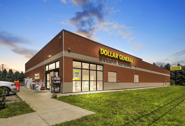

Property Detail
412 Cornelius Rd
Cedartown, GA
LTS 14-18
019C010B
POLK
Commercialnec
Georgia
B and X Area of moderate flood hazard, usually the area between the limits of the 100-year and 500-year floods.
14-18
2025
2.18 AC
2025
Georgia Northwest
010300
Other Market Areas
10,712 SF
NEARBY LISTINGS FOR SALE OR LEASE
DEMOGRAPHICS near 412 Cornelius Rd
1 mile
3 mile
5 mile
2025 Total Population
584
7,615
19,193
2030 Population
609
7,903
19,869
Pop Growth 2025-2030
+ 4.28%
+ 3.78%
+ 3.52%
Average Age
39
37
39
2025 Total Households
212
2,618
6,986
HH Growth 2025-2030
+ 4.25%
+ 3.74%
+ 3.46%
Median Household Inc
$76,190
$53,402
$52,123
Avg Household Size
2.70
2.80
2.60
2025 Avg HH Vehicles
2.00
2.00
2.00
Median Home Value
$174,467
$143,217
$158,623
Median Year Built
1981
1979
1978
Nearby Places
Map Layers
Map Styles
 Street
 Aerial
Layers
 Traffic
 Biking
Places
Listings with unknown addresses are not visible on the map
- Restaurants
- Banks
- Shops
- Fitness
- Groceries
SALE & LEASE HISTORY
LISTING DATE
SALE/LEASE

Jul 10, 2024
For Sale
Nearby Properties
Address
Land Use
TOTAL SIZE
Lot Size
Zoning
Address
Land Use
TOTAL SIZE
Lot Size
Zoning
563,570 SF
44.28 AC
Address
Land Use
TOTAL SIZE
Lot Size
Zoning
47,050 SF
349.53 AC
Address
Land Use
TOTAL SIZE
Lot Size
Zoning
85,418 SF
2.19 AC
Address
Land Use
TOTAL SIZE
Lot Size
Zoning
82,750 SF
6.91 AC
Address
Land Use
TOTAL SIZE
Lot Size
Zoning
45,000 SF
10 AC
Address
Land Use
TOTAL SIZE
Lot Size
Zoning
23,390 SF
6.79 AC
Address
Land Use
TOTAL SIZE
Lot Size
Zoning
12,634 SF
2.70 AC
Address
Land Use
TOTAL SIZE
Lot Size
Zoning
54,844 SF
10 AC
Address
Land Use
TOTAL SIZE
Lot Size
Zoning
188,490 SF
20.01 AC
Address
Land Use
TOTAL SIZE
Lot Size
Zoning
70,904 SF
4.64 AC
Address
Land Use
TOTAL SIZE
Lot Size
Zoning
17,280 SF
16 AC
Address
Land Use
TOTAL SIZE
Lot Size
Zoning
77,340 SF
5 AC
Address
Land Use
TOTAL SIZE
Lot Size
Zoning
1,512 SF
3.50 AC
Address
Land Use
TOTAL SIZE
Lot Size
Zoning
38,938 SF
5.28 AC
Address
Land Use
TOTAL SIZE
Lot Size
Zoning
156,527 SF
9.50 AC
Address
Land Use
TOTAL SIZE
Lot Size
Zoning
95,611 SF
23 AC
Address
Land Use
TOTAL SIZE
Lot Size
Zoning
30,595 SF
12 AC
Address
Land Use
TOTAL SIZE
Lot Size
Zoning
709.74 AC
Address
Land Use
TOTAL SIZE
Lot Size
Zoning
50,000 SF
13.77 AC
Address
Land Use
TOTAL SIZE
Lot Size
Zoning
25,589 SF
1.47 AC
Address
Land Use
TOTAL SIZE
Lot Size
Zoning
50,000 SF
13.18 AC
Address
Land Use
TOTAL SIZE
Lot Size
Zoning
24,000 SF
5.33 AC
Address
Land Use
TOTAL SIZE
Lot Size
Zoning
24,600 SF
5.06 AC
Address
Land Use
TOTAL SIZE
Lot Size
Zoning
15,500 SF
6.56 AC
IND-L (I-1
Address
Land Use
TOTAL SIZE
Lot Size
Zoning
10,850 SF
0.25 AC
Address
Land Use
TOTAL SIZE
Lot Size
Zoning
4,102 SF
6.03 AC
Address
Land Use
TOTAL SIZE
Lot Size
Zoning
7,840 SF
9.48 AC
Address
Land Use
TOTAL SIZE
Lot Size
Zoning
19,200 SF
24.11 AC
Address
Land Use
TOTAL SIZE
Lot Size
Zoning
14,760 SF
4.02 AC
The World's #1 Commercial Real Estate Marketplace
Connect with us
© 2026 CoStar Group
The information above has been obtained from sources believed reliable. While we do not doubt its accuracy we have not verified it and make no guarantee, warranty or representation about it. It is your responsibility to independently confirm its accuracy and completeness. Any projections, opinions, assumptions, or estimates used are for example only and do not represent the current or future performance of the property. The value of this transaction to you depends on tax and other factors which should be evaluated by your tax, financial, and legal advisors. You and your advisors should conduct a careful, independent investigation of the property to determine to your satisfaction the suitability of the property for your needs.