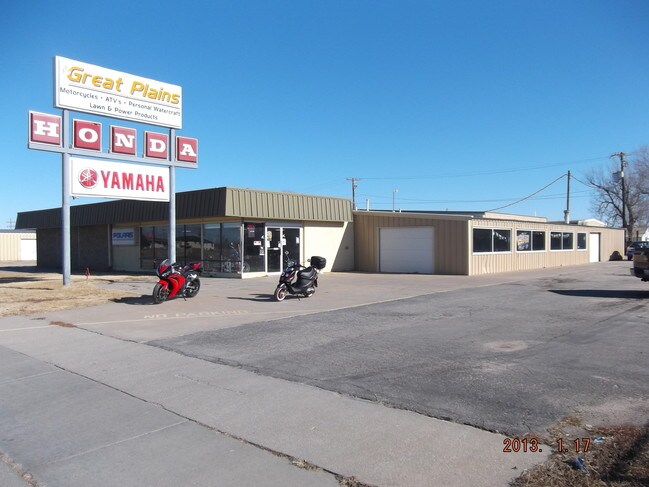
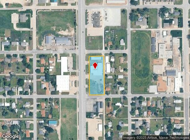
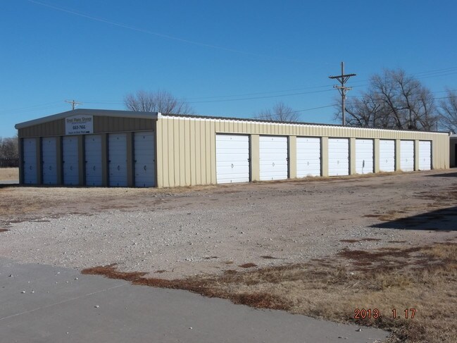
Property Record
412 S Main St, South Hutchinson, KS 67505
NEARBY LISTINGS FOR SALE OR LEASE
-
-
View all South Hutchinson listings for sale on LoopNet.com
Property Detail
412 S Main St
Hutchinson, KS
South Main
127-25-0-20-26-004.00
SOUTH MAIN, S25, T23, R06W, LOT 114 - 140 EVEN, LOTS 114 THRU 140 EVEN INCL & S 15 FT E AVE D VACATED AND N 15 FT E AVE E
Publicstorage
Reno
X
Kansas
20155C0289G
114,140
2024
1.31 AC
2024
Kansas Area
001300
Other Market Areas
3,000 SF
DEMOGRAPHICS near 412 S Main St
1 Mile
3 Mile
5 Mile
2024 Total Population
2,056
14,791
38,328
2029 Population
2,026
14,899
38,258
Pop Growth 2024-2029
(1.46%)
+ 0.73%
(0.18%)
Average Age
45
40
41
2024 Total Households
948
6,494
16,577
HH Growth 2024-2029
(1.58%)
+ 0.68%
(0.24%)
Median Household Inc
$39,045
$39,123
$48,617
Avg Household Size
2.10
2.20
2.20
2024 Avg HH Vehicles
2.00
2.00
2.00
Median Home Value
$121,254
$70,693
$96,093
Median Year Built
1972
1949
1957
Nearby Places
Map Layers
Map Styles
 Street
 Aerial
- Restaurants
- Banks
- Shops
- Fitness
- Groceries
PUBLIC TRANSPORTATION
COMMUTER RAIL
Hutchinson Amtrak Station (Southwest Chief - Amtrak)
DRIVE
WALK
Distance
Hutchinson Amtrak Station (Southwest Chief - Amtrak)
5 min
2.6 mi
Freight Ports
Tulsa Port Of Catoosa
DRIVE
WALK
Distance
Tulsa Port Of Catoosa
257 min
239.5 mi
SALE & LEASE HISTORY
LISTING DATE
SALE/LEASE

Oct 22, 2018
For Sale
Nearby Properties
Address
Land Use
TOTAL SIZE
Lot Size
Zoning
Address
Land Use
TOTAL SIZE
Lot Size
Zoning
94,825 SF
10 AC
Address
Land Use
TOTAL SIZE
Lot Size
Zoning
89,458 SF
1.88 AC
P
Address
Land Use
TOTAL SIZE
Lot Size
Zoning
59.65 AC
P
Address
Land Use
TOTAL SIZE
Lot Size
Zoning
1,960 SF
15.96 AC
Address
Land Use
TOTAL SIZE
Lot Size
Zoning
29,431 SF
1.50 AC
C5
Address
Land Use
TOTAL SIZE
Lot Size
Zoning
36,000 SF
19.49 AC
Address
Land Use
TOTAL SIZE
Lot Size
Zoning
1,136 SF
4.68 AC
Address
Land Use
TOTAL SIZE
Lot Size
Zoning
101,932 SF
1.50 AC
P
Address
Land Use
TOTAL SIZE
Lot Size
Zoning
1,848 SF
12.35 AC
Address
Land Use
TOTAL SIZE
Lot Size
Zoning
59,962 SF
2.52 AC
P
Address
Land Use
TOTAL SIZE
Lot Size
Zoning
2,250 SF
91.13 AC
Address
Land Use
TOTAL SIZE
Lot Size
Zoning
151.45 AC
Address
Land Use
TOTAL SIZE
Lot Size
Zoning
16,288 SF
0.38 AC
C5
Address
Land Use
TOTAL SIZE
Lot Size
Zoning
11,216 SF
1.88 AC
P
Address
Land Use
TOTAL SIZE
Lot Size
Zoning
48,596 SF
2.59 AC
P
Address
Land Use
TOTAL SIZE
Lot Size
Zoning
47,402 SF
3.71 AC
P
Address
Land Use
TOTAL SIZE
Lot Size
Zoning
1,752 SF
103.49 AC
Address
Land Use
TOTAL SIZE
Lot Size
Zoning
468 SF
34.12 AC
Address
Land Use
TOTAL SIZE
Lot Size
Zoning
4,000 SF
15.02 AC
I2
Address
Land Use
TOTAL SIZE
Lot Size
Zoning
154.95 AC
Address
Land Use
TOTAL SIZE
Lot Size
Zoning
58,907 SF
6.63 AC
Address
Land Use
TOTAL SIZE
Lot Size
Zoning
9,600 SF
17.98 AC
Address
Land Use
TOTAL SIZE
Lot Size
Zoning
2,035 SF
43.77 AC
Address
Land Use
TOTAL SIZE
Lot Size
Zoning
39,856 SF
12.80 AC
PI
Address
Land Use
TOTAL SIZE
Lot Size
Zoning
23,424 SF
0.80 AC
C5
Address
Land Use
TOTAL SIZE
Lot Size
Zoning
44,204 SF
1.46 AC
C5
Address
Land Use
TOTAL SIZE
Lot Size
Zoning
35,372 SF
0.83 AC
PI
Address
Land Use
TOTAL SIZE
Lot Size
Zoning
31,338 SF
1.09 AC
R4
Address
Land Use
TOTAL SIZE
Lot Size
Zoning
28,864 SF
0.72 AC
C4
Address
Land Use
TOTAL SIZE
Lot Size
Zoning
7,326 SF
0.80 AC
The World's #1 Commercial Real Estate Marketplace
Connect with us
© 2025 CoStar Group
The information above has been obtained from sources believed reliable. While we do not doubt its accuracy we have not verified it and make no guarantee, warranty or representation about it. It is your responsibility to independently confirm its accuracy and completeness. Any projections, opinions, assumptions, or estimates used are for example only and do not represent the current or future performance of the property. The value of this transaction to you depends on tax and other factors which should be evaluated by your tax, financial, and legal advisors. You and your advisors should conduct a careful, independent investigation of the property to determine to your satisfaction the suitability of the property for your needs.