Property Record
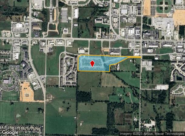
412 Sw Stone Blvd, Bentonville, AR 72713
NEARBY LISTINGS FOR SALE OR LEASE
-
-
View all Bentonville listings for sale on LoopNet.com
Property Detail
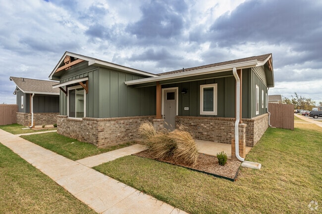
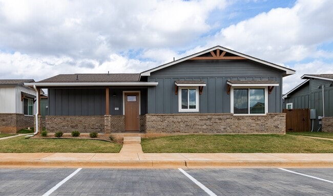
412 Sw Stone Blvd
Fayetteville/Springdale/Rogers
Tara Ridge Sub-Bentonville
Fayetteville-Springdale-Rogers, AR-MO
PLAT 12/07/2022 L202275904
01-20534-000
Benton
Nightclub
Arkansas
2025
1
2025
24.49 AC
020607
Outer Central Benton County
9,118 SF
DEMOGRAPHICS near 412 Sw Stone Blvd
1 Mile
3 Mile
5 Mile
2024 Total Population
5,036
52,152
132,392
2029 Population
6,037
61,703
156,130
Pop Growth 2024-2029
+ 19.88%
+ 18.31%
+ 17.93%
Average Age
35
35
35
2024 Total Households
2,197
20,412
49,387
HH Growth 2024-2029
+ 20.03%
+ 18.43%
+ 18.07%
Median Household Inc
$78,058
$88,525
$88,707
Avg Household Size
2.20
2.50
2.60
2024 Avg HH Vehicles
2.00
2.00
2.00
Median Home Value
$330,392
$283,535
$286,271
Median Year Built
2005
2003
2002
Nearby Places
Map Layers
Map Styles
 Street
 Aerial
- Restaurants
- Banks
- Shops
- Fitness
- Groceries
PUBLIC TRANSPORTATION
AIRPORT
Northwest Arkansas Ntl
DRIVE
WALK
Distance
Northwest Arkansas Ntl
22 min
9.8 mi
Freight Ports
Tulsa Port of Inola
DRIVE
WALK
Distance
Tulsa Port of Inola
115 min
98.3 mi
Nearby Properties
Address
Land Use
TOTAL SIZE
Lot Size
Zoning
Address
Land Use
TOTAL SIZE
Lot Size
Zoning
441,673 SF
55.19 AC
Address
Land Use
TOTAL SIZE
Lot Size
Zoning
147,199 SF
16.11 AC
Address
Land Use
TOTAL SIZE
Lot Size
Zoning
344,315 SF
12.74 AC
Address
Land Use
TOTAL SIZE
Lot Size
Zoning
516,588 SF
24.53 AC
Address
Land Use
TOTAL SIZE
Lot Size
Zoning
384,427 SF
10.51 AC
Address
Land Use
TOTAL SIZE
Lot Size
Zoning
216,538 SF
22.14 AC
Address
Land Use
TOTAL SIZE
Lot Size
Zoning
149,727 SF
1.32 AC
Address
Land Use
TOTAL SIZE
Lot Size
Zoning
675,465 SF
37.34 AC
Address
Land Use
TOTAL SIZE
Lot Size
Zoning
1,159,141 SF
176.54 AC
Address
Land Use
TOTAL SIZE
Lot Size
Zoning
472,987 SF
3.75 AC
Address
Land Use
TOTAL SIZE
Lot Size
Zoning
381,924 SF
10.23 AC
Address
Land Use
TOTAL SIZE
Lot Size
Zoning
307,725 SF
9.36 AC
Address
Land Use
TOTAL SIZE
Lot Size
Zoning
546,195 SF
15.80 AC
Address
Land Use
TOTAL SIZE
Lot Size
Zoning
187,529 SF
37.78 AC
Address
Land Use
TOTAL SIZE
Lot Size
Zoning
254,163 SF
10.98 AC
Address
Land Use
TOTAL SIZE
Lot Size
Zoning
573,822 SF
10.56 AC
Address
Land Use
TOTAL SIZE
Lot Size
Zoning
375,605 SF
24.54 AC
Address
Land Use
TOTAL SIZE
Lot Size
Zoning
247,292 SF
1.57 AC
Address
Land Use
TOTAL SIZE
Lot Size
Zoning
234,432 SF
19.98 AC
Address
Land Use
TOTAL SIZE
Lot Size
Zoning
269,397 SF
27.07 AC
Address
Land Use
TOTAL SIZE
Lot Size
Zoning
299,595 SF
18 AC
Address
Land Use
TOTAL SIZE
Lot Size
Zoning
458,697 SF
35.35 AC
Address
Land Use
TOTAL SIZE
Lot Size
Zoning
208,865 SF
7.73 AC
Address
Land Use
TOTAL SIZE
Lot Size
Zoning
42,848 SF
3.08 AC
Address
Land Use
TOTAL SIZE
Lot Size
Zoning
251,590 SF
6.95 AC
Address
Land Use
TOTAL SIZE
Lot Size
Zoning
270,199 SF
10.23 AC
Address
Land Use
TOTAL SIZE
Lot Size
Zoning
418,411 SF
26.88 AC
Address
Land Use
TOTAL SIZE
Lot Size
Zoning
17,340 SF
14.15 AC
Address
Land Use
TOTAL SIZE
Lot Size
Zoning
283,760 SF
11.61 AC
The World's #1 Commercial Real Estate Marketplace
Connect with us
© 2025 CoStar Group
The information above has been obtained from sources believed reliable. While we do not doubt its accuracy we have not verified it and make no guarantee, warranty or representation about it. It is your responsibility to independently confirm its accuracy and completeness. Any projections, opinions, assumptions, or estimates used are for example only and do not represent the current or future performance of the property. The value of this transaction to you depends on tax and other factors which should be evaluated by your tax, financial, and legal advisors. You and your advisors should conduct a careful, independent investigation of the property to determine to your satisfaction the suitability of the property for your needs.