Property Record
4120 2Nd Ave, Detroit, MI 48201
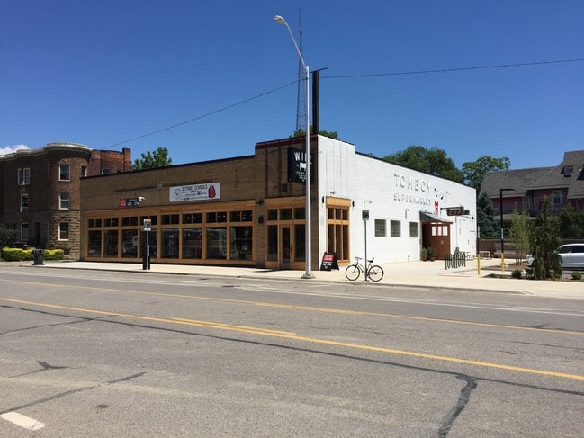


This Property Is For Sale
Property Detail
4120 2Nd Ave
02-002364
E SECOND BLVD 15-16 BLK 95 AND N 20 FT VAC ALEXANDRINE--SUB PT CASS FARM L1 P175-7 PLATS, W C R 2/103 173 X 99.8
Commercialnec
Wayne
SD2
Michigan
B and X Area of moderate flood hazard, usually the area between the limits of the 100-year and 500-year floods.
0.35 AC
2025
Detroit-New Center
2025
Detroit
520300
Detroit-Warren-Dearborn, MI
7,784 SF
NEARBY LISTINGS FOR SALE OR LEASE
DEMOGRAPHICS near 4120 2Nd Ave
1 mile
3 mile
5 mile
2025 Total Population
23,760
109,302
287,748
2030 Population
23,911
112,032
294,445
Pop Growth 2025-2030
+ 0.64%
+ 2.50%
+ 2.33%
Average Age
36
39
38
2025 Total Households
11,919
52,743
118,868
HH Growth 2025-2030
+ 1.07%
+ 2.28%
+ 2.51%
Median Household Inc
$32,001
$41,097
$37,256
Avg Household Size
1.70
1.90
2.30
2025 Avg HH Vehicles
1.00
1.00
1.00
Median Home Value
$392,104
$177,052
$100,521
Median Year Built
1971
1953
1948
Nearby Places
Map Layers
Map Styles
 Street
 Aerial
Layers
 Traffic
 Biking
Places
Listings with unknown addresses are not visible on the map
- Restaurants
- Banks
- Shops
- Fitness
- Groceries
PUBLIC TRANSPORTATION
COMMUTER RAIL
Drive
Walk
Distance
5 min
1.7 mi
Drive
Walk
Distance
15 min
6.5 mi
AIRPORT
Windsor International
Drive
Walk
Distance
Windsor International
29 min
12.4 mi
Detroit Metro Wayne County
Drive
Walk
Distance
Detroit Metro Wayne County
34 min
21.8 mi
Freight Ports
Drive
Walk
Distance
77 min
61.2 mi
Nearby Properties
Address
Land Use
TOTAL SIZE
Lot Size
Zoning
Address
Land Use
TOTAL SIZE
Lot Size
Zoning
3,032,363 SF
24.24 AC
SD5
Address
Land Use
TOTAL SIZE
Lot Size
Zoning
6,112,830 SF
13.67 AC
PD
Address
Land Use
TOTAL SIZE
Lot Size
Zoning
409,438 SF
0.83 AC
B6
Address
Land Use
TOTAL SIZE
Lot Size
Zoning
1,409,416 SF
13.53 AC
R6
Address
Land Use
TOTAL SIZE
Lot Size
Zoning
1,553,311 SF
3.05 AC
SD5
Address
Land Use
TOTAL SIZE
Lot Size
Zoning
1,994,989 SF
4.97 AC
B5
Address
Land Use
TOTAL SIZE
Lot Size
Zoning
873,048 SF
7.70 AC
R6
Address
Land Use
TOTAL SIZE
Lot Size
Zoning
1,478,866 SF
2.88 AC
PCA
Address
Land Use
TOTAL SIZE
Lot Size
Zoning
1,017,009 SF
1.35 AC
R6
Address
Land Use
TOTAL SIZE
Lot Size
Zoning
848,598 SF
8.78 AC
SD5
Address
Land Use
TOTAL SIZE
Lot Size
Zoning
252,150 SF
2.46 AC
SD5
Address
Land Use
TOTAL SIZE
Lot Size
Zoning
185,300 SF
3.36 AC
SD5
Address
Land Use
TOTAL SIZE
Lot Size
Zoning
1,847,449 SF
13.85 AC
PD
Address
Land Use
TOTAL SIZE
Lot Size
Zoning
6,620 SF
9.43 AC
B6
Address
Land Use
TOTAL SIZE
Lot Size
Zoning
1,004,872 SF
1.05 AC
PCA
Address
Land Use
TOTAL SIZE
Lot Size
Zoning
720,653 SF
1.53 AC
PCA
Address
Land Use
TOTAL SIZE
Lot Size
Zoning
3,793,609 SF
265.70 AC
M4
Address
Land Use
TOTAL SIZE
Lot Size
Zoning
895,279 SF
3.58 AC
PCA
Address
Land Use
TOTAL SIZE
Lot Size
Zoning
1,149,710 SF
1.07 AC
B5
Address
Land Use
TOTAL SIZE
Lot Size
Zoning
503,688 SF
Address
Land Use
TOTAL SIZE
Lot Size
Zoning
919,213 SF
B5
Address
Land Use
TOTAL SIZE
Lot Size
Zoning
568,546 SF
B5
Address
Land Use
TOTAL SIZE
Lot Size
Zoning
874,160 SF
9.91 AC
R6
Address
Land Use
TOTAL SIZE
Lot Size
Zoning
520,897 SF
0.85 AC
Address
Land Use
TOTAL SIZE
Lot Size
Zoning
306,496 SF
1.91 AC
R6
Address
Land Use
TOTAL SIZE
Lot Size
Zoning
430,286 SF
1.14 AC
PCA
Address
Land Use
TOTAL SIZE
Lot Size
Zoning
437,558 SF
0.72 AC
Address
Land Use
TOTAL SIZE
Lot Size
Zoning
187,652 SF
Address
Land Use
TOTAL SIZE
Lot Size
Zoning
268,746 SF
B5
Address
Land Use
TOTAL SIZE
Lot Size
Zoning
576,286 SF
1.66 AC
B4
The World's #1 Commercial Real Estate Marketplace
Connect with us
© 2026 CoStar Group
The information above has been obtained from sources believed reliable. While we do not doubt its accuracy we have not verified it and make no guarantee, warranty or representation about it. It is your responsibility to independently confirm its accuracy and completeness. Any projections, opinions, assumptions, or estimates used are for example only and do not represent the current or future performance of the property. The value of this transaction to you depends on tax and other factors which should be evaluated by your tax, financial, and legal advisors. You and your advisors should conduct a careful, independent investigation of the property to determine to your satisfaction the suitability of the property for your needs.