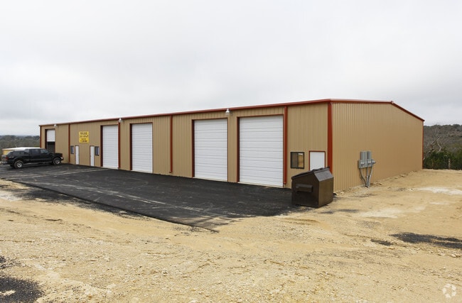
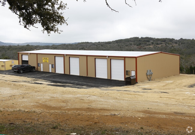
Property Record
41205 Interstate 10 W, Boerne, TX 78006

Property Detail
41205 Interstate 10 W
46195
A10166 - SURVEY 174 N FLORES 5.3 ACRES
Commercialbuilding
Kendall
B and X Area of moderate flood hazard, usually the area between the limits of the 100-year and 500-year floods.
Texas
2024
5.30 AC
2025
Kendall County
970302
San Antonio
31,300 SF
San Antonio-New Braunfels, TX
NEARBY LISTINGS FOR SALE OR LEASE
DEMOGRAPHICS near 41205 Interstate 10 W
1 mile
3 mile
5 mile
2025 Total Population
101
3,547
16,497
2030 Population
114
3,992
18,505
Pop Growth 2025-2030
+ 12.87%
+ 12.55%
+ 12.17%
Average Age
48
47
44
2025 Total Households
38
1,368
6,384
HH Growth 2025-2030
+ 13.16%
+ 12.57%
+ 12.31%
Median Household Inc
$137,500
$116,720
$90,388
Avg Household Size
2.60
2.60
2.50
2025 Avg HH Vehicles
3.00
3.00
2.00
Median Home Value
$583,333
$512,324
$470,940
Median Year Built
1998
1995
1999
Nearby Places
Map Layers
Map Styles
 Street
 Aerial
Transit
 Traffic
 Biking
Places
Listings with unknown addresses are not visible on the map
- Restaurants
- Banks
- Shops
- Fitness
- Groceries
PUBLIC TRANSPORTATION
AIRPORT
San Antonio International
Drive
Walk
Distance
San Antonio International
42 min
33.7 mi
Freight Ports
Calhoun Port
Drive
Walk
Distance
Calhoun Port
221 min
185.3 mi
SALE & LEASE HISTORY
LISTING DATE
SALE/LEASE

Sep 07, 2021
For Lease
Nearby Properties
Address
Land Use
TOTAL SIZE
Lot Size
Zoning
Address
Land Use
TOTAL SIZE
Lot Size
Zoning
4,080 SF
302.27 AC
Address
Land Use
TOTAL SIZE
Lot Size
Zoning
86,137 SF
Address
Land Use
TOTAL SIZE
Lot Size
Zoning
128,730 SF
Address
Land Use
TOTAL SIZE
Lot Size
Zoning
90,229 SF
13.38 AC
Address
Land Use
TOTAL SIZE
Lot Size
Zoning
31,678 SF
30 AC
Address
Land Use
TOTAL SIZE
Lot Size
Zoning
14,144 SF
12.25 AC
Address
Land Use
TOTAL SIZE
Lot Size
Zoning
91,270 SF
6.74 AC
Address
Land Use
TOTAL SIZE
Lot Size
Zoning
Address
Land Use
TOTAL SIZE
Lot Size
Zoning
7.35 AC
Address
Land Use
TOTAL SIZE
Lot Size
Zoning
12,393 SF
2.52 AC
Address
Land Use
TOTAL SIZE
Lot Size
Zoning
77,640 SF
3.52 AC
Address
Land Use
TOTAL SIZE
Lot Size
Zoning
53,650 SF
1.77 AC
Address
Land Use
TOTAL SIZE
Lot Size
Zoning
6,654 SF
14.60 AC
Address
Land Use
TOTAL SIZE
Lot Size
Zoning
11,179 SF
1.37 AC
Address
Land Use
TOTAL SIZE
Lot Size
Zoning
7.10 AC
Address
Land Use
TOTAL SIZE
Lot Size
Zoning
37,882 SF
6.87 AC
Address
Land Use
TOTAL SIZE
Lot Size
Zoning
10,391 SF
91.99 AC
Address
Land Use
TOTAL SIZE
Lot Size
Zoning
16,524 SF
2.37 AC
Address
Land Use
TOTAL SIZE
Lot Size
Zoning
22,344 SF
5.48 AC
Address
Land Use
TOTAL SIZE
Lot Size
Zoning
7,930 SF
12.81 AC
Address
Land Use
TOTAL SIZE
Lot Size
Zoning
22,860 SF
3.10 AC
Address
Land Use
TOTAL SIZE
Lot Size
Zoning
39,450 SF
10.47 AC
Address
Land Use
TOTAL SIZE
Lot Size
Zoning
Address
Land Use
TOTAL SIZE
Lot Size
Zoning
10,000 SF
2.05 AC
Address
Land Use
TOTAL SIZE
Lot Size
Zoning
4,936 SF
1.03 AC
Address
Land Use
TOTAL SIZE
Lot Size
Zoning
18,000 SF
1.43 AC
Address
Land Use
TOTAL SIZE
Lot Size
Zoning
5,445 SF
2.06 AC
Address
Land Use
TOTAL SIZE
Lot Size
Zoning
15,200 SF
2.35 AC
Address
Land Use
TOTAL SIZE
Lot Size
Zoning
25,000 SF
2.42 AC
Address
Land Use
TOTAL SIZE
Lot Size
Zoning
16,109 SF
8.49 AC
The World's #1 Commercial Real Estate Marketplace
Connect with us
© 2026 CoStar Group
The information above has been obtained from sources believed reliable. While we do not doubt its accuracy we have not verified it and make no guarantee, warranty or representation about it. It is your responsibility to independently confirm its accuracy and completeness. Any projections, opinions, assumptions, or estimates used are for example only and do not represent the current or future performance of the property. The value of this transaction to you depends on tax and other factors which should be evaluated by your tax, financial, and legal advisors. You and your advisors should conduct a careful, independent investigation of the property to determine to your satisfaction the suitability of the property for your needs.