Property Record
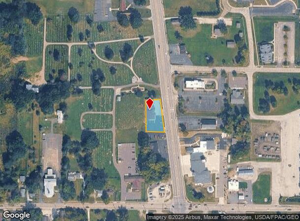
4121 State Route 43, Kent, OH 44240

NEARBY LISTINGS FOR SALE OR LEASE
Property Detail
4121 State Route 43
04-032-00-00-021-000
LOT 32 SD-62
Storebuilding
Portage
X
Ohio
39133C0226D
32
2024
0.45 AC
2024
Portage County
6017022069
Cleveland
5,675 SF
Akron, OH
DEMOGRAPHICS near 4121 State Route 43
1 Mile
3 Mile
5 Mile
2024 Total Population
2,836
13,613
68,026
2029 Population
2,859
13,782
68,268
Pop Growth 2024-2029
+ 0.81%
+ 1.24%
+ 0.36%
Average Age
42
41
39
2024 Total Households
1,103
5,598
27,538
HH Growth 2024-2029
+ 0.63%
+ 1.20%
+ 0.44%
Median Household Inc
$70,519
$73,777
$59,925
Avg Household Size
2.50
2.40
2.20
2024 Avg HH Vehicles
2.00
2.00
2.00
Median Home Value
$170,947
$216,656
$189,945
Median Year Built
1967
1990
1971
Nearby Places
Map Layers
Map Styles
 Street
 Aerial
- Restaurants
- Banks
- Shops
- Fitness
- Groceries
PUBLIC TRANSPORTATION
AIRPORT
Akron-Canton Regional
DRIVE
WALK
Distance
Akron-Canton Regional
29 min
22.0 mi
Freight Ports
Port of Toledo
DRIVE
WALK
Distance
Port of Toledo
170 min
140.0 mi
Nearby Properties
Address
Land Use
TOTAL SIZE
Lot Size
Zoning
Address
Land Use
TOTAL SIZE
Lot Size
Zoning
815,100 SF
66.78 AC
Address
Land Use
TOTAL SIZE
Lot Size
Zoning
68,754 SF
25.80 AC
Address
Land Use
TOTAL SIZE
Lot Size
Zoning
179,055 SF
19.68 AC
Address
Land Use
TOTAL SIZE
Lot Size
Zoning
193,894 SF
24.63 AC
Address
Land Use
TOTAL SIZE
Lot Size
Zoning
48,734 SF
18.12 AC
Address
Land Use
TOTAL SIZE
Lot Size
Zoning
161,806 SF
1.92 AC
Address
Land Use
TOTAL SIZE
Lot Size
Zoning
91,286 SF
27.27 AC
Address
Land Use
TOTAL SIZE
Lot Size
Zoning
125,410 SF
119.68 AC
Address
Land Use
TOTAL SIZE
Lot Size
Zoning
212,628 SF
27.25 AC
Address
Land Use
TOTAL SIZE
Lot Size
Zoning
67,107 SF
9.29 AC
Address
Land Use
TOTAL SIZE
Lot Size
Zoning
168,889 SF
30.80 AC
Address
Land Use
TOTAL SIZE
Lot Size
Zoning
88,682 SF
11.55 AC
Address
Land Use
TOTAL SIZE
Lot Size
Zoning
68,649 SF
13.45 AC
Address
Land Use
TOTAL SIZE
Lot Size
Zoning
78,805 SF
9.13 AC
Address
Land Use
TOTAL SIZE
Lot Size
Zoning
250,693 SF
93.26 AC
Address
Land Use
TOTAL SIZE
Lot Size
Zoning
130,766 SF
16.45 AC
Address
Land Use
TOTAL SIZE
Lot Size
Zoning
62,390 SF
8.39 AC
Address
Land Use
TOTAL SIZE
Lot Size
Zoning
57,542 SF
9.44 AC
Address
Land Use
TOTAL SIZE
Lot Size
Zoning
117,966 SF
5.81 AC
Address
Land Use
TOTAL SIZE
Lot Size
Zoning
60,316 SF
13.94 AC
Address
Land Use
TOTAL SIZE
Lot Size
Zoning
13,924 SF
10.93 AC
Address
Land Use
TOTAL SIZE
Lot Size
Zoning
154,050 SF
20.36 AC
Address
Land Use
TOTAL SIZE
Lot Size
Zoning
138,154 SF
13.25 AC
Address
Land Use
TOTAL SIZE
Lot Size
Zoning
110,238 SF
9.52 AC
Address
Land Use
TOTAL SIZE
Lot Size
Zoning
62,892 SF
8.36 AC
Address
Land Use
TOTAL SIZE
Lot Size
Zoning
46,978 SF
7 AC
Address
Land Use
TOTAL SIZE
Lot Size
Zoning
62,064 SF
10 AC
Address
Land Use
TOTAL SIZE
Lot Size
Zoning
38,469 SF
1.80 AC
Address
Land Use
TOTAL SIZE
Lot Size
Zoning
37,638 SF
2.54 AC
Address
Land Use
TOTAL SIZE
Lot Size
Zoning
141,251 SF
20.29 AC
The World's #1 Commercial Real Estate Marketplace
Connect with us
© 2025 CoStar Group
The information above has been obtained from sources believed reliable. While we do not doubt its accuracy we have not verified it and make no guarantee, warranty or representation about it. It is your responsibility to independently confirm its accuracy and completeness. Any projections, opinions, assumptions, or estimates used are for example only and do not represent the current or future performance of the property. The value of this transaction to you depends on tax and other factors which should be evaluated by your tax, financial, and legal advisors. You and your advisors should conduct a careful, independent investigation of the property to determine to your satisfaction the suitability of the property for your needs.