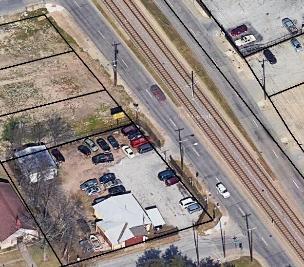
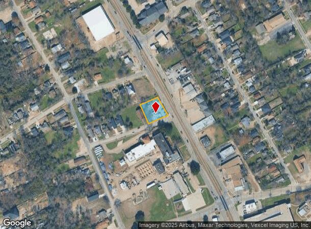
Property Record
4123 S Lancaster Rd, Dallas, TX 75216
This Property Is For Sale
NEARBY LISTINGS FOR SALE OR LEASE
Property Detail
4123 S Lancaster Rd
Dallas-Fort Worth-Arlington, TX
E A Gracey Estates
00000316957000000
BLK 4325 TR 2 ACS 0.4291 VOL2001029/6575 DD02122001 CO-DC 4325 000 002 2004325 000
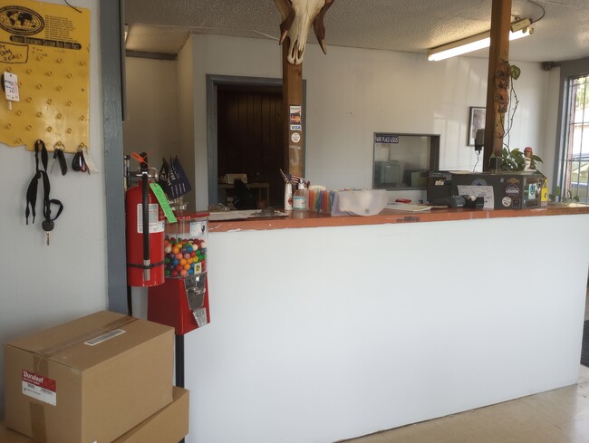
Autorepair
Dallas
X
Texas
48113C0485J
2
2024
0.43 AC
2025
Southwest Dallas
005700
Dallas/Ft Worth
2,063 SF
DEMOGRAPHICS near 4123 S Lancaster Rd
1 Mile
3 Mile
5 Mile
2024 Total Population
16,137
109,232
237,680
2029 Population
16,129
108,937
237,371
Pop Growth 2024-2029
(0.05%)
(0.27%)
(0.13%)
Average Age
36
36
36
2024 Total Households
5,105
35,407
79,443
HH Growth 2024-2029
(0.24%)
(0.46%)
(0.24%)
Median Household Inc
$29,202
$33,272
$41,291
Avg Household Size
3.00
2.90
2.90
2024 Avg HH Vehicles
2.00
2.00
2.00
Median Home Value
$121,406
$139,330
$173,314
Median Year Built
1958
1963
1964
Nearby Places
- Restaurants
- Banks
- Shops
- Fitness
- Groceries
PUBLIC TRANSPORTATION
TRANSIT/SUBWAY
Va Medical Center (Blue Line - Dallas Area Rapid Transit (DART), DART LIGHT RAIL - BLUE LINE - Dallas Area Rapid Transit (DART))
DRIVE
WALK
Distance
Va Medical Center (Blue Line - Dallas Area Rapid Transit (DART), DART LIGHT RAIL - BLUE LINE - Dallas Area Rapid Transit (DART))
0 min
7 min
0.4 mi
Kiest (Blue Line - Dallas Area Rapid Transit (DART), DART LIGHT RAIL - BLUE LINE - Dallas Area Rapid Transit (DART))
DRIVE
WALK
Distance
Kiest (Blue Line - Dallas Area Rapid Transit (DART), DART LIGHT RAIL - BLUE LINE - Dallas Area Rapid Transit (DART))
2 min
14 min
0.7 mi
COMMUTER RAIL
Victory Station (DART LIGHT RAIL - GREEN LINE - Dallas Area Rapid Transit (DART), DART LIGHT RAIL - ORANGE LINE - Dallas Area Rapid Transit (DART), TRINITY RAILWAY - Dallas Area Rapid Transit (DART))
DRIVE
WALK
Distance
Victory Station (DART LIGHT RAIL - GREEN LINE - Dallas Area Rapid Transit (DART), DART LIGHT RAIL - ORANGE LINE - Dallas Area Rapid Transit (DART), TRINITY RAILWAY - Dallas Area Rapid Transit (DART))
14 min
7.6 mi
AIRPORT
Dallas Love Field
DRIVE
WALK
Distance
Dallas Love Field
24 min
12.6 mi
Dallas-Fort Worth International
DRIVE
WALK
Distance
Dallas-Fort Worth International
37 min
26.7 mi
Freight Ports
Port of Shreveport
DRIVE
WALK
Distance
Port of Shreveport
214 min
197.7 mi
Nearby Properties
Address
Land Use
TOTAL SIZE
Lot Size
Zoning
Address
Land Use
TOTAL SIZE
Lot Size
Zoning
271,956 SF
23.18 AC
Z298
Address
Land Use
TOTAL SIZE
Lot Size
Zoning
698.53 AC
Z46
Address
Land Use
TOTAL SIZE
Lot Size
Zoning
245,554 SF
12 AC
Z59
Address
Land Use
TOTAL SIZE
Lot Size
Zoning
423,864 SF
3.56 AC
Z164
Address
Land Use
TOTAL SIZE
Lot Size
Zoning
532,726 SF
64.28 AC
Z248
Address
Land Use
TOTAL SIZE
Lot Size
Zoning
353,319 SF
20.49 AC
Address
Land Use
TOTAL SIZE
Lot Size
Zoning
389,900 SF
22.88 AC
Z298
Address
Land Use
TOTAL SIZE
Lot Size
Zoning
273,914 SF
46.58 AC
Z413
Address
Land Use
TOTAL SIZE
Lot Size
Zoning
111,111 SF
10.07 AC
Z202
Address
Land Use
TOTAL SIZE
Lot Size
Zoning
532,564 SF
10.19 AC
Z297
Address
Land Use
TOTAL SIZE
Lot Size
Zoning
416,967 SF
22.88 AC
MF2A
Address
Land Use
TOTAL SIZE
Lot Size
Zoning
361,851 SF
29.17 AC
Z164
Address
Land Use
TOTAL SIZE
Lot Size
Zoning
317,448 SF
12.93 AC
Address
Land Use
TOTAL SIZE
Lot Size
Zoning
178,050 SF
7.38 AC
Z164
Address
Land Use
TOTAL SIZE
Lot Size
Zoning
276,324 SF
19.10 AC
Z164
Address
Land Use
TOTAL SIZE
Lot Size
Zoning
172,619 SF
20.79 AC
Z164
Address
Land Use
TOTAL SIZE
Lot Size
Zoning
74,259 SF
7.81 AC
Z298
Address
Land Use
TOTAL SIZE
Lot Size
Zoning
121,312 SF
45.99 AC
Z239
Address
Land Use
TOTAL SIZE
Lot Size
Zoning
275,128 SF
28.21 AC
Z298
Address
Land Use
TOTAL SIZE
Lot Size
Zoning
261,344 SF
18.16 AC
Z239
Address
Land Use
TOTAL SIZE
Lot Size
Zoning
317,448 SF
13.03 AC
Z59
Address
Land Use
TOTAL SIZE
Lot Size
Zoning
116,712 SF
7.55 AC
Z297
Address
Land Use
TOTAL SIZE
Lot Size
Zoning
261,965 SF
20.02 AC
Z248
Address
Land Use
TOTAL SIZE
Lot Size
Zoning
100 SF
86.88 AC
Z298
Address
Land Use
TOTAL SIZE
Lot Size
Zoning
263,200 SF
13.84 AC
Z59
Address
Land Use
TOTAL SIZE
Lot Size
Zoning
335,503 SF
124.87 AC
Z239
Address
Land Use
TOTAL SIZE
Lot Size
Zoning
175,414 SF
16.05 AC
Z248
Address
Land Use
TOTAL SIZE
Lot Size
Zoning
81,622 SF
4.61 AC
Z239
Address
Land Use
TOTAL SIZE
Lot Size
Zoning
157,425 SF
5.85 AC
Z164
Address
Land Use
TOTAL SIZE
Lot Size
Zoning
261,459 SF
22.14 AC
Z164
The World's #1 Commercial Real Estate Marketplace
Connect with us
© 2025 CoStar Group
The information above has been obtained from sources believed reliable. While we do not doubt its accuracy we have not verified it and make no guarantee, warranty or representation about it. It is your responsibility to independently confirm its accuracy and completeness. Any projections, opinions, assumptions, or estimates used are for example only and do not represent the current or future performance of the property. The value of this transaction to you depends on tax and other factors which should be evaluated by your tax, financial, and legal advisors. You and your advisors should conduct a careful, independent investigation of the property to determine to your satisfaction the suitability of the property for your needs.