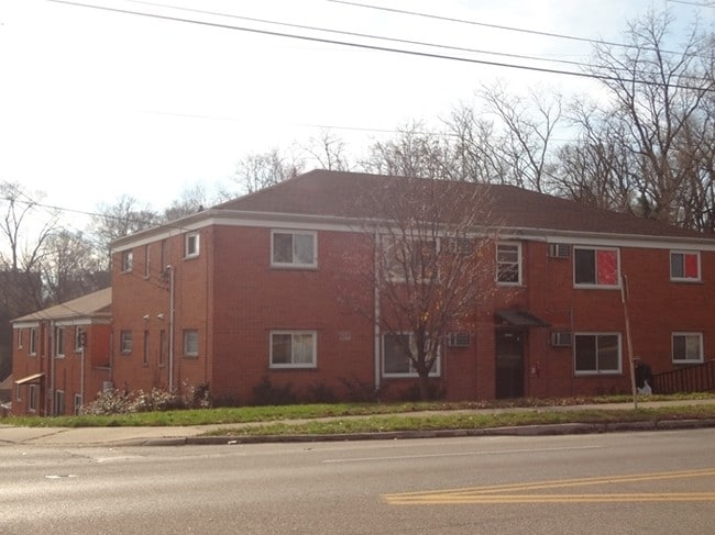
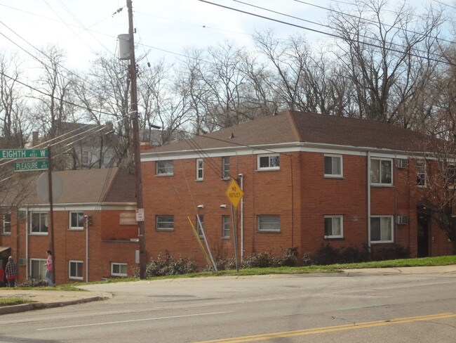
Property Record
4127 W 8Th St, Cincinnati, OH 45205

NEARBY LISTINGS FOR SALE OR LEASE
Property Detail
4127 W 8Th St
Cincinnati, OH-KY-IN
Vaughns Est Sub
179-0078-0566
REAR EIGHTH ST 44 X 117.61 IRR PT LOT 7 VAUGHNS EST SUB
Apartment
Hamilton
X
Ohio
21037C0025E
7
2024
0.39 AC
2024
West Price Hill
009700
Cincinnati/Dayton
8,590 SF
DEMOGRAPHICS near 4127 W 8Th St
1 Mile
3 Mile
5 Mile
2024 Total Population
16,805
104,989
271,973
2029 Population
16,542
104,777
273,522
Pop Growth 2024-2029
(1.57%)
(0.20%)
+ 0.57%
Average Age
36
38
37
2024 Total Households
6,568
42,201
116,265
HH Growth 2024-2029
(1.71%)
(0.27%)
+ 0.70%
Median Household Inc
$43,335
$44,907
$51,616
Avg Household Size
2.40
2.40
2.20
2024 Avg HH Vehicles
1.00
2.00
1.00
Median Home Value
$107,746
$145,884
$180,771
Median Year Built
1948
1958
1959
Nearby Places
Map Layers
Map Styles
 Street
 Aerial
- Restaurants
- Banks
- Shops
- Fitness
- Groceries
PUBLIC TRANSPORTATION
COMMUTER RAIL
DRIVE
WALK
Distance
11 min
4.2 mi
AIRPORT
Cincinnati/Northern Kentucky International
DRIVE
WALK
Distance
Cincinnati/Northern Kentucky International
34 min
17.9 mi
SALE & LEASE HISTORY
LISTING DATE
SALE/LEASE

Sep 23, 2016
For Sale
Nearby Properties
Address
Land Use
TOTAL SIZE
Lot Size
Zoning
Address
Land Use
TOTAL SIZE
Lot Size
Zoning
46.68 AC
Address
Land Use
TOTAL SIZE
Lot Size
Zoning
9.38 AC
PR
Address
Land Use
TOTAL SIZE
Lot Size
Zoning
99.35 AC
Address
Land Use
TOTAL SIZE
Lot Size
Zoning
30.43 AC
AA
Address
Land Use
TOTAL SIZE
Lot Size
Zoning
17,857 SF
26.60 AC
CGA
Address
Land Use
TOTAL SIZE
Lot Size
Zoning
23.05 AC
Address
Land Use
TOTAL SIZE
Lot Size
Zoning
8.18 AC
SF4
Address
Land Use
TOTAL SIZE
Lot Size
Zoning
77,628 SF
2.18 AC
Address
Land Use
TOTAL SIZE
Lot Size
Zoning
13.44 AC
Address
Land Use
TOTAL SIZE
Lot Size
Zoning
50,350 SF
15.41 AC
MG
Address
Land Use
TOTAL SIZE
Lot Size
Zoning
2.16 AC
MG
Address
Land Use
TOTAL SIZE
Lot Size
Zoning
Address
Land Use
TOTAL SIZE
Lot Size
Zoning
6,537 SF
12.55 AC
Address
Land Use
TOTAL SIZE
Lot Size
Zoning
1,873 SF
12.20 AC
Address
Land Use
TOTAL SIZE
Lot Size
Zoning
22.17 AC
Address
Land Use
TOTAL SIZE
Lot Size
Zoning
125,405 SF
16.69 AC
SF6
Address
Land Use
TOTAL SIZE
Lot Size
Zoning
7.33 AC
Address
Land Use
TOTAL SIZE
Lot Size
Zoning
7.27 AC
MG
Address
Land Use
TOTAL SIZE
Lot Size
Zoning
62,160 SF
13.70 AC
RM20
Address
Land Use
TOTAL SIZE
Lot Size
Zoning
4.60 AC
SF6
Address
Land Use
TOTAL SIZE
Lot Size
Zoning
55,572 SF
6.12 AC
C
Address
Land Use
TOTAL SIZE
Lot Size
Zoning
25.46 AC
Address
Land Use
TOTAL SIZE
Lot Size
Zoning
169,636 SF
20.22 AC
IR
Address
Land Use
TOTAL SIZE
Lot Size
Zoning
14.01 AC
CGA
Address
Land Use
TOTAL SIZE
Lot Size
Zoning
1,329 SF
3.16 AC
SF4
Address
Land Use
TOTAL SIZE
Lot Size
Zoning
82.94 AC
Address
Land Use
TOTAL SIZE
Lot Size
Zoning
19,730 SF
0.16 AC
SF2
Address
Land Use
TOTAL SIZE
Lot Size
Zoning
3,654 SF
10.82 AC
E
Address
Land Use
TOTAL SIZE
Lot Size
Zoning
2,400 SF
1.49 AC
MG
Address
Land Use
TOTAL SIZE
Lot Size
Zoning
12,600 SF
0.62 AC
The World's #1 Commercial Real Estate Marketplace
Connect with us
© 2025 CoStar Group
The information above has been obtained from sources believed reliable. While we do not doubt its accuracy we have not verified it and make no guarantee, warranty or representation about it. It is your responsibility to independently confirm its accuracy and completeness. Any projections, opinions, assumptions, or estimates used are for example only and do not represent the current or future performance of the property. The value of this transaction to you depends on tax and other factors which should be evaluated by your tax, financial, and legal advisors. You and your advisors should conduct a careful, independent investigation of the property to determine to your satisfaction the suitability of the property for your needs.