Property Record
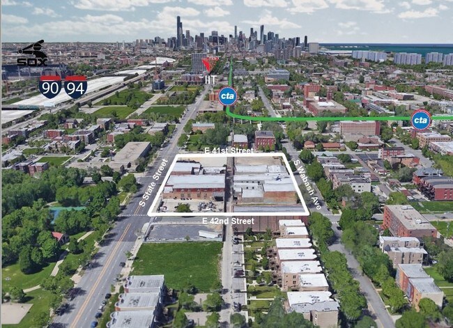
4128 S Wabash Ave, Chicago, IL 60653
NEARBY LISTINGS FOR SALE OR LEASE
Property Detail
4128 S Wabash Ave
20-03-112-016-0000
Pryor & Hopkins
Industrialgeneral
Cook
X
Illinois
17031C0509J
4
2023
0.18 AC
2024
South Chicago
380100
Chicago
11,300 SF
Chicago-Naperville-Elgin, IL-IN-WI
DEMOGRAPHICS near 4128 S Wabash Ave
1 Mile
3 Mile
5 Mile
2024 Total Population
33,038
248,457
689,386
2029 Population
32,029
238,029
660,749
Pop Growth 2024-2029
(3.05%)
(4.20%)
(4.15%)
Average Age
39
38
37
2024 Total Households
14,549
107,074
291,313
HH Growth 2024-2029
(3.29%)
(4.17%)
(3.80%)
Median Household Inc
$34,139
$47,543
$56,393
Avg Household Size
2.20
2.20
2.20
2024 Avg HH Vehicles
1.00
1.00
1.00
Median Home Value
$293,732
$323,387
$297,238
Median Year Built
1969
1955
1959
Nearby Places
Map Layers
Map Styles
 Street
 Aerial
- Restaurants
- Banks
- Shops
- Fitness
- Groceries
PUBLIC TRANSPORTATION
TRANSIT/SUBWAY
Indiana Station (Green Line - Chicago Transit Authority "L" Trains (The "L"))
DRIVE
WALK
Distance
Indiana Station (Green Line - Chicago Transit Authority "L" Trains (The "L"))
2 min
6 min
0.3 mi
43rd Street Station (Green Line - Chicago Transit Authority "L" Trains (The "L"))
DRIVE
WALK
Distance
43rd Street Station (Green Line - Chicago Transit Authority "L" Trains (The "L"))
2 min
9 min
0.5 mi
35th-Bronzeville-IIT Station (Green Line - Chicago Transit Authority "L" Trains (The "L"))
DRIVE
WALK
Distance
35th-Bronzeville-IIT Station (Green Line - Chicago Transit Authority "L" Trains (The "L"))
3 min
18 min
1.0 mi
47th Street Station (Green Line) (Green Line - Chicago Transit Authority "L" Trains (The "L"))
DRIVE
WALK
Distance
47th Street Station (Green Line) (Green Line - Chicago Transit Authority "L" Trains (The "L"))
4 min
18 min
1.0 mi
47th Street Station (Red Line) (Red Line - Chicago Transit Authority "L" Trains (The "L"))
DRIVE
WALK
Distance
47th Street Station (Red Line) (Red Line - Chicago Transit Authority "L" Trains (The "L"))
3 min
19 min
1.0 mi
COMMUTER RAIL
Halsted Station (Burlington Northern-Santa Fe Railway Line - Northeast Illinois Regional Commuter Railroad (Metra))
DRIVE
WALK
Distance
Halsted Station (Burlington Northern-Santa Fe Railway Line - Northeast Illinois Regional Commuter Railroad (Metra))
7 min
4.0 mi
Chicago LaSalle Station (Rock Island District Line - Northeast Illinois Regional Commuter Railroad (Metra))
DRIVE
WALK
Distance
Chicago LaSalle Station (Rock Island District Line - Northeast Illinois Regional Commuter Railroad (Metra))
9 min
5.6 mi
AIRPORT
Chicago Midway International
DRIVE
WALK
Distance
Chicago Midway International
18 min
11.0 mi
Chicago O'Hare International
DRIVE
WALK
Distance
Chicago O'Hare International
29 min
22.4 mi
Freight Ports
Port of Baltimore
DRIVE
WALK
Distance
Port of Baltimore
1 min
604.9 mi
SALE & LEASE HISTORY
LISTING DATE
SALE/LEASE

Sep 24, 2016
For Sale
Oct 02, 2018
For Lease
Mar 28, 2017
For Sale
Aug 09, 2017
For Sale
Nearby Properties
Address
Land Use
TOTAL SIZE
Lot Size
Zoning
Address
Land Use
TOTAL SIZE
Lot Size
Zoning
1,215,367 SF
3.76 AC
PD 675
Address
Land Use
TOTAL SIZE
Lot Size
Zoning
474,979 SF
29.67 AC
PD 553
Address
Land Use
TOTAL SIZE
Lot Size
Zoning
590,844 SF
0.80 AC
PD 26
Address
Land Use
TOTAL SIZE
Lot Size
Zoning
4.11 AC
M2-3
Address
Land Use
TOTAL SIZE
Lot Size
Zoning
1,302,463 SF
3.14 AC
PD 1211
Address
Land Use
TOTAL SIZE
Lot Size
Zoning
3.14 AC
PD 1211
Address
Land Use
TOTAL SIZE
Lot Size
Zoning
548,210 SF
1.11 AC
PD 681
Address
Land Use
TOTAL SIZE
Lot Size
Zoning
0.91 AC
PD 1177
Address
Land Use
TOTAL SIZE
Lot Size
Zoning
111,322 SF
1 AC
DS-5
Address
Land Use
TOTAL SIZE
Lot Size
Zoning
250,040 SF
15.70 AC
PD 1169
Address
Land Use
TOTAL SIZE
Lot Size
Zoning
136,720 SF
0.54 AC
PD 1
Address
Land Use
TOTAL SIZE
Lot Size
Zoning
169,435 SF
11.35 AC
PD 307
Address
Land Use
TOTAL SIZE
Lot Size
Zoning
313,559 SF
PD 1318
Address
Land Use
TOTAL SIZE
Lot Size
Zoning
2.65 AC
PD 38
Address
Land Use
TOTAL SIZE
Lot Size
Zoning
10 AC
PD 1169
Address
Land Use
TOTAL SIZE
Lot Size
Zoning
8.54 AC
PD 1169
Address
Land Use
TOTAL SIZE
Lot Size
Zoning
1,687,020 SF
10.25 AC
PD 1169
Address
Land Use
TOTAL SIZE
Lot Size
Zoning
475,000 SF
14.01 AC
PMD 8
Address
Land Use
TOTAL SIZE
Lot Size
Zoning
304,685 SF
1.11 AC
PD 1218
Address
Land Use
TOTAL SIZE
Lot Size
Zoning
Address
Land Use
TOTAL SIZE
Lot Size
Zoning
633,057 SF
34.96 AC
PMD 8
Address
Land Use
TOTAL SIZE
Lot Size
Zoning
240,400 SF
1.34 AC
PMD 11
Address
Land Use
TOTAL SIZE
Lot Size
Zoning
478,260 SF
2.91 AC
DX-5
Address
Land Use
TOTAL SIZE
Lot Size
Zoning
Address
Land Use
TOTAL SIZE
Lot Size
Zoning
38,214 SF
0.92 AC
C2-3
Address
Land Use
TOTAL SIZE
Lot Size
Zoning
156,800 SF
2.65 AC
PD 38
Address
Land Use
TOTAL SIZE
Lot Size
Zoning
1.09 AC
B2-2
Address
Land Use
TOTAL SIZE
Lot Size
Zoning
430,548 SF
13.12 AC
PMD 11
Address
Land Use
TOTAL SIZE
Lot Size
Zoning
PD 43
Address
Land Use
TOTAL SIZE
Lot Size
Zoning
451,349 SF
1.62 AC
PD 1062
The World's #1 Commercial Real Estate Marketplace
Connect with us
© 2025 CoStar Group
The information above has been obtained from sources believed reliable. While we do not doubt its accuracy we have not verified it and make no guarantee, warranty or representation about it. It is your responsibility to independently confirm its accuracy and completeness. Any projections, opinions, assumptions, or estimates used are for example only and do not represent the current or future performance of the property. The value of this transaction to you depends on tax and other factors which should be evaluated by your tax, financial, and legal advisors. You and your advisors should conduct a careful, independent investigation of the property to determine to your satisfaction the suitability of the property for your needs.