Property Record
413 2Nd Ave, Carbon Cliff, IL 61239
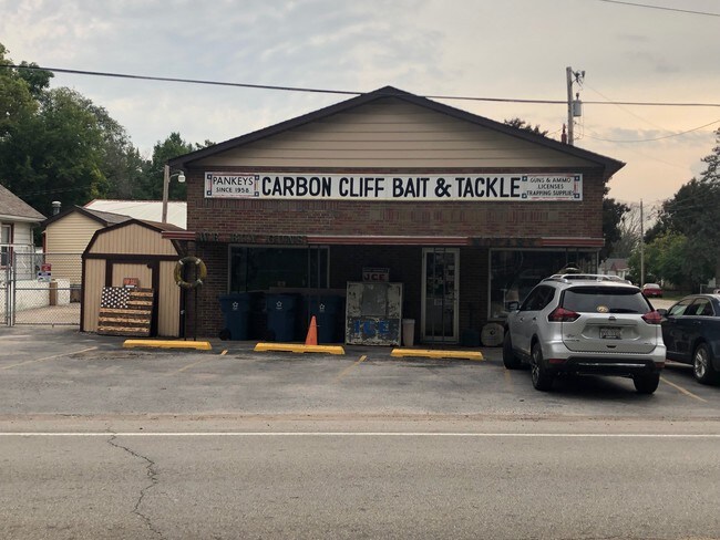

Property Detail
413 2Nd Ave
18-04-301-035
LOT 18 BLOCK 1 T AND R ADD TO CARBON CLIFF EXC NWLY PT TO STATE
Commercialnec
Rock Island
CCL
Illinois
AO River or stream flood hazard areas, and areas with a 1% or greater chance of shallow flooding each year. These areas have a 26% chance of flooding over the life of a 30-year mortgage.
18
2025
0.30 AC
2024
Outlying Rock Island Cnty
020200
Davenport/Moline/Rock Island
720 SF
Davenport-Moline-Rock Island, IA-IL
NEARBY LISTINGS FOR SALE OR LEASE
DEMOGRAPHICS near 413 2Nd Ave
1 mile
3 mile
5 mile
2025 Total Population
2,318
25,955
57,986
2030 Population
2,327
25,866
57,722
Pop Growth 2025-2030
+ 0.39%
(0.34%)
(0.46%)
Average Age
40
41
42
2025 Total Households
976
11,148
24,300
HH Growth 2025-2030
+ 0.41%
(0.29%)
(0.44%)
Median Household Inc
$56,089
$65,035
$68,531
Avg Household Size
2.30
2.30
2.30
2025 Avg HH Vehicles
2.00
2.00
2.00
Median Home Value
$163,813
$154,883
$167,380
Median Year Built
1980
1971
1967
Nearby Places
Map Layers
Map Styles
 Street
 Aerial
Layers
 Traffic
 Biking
Places
Listings with unknown addresses are not visible on the map
- Restaurants
- Banks
- Shops
- Fitness
- Groceries
PUBLIC TRANSPORTATION
AIRPORT
Quad Cities International
Drive
Walk
Distance
Quad Cities International
17 min
9.0 mi
Freight Ports
Port Milwaukee
Drive
Walk
Distance
Port Milwaukee
226 min
200.5 mi
SALE & LEASE HISTORY
LISTING DATE
SALE/LEASE

Oct 10, 2019
For Sale
Nearby Properties
Address
Land Use
TOTAL SIZE
Lot Size
Zoning
Address
Land Use
TOTAL SIZE
Lot Size
Zoning
333.38 AC
B3
Address
Land Use
TOTAL SIZE
Lot Size
Zoning
122,298 SF
65.13 AC
EM
Address
Land Use
TOTAL SIZE
Lot Size
Zoning
197,382 SF
14.06 AC
EM
Address
Land Use
TOTAL SIZE
Lot Size
Zoning
112,000 SF
16.50 AC
EM
Address
Land Use
TOTAL SIZE
Lot Size
Zoning
166,102 SF
4.36 AC
SIL
Address
Land Use
TOTAL SIZE
Lot Size
Zoning
333,348 SF
30.81 AC
EM
Address
Land Use
TOTAL SIZE
Lot Size
Zoning
196,305 SF
24.75 AC
SIL
Address
Land Use
TOTAL SIZE
Lot Size
Zoning
253.10 AC
SIL
Address
Land Use
TOTAL SIZE
Lot Size
Zoning
46,917 SF
4.57 AC
SIL
Address
Land Use
TOTAL SIZE
Lot Size
Zoning
203,904 SF
12.75 AC
MOL
Address
Land Use
TOTAL SIZE
Lot Size
Zoning
18.46 AC
EM
Address
Land Use
TOTAL SIZE
Lot Size
Zoning
103,360 SF
14.66 AC
EM
Address
Land Use
TOTAL SIZE
Lot Size
Zoning
45,000 SF
2.52 AC
SIL
Address
Land Use
TOTAL SIZE
Lot Size
Zoning
134,142 SF
13.31 AC
EM
Address
Land Use
TOTAL SIZE
Lot Size
Zoning
3.12 AC
SIL
Address
Land Use
TOTAL SIZE
Lot Size
Zoning
218,640 SF
9.97 AC
EM
Address
Land Use
TOTAL SIZE
Lot Size
Zoning
5.26 AC
Address
Land Use
TOTAL SIZE
Lot Size
Zoning
81,027 SF
6.57 AC
SIL
Address
Land Use
TOTAL SIZE
Lot Size
Zoning
64,800 SF
97.96 AC
EM
Address
Land Use
TOTAL SIZE
Lot Size
Zoning
Address
Land Use
TOTAL SIZE
Lot Size
Zoning
166,320 SF
12.28 AC
CCL
Address
Land Use
TOTAL SIZE
Lot Size
Zoning
118,700 SF
13.11 AC
EM
Address
Land Use
TOTAL SIZE
Lot Size
Zoning
720,645 SF
61.10 AC
SIL
Address
Land Use
TOTAL SIZE
Lot Size
Zoning
Address
Land Use
TOTAL SIZE
Lot Size
Zoning
16.75 AC
Address
Land Use
TOTAL SIZE
Lot Size
Zoning
94,188 SF
2.80 AC
EM
Address
Land Use
TOTAL SIZE
Lot Size
Zoning
11,565 SF
292.96 AC
SIL
Address
Land Use
TOTAL SIZE
Lot Size
Zoning
36,616 SF
15.76 AC
SIL
The World's #1 Commercial Real Estate Marketplace
Connect with us
© 2026 CoStar Group
The information above has been obtained from sources believed reliable. While we do not doubt its accuracy we have not verified it and make no guarantee, warranty or representation about it. It is your responsibility to independently confirm its accuracy and completeness. Any projections, opinions, assumptions, or estimates used are for example only and do not represent the current or future performance of the property. The value of this transaction to you depends on tax and other factors which should be evaluated by your tax, financial, and legal advisors. You and your advisors should conduct a careful, independent investigation of the property to determine to your satisfaction the suitability of the property for your needs.