Property Record
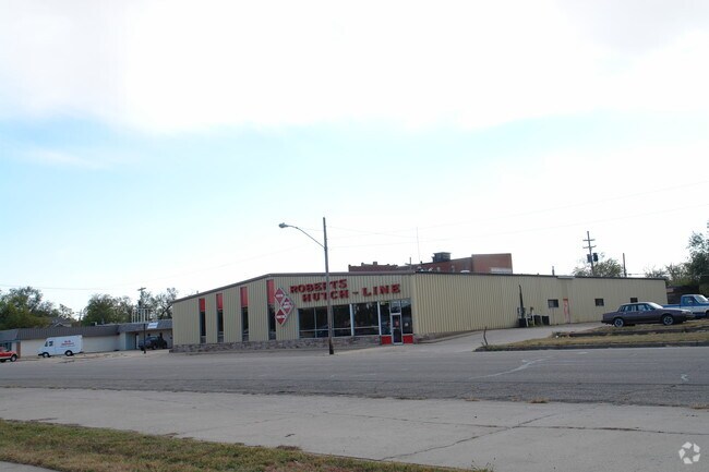
413 E 3Rd Ave, Hutchinson, KS 67501


Property Detail
413 E 3Rd Ave
126-13-0-10-10-003.00
3RD E ORIG. TOWN, S13, T23, R06W, LOTS 109-119 ODD ENC 3RD AVE EAST
Warehouse
RENO
I1
Kansas
B and X Area of moderate flood hazard, usually the area between the limits of the 100-year and 500-year floods.
109-119
2025
0.75 AC
2025
Kansas Area
000600
Other Market Areas
15,000 SF
Hutchinson, KS
NEARBY LISTINGS FOR SALE OR LEASE
DEMOGRAPHICS near 413 E 3Rd Ave
1 mile
3 mile
5 mile
2025 Total Population
10,705
38,420
43,885
2030 Population
10,880
38,333
43,742
Pop Growth 2025-2030
+ 1.63%
(0.23%)
(0.33%)
Average Age
38
41
42
2025 Total Households
4,558
16,609
18,658
HH Growth 2025-2030
+ 1.69%
(0.25%)
(0.33%)
Median Household Inc
$48,705
$54,452
$57,541
Avg Household Size
2.20
2.20
2.20
2025 Avg HH Vehicles
2.00
2.00
2.00
Median Home Value
$65,420
$119,002
$132,572
Median Year Built
1947
1957
1960
Nearby Places
Map Layers
Map Styles
 Street
 Aerial
Layers
 Traffic
 Biking
Places
Listings with unknown addresses are not visible on the map
- Restaurants
- Banks
- Shops
- Fitness
- Groceries
PUBLIC TRANSPORTATION
COMMUTER RAIL
Hutchinson Amtrak Station (Southwest Chief - Amtrak)
Drive
Walk
Distance
Hutchinson Amtrak Station (Southwest Chief - Amtrak)
1 min
9 min
0.5 mi
Freight Ports
Tulsa Port Of Catoosa
Drive
Walk
Distance
Tulsa Port Of Catoosa
264 min
242.7 mi
Nearby Properties
Address
Land Use
TOTAL SIZE
Lot Size
Zoning
Address
Land Use
TOTAL SIZE
Lot Size
Zoning
279,450 SF
11 AC
P
Address
Land Use
TOTAL SIZE
Lot Size
Zoning
94,825 SF
10 AC
Address
Land Use
TOTAL SIZE
Lot Size
Zoning
13,170 SF
36.34 AC
PI
Address
Land Use
TOTAL SIZE
Lot Size
Zoning
89,458 SF
1.88 AC
P
Address
Land Use
TOTAL SIZE
Lot Size
Zoning
77,674 SF
44.42 AC
P
Address
Land Use
TOTAL SIZE
Lot Size
Zoning
82,859 SF
8.85 AC
R5
Address
Land Use
TOTAL SIZE
Lot Size
Zoning
9,509 SF
10.68 AC
P
Address
Land Use
TOTAL SIZE
Lot Size
Zoning
59.65 AC
P
Address
Land Use
TOTAL SIZE
Lot Size
Zoning
31,917 SF
10.36 AC
R5
Address
Land Use
TOTAL SIZE
Lot Size
Zoning
60,073 SF
4.58 AC
P
Address
Land Use
TOTAL SIZE
Lot Size
Zoning
276,078 SF
102.35 AC
I3
Address
Land Use
TOTAL SIZE
Lot Size
Zoning
121,446 SF
14.69 AC
PI
Address
Land Use
TOTAL SIZE
Lot Size
Zoning
42,440 SF
9.49 AC
Address
Land Use
TOTAL SIZE
Lot Size
Zoning
576 SF
110.23 AC
P
Address
Land Use
TOTAL SIZE
Lot Size
Zoning
79,601 SF
15.96 AC
Address
Land Use
TOTAL SIZE
Lot Size
Zoning
89,642 SF
19.83 AC
C1
Address
Land Use
TOTAL SIZE
Lot Size
Zoning
64,700 SF
5.73 AC
C4
Address
Land Use
TOTAL SIZE
Lot Size
Zoning
7,273 SF
6.40 AC
Address
Land Use
TOTAL SIZE
Lot Size
Zoning
29,431 SF
1.50 AC
C5
Address
Land Use
TOTAL SIZE
Lot Size
Zoning
64,802 SF
14.07 AC
P
Address
Land Use
TOTAL SIZE
Lot Size
Zoning
61,650 SF
19.49 AC
Address
Land Use
TOTAL SIZE
Lot Size
Zoning
35,136 SF
3.86 AC
Address
Land Use
TOTAL SIZE
Lot Size
Zoning
1,320 SF
5.94 AC
Address
Land Use
TOTAL SIZE
Lot Size
Zoning
23,394 SF
35.24 AC
Address
Land Use
TOTAL SIZE
Lot Size
Zoning
69,395 SF
17.62 AC
P
Address
Land Use
TOTAL SIZE
Lot Size
Zoning
47,545 SF
15.60 AC
CR
Address
Land Use
TOTAL SIZE
Lot Size
Zoning
2,450 SF
4.68 AC
Address
Land Use
TOTAL SIZE
Lot Size
Zoning
101,932 SF
1.50 AC
P
Address
Land Use
TOTAL SIZE
Lot Size
Zoning
52,857 SF
12.35 AC
Address
Land Use
TOTAL SIZE
Lot Size
Zoning
89,591 SF
3.31 AC
P
The World's #1 Commercial Real Estate Marketplace
Connect with us
© 2026 CoStar Group
The information above has been obtained from sources believed reliable. While we do not doubt its accuracy we have not verified it and make no guarantee, warranty or representation about it. It is your responsibility to independently confirm its accuracy and completeness. Any projections, opinions, assumptions, or estimates used are for example only and do not represent the current or future performance of the property. The value of this transaction to you depends on tax and other factors which should be evaluated by your tax, financial, and legal advisors. You and your advisors should conduct a careful, independent investigation of the property to determine to your satisfaction the suitability of the property for your needs.