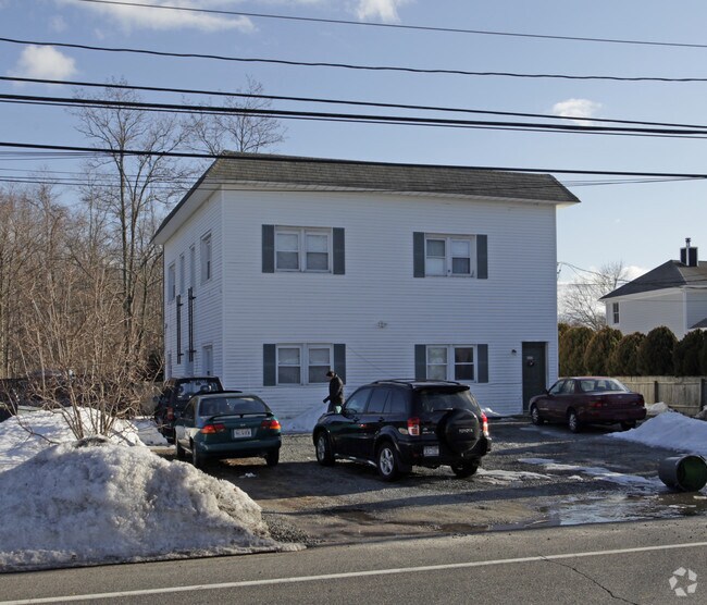
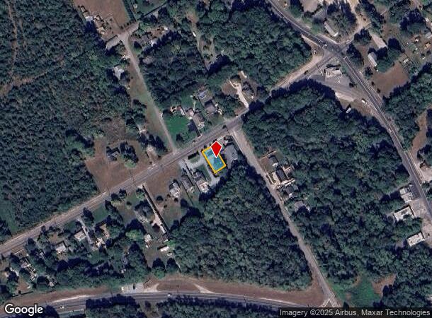
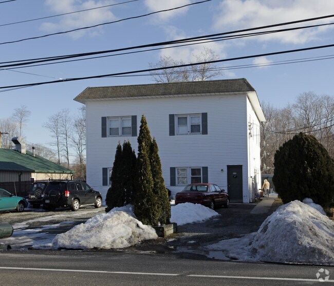
Property Record
413 Old Montauk Hwy, Eastport, NY 11941
NEARBY LISTINGS FOR SALE OR LEASE
-
-
View all Eastport listings for sale on LoopNet.com
Property Detail
413 Old Montauk Hwy
Nassau County-Suffolk County, NY
Southampton Eastport
0200-686-00-01-00-008-001
N SOUTH COUNTRY RD E CANTON S-25-17
Apartment
Suffolk
X
New York
36103C0753H
8
2024
0.13 AC
2024
Eastport
159406
Long Island (New York)
2,880 SF
DEMOGRAPHICS near 413 Old Montauk Hwy
1 Mile
3 Mile
5 Mile
2024 Total Population
2,518
18,777
44,121
2029 Population
2,508
18,566
44,392
Pop Growth 2024-2029
(0.40%)
(1.12%)
+ 0.61%
Average Age
47
43
43
2024 Total Households
965
6,587
16,092
HH Growth 2024-2029
(0.41%)
(1.31%)
+ 0.55%
Median Household Inc
$119,459
$116,932
$115,424
Avg Household Size
2.50
2.70
2.60
2024 Avg HH Vehicles
2.00
2.00
2.00
Median Home Value
$658,088
$638,723
$636,881
Median Year Built
1978
1988
1986
Nearby Places
- Restaurants
- Banks
- Shops
- Fitness
- Groceries
PUBLIC TRANSPORTATION
COMMUTER RAIL
Speonk Station (Montauk Branch - Long Island Rail Road)
DRIVE
WALK
Distance
Speonk Station (Montauk Branch - Long Island Rail Road)
4 min
2.2 mi
Westhampton Station (Montauk Branch - Long Island Rail Road)
DRIVE
WALK
Distance
Westhampton Station (Montauk Branch - Long Island Rail Road)
10 min
6.1 mi
AIRPORT
Long Island MacArthur
DRIVE
WALK
Distance
Long Island MacArthur
33 min
21.4 mi
Freight Ports
Port of New Haven
DRIVE
WALK
Distance
Port of New Haven
149 min
61.9 mi
Nearby Properties
Address
Land Use
TOTAL SIZE
Lot Size
Zoning
Address
Land Use
TOTAL SIZE
Lot Size
Zoning
200 SF
67.80 AC
CR200
Address
Land Use
TOTAL SIZE
Lot Size
Zoning
15,084 SF
10.25 AC
R40
Address
Land Use
TOTAL SIZE
Lot Size
Zoning
26,824 SF
146.40 AC
CR200
Address
Land Use
TOTAL SIZE
Lot Size
Zoning
87,569 SF
19 AC
R120
Address
Land Use
TOTAL SIZE
Lot Size
Zoning
30,512 SF
4.28 AC
VB
Address
Land Use
TOTAL SIZE
Lot Size
Zoning
16,854 SF
11.95 AC
OD
Address
Land Use
TOTAL SIZE
Lot Size
Zoning
92.10 AC
CR200
Address
Land Use
TOTAL SIZE
Lot Size
Zoning
8,636 SF
1.55 AC
R40
Address
Land Use
TOTAL SIZE
Lot Size
Zoning
9,069 SF
4.19 AC
R60
Address
Land Use
TOTAL SIZE
Lot Size
Zoning
7.40 AC
R40
Address
Land Use
TOTAL SIZE
Lot Size
Zoning
90.50 AC
CR200
Address
Land Use
TOTAL SIZE
Lot Size
Zoning
78.40 AC
CR200
Address
Land Use
TOTAL SIZE
Lot Size
Zoning
8,098 SF
3 AC
R40
Address
Land Use
TOTAL SIZE
Lot Size
Zoning
6,975 SF
0.92 AC
R40
Address
Land Use
TOTAL SIZE
Lot Size
Zoning
40,190 SF
4.89 AC
LI40
Address
Land Use
TOTAL SIZE
Lot Size
Zoning
1,984 SF
6.19 AC
R60
Address
Land Use
TOTAL SIZE
Lot Size
Zoning
5,897 SF
1.48 AC
R40
Address
Land Use
TOTAL SIZE
Lot Size
Zoning
16,654 SF
1.64 AC
R40
Address
Land Use
TOTAL SIZE
Lot Size
Zoning
607,016 SF
8.41 AC
LI40
Address
Land Use
TOTAL SIZE
Lot Size
Zoning
8,282 SF
4.41 AC
R40
Address
Land Use
TOTAL SIZE
Lot Size
Zoning
150 SF
4.70 AC
RWB
Address
Land Use
TOTAL SIZE
Lot Size
Zoning
36.77 AC
CR60
Address
Land Use
TOTAL SIZE
Lot Size
Zoning
26,488 SF
2.90 AC
LI40
Address
Land Use
TOTAL SIZE
Lot Size
Zoning
1.60 AC
R60
Address
Land Use
TOTAL SIZE
Lot Size
Zoning
9,256 SF
0.90 AC
R40
Address
Land Use
TOTAL SIZE
Lot Size
Zoning
1.30 AC
R60
Address
Land Use
TOTAL SIZE
Lot Size
Zoning
12.70 AC
RPDD
Address
Land Use
TOTAL SIZE
Lot Size
Zoning
3,273 SF
1.10 AC
R20
Address
Land Use
TOTAL SIZE
Lot Size
Zoning
3,976 SF
2.80 AC
R20
Address
Land Use
TOTAL SIZE
Lot Size
Zoning
4,648 SF
0.92 AC
R40
The World's #1 Commercial Real Estate Marketplace
Connect with us
© 2025 CoStar Group
The information above has been obtained from sources believed reliable. While we do not doubt its accuracy we have not verified it and make no guarantee, warranty or representation about it. It is your responsibility to independently confirm its accuracy and completeness. Any projections, opinions, assumptions, or estimates used are for example only and do not represent the current or future performance of the property. The value of this transaction to you depends on tax and other factors which should be evaluated by your tax, financial, and legal advisors. You and your advisors should conduct a careful, independent investigation of the property to determine to your satisfaction the suitability of the property for your needs.