Property Record
4131 University Blvd S, Jacksonville, FL 32216

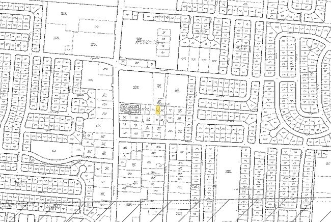
NEARBY LISTINGS FOR SALE OR LEASE
Property Detail
4131 University Blvd S
137147-0140
Spring Glen Farms
Medicalbuilding
33-2S-27E SPRING GLEN FARMS PT FARM 28 RECD O/R BK 5654-61(EX OR 6286-20)
X
Duval
12031C0386J
Florida
2025
0.47 AC
2026
Southside
016001
Jacksonville (Florida)
3,448 SF
Jacksonville, FL
DEMOGRAPHICS near 4131 University Blvd S
1 Mile
3 Mile
5 Mile
2024 Total Population
12,483
87,201
208,162
2029 Population
13,028
91,517
219,354
Pop Growth 2024-2029
+ 4.37%
+ 4.95%
+ 5.38%
Average Age
40
39
38
2024 Total Households
4,839
36,720
88,059
HH Growth 2024-2029
+ 4.44%
+ 5.09%
+ 5.62%
Median Household Inc
$48,211
$50,659
$52,862
Avg Household Size
2.40
2.30
2.20
2024 Avg HH Vehicles
2.00
2.00
1.00
Median Home Value
$174,245
$205,561
$213,155
Median Year Built
1966
1974
1978
Nearby Places
Map Layers
Map Styles
 Street
 Aerial
- Restaurants
- Banks
- Shops
- Fitness
- Groceries
PUBLIC TRANSPORTATION
AIRPORT
Jacksonville International
DRIVE
WALK
Distance
Jacksonville International
33 min
20.7 mi
Freight Ports
Jacksonville Port
DRIVE
WALK
Distance
Jacksonville Port
14 min
7.5 mi
Nearby Properties
Address
Land Use
TOTAL SIZE
Lot Size
Zoning
Address
Land Use
TOTAL SIZE
Lot Size
Zoning
875,866 SF
22.33 AC
PBF-3
Address
Land Use
TOTAL SIZE
Lot Size
Zoning
478,012 SF
29.87 AC
PUD
Address
Land Use
TOTAL SIZE
Lot Size
Zoning
419,299 SF
40.24 AC
PUD
Address
Land Use
TOTAL SIZE
Lot Size
Zoning
257,667 SF
3.91 AC
CCBD
Address
Land Use
TOTAL SIZE
Lot Size
Zoning
371,466 SF
49.16 AC
PBF-2
Address
Land Use
TOTAL SIZE
Lot Size
Zoning
565,202 SF
33.92 AC
RMD-D
Address
Land Use
TOTAL SIZE
Lot Size
Zoning
273,196 SF
16.57 AC
PUD
Address
Land Use
TOTAL SIZE
Lot Size
Zoning
329,810 SF
33.39 AC
PUD
Address
Land Use
TOTAL SIZE
Lot Size
Zoning
316,705 SF
15.44 AC
PUD
Address
Land Use
TOTAL SIZE
Lot Size
Zoning
250,989 SF
19.48 AC
PUD
Address
Land Use
TOTAL SIZE
Lot Size
Zoning
211,073 SF
8.99 AC
PUD
Address
Land Use
TOTAL SIZE
Lot Size
Zoning
203,763 SF
9.97 AC
PUD
Address
Land Use
TOTAL SIZE
Lot Size
Zoning
193,941 SF
7.35 AC
PUD
Address
Land Use
TOTAL SIZE
Lot Size
Zoning
430,668 SF
27.20 AC
RMD-D
Address
Land Use
TOTAL SIZE
Lot Size
Zoning
181,522 SF
6.56 AC
PUD
Address
Land Use
TOTAL SIZE
Lot Size
Zoning
313,009 SF
22.50 AC
RMD-D
Address
Land Use
TOTAL SIZE
Lot Size
Zoning
415,146 SF
19.27 AC
RMD-D
Address
Land Use
TOTAL SIZE
Lot Size
Zoning
93,059 SF
8.54 AC
CCG-2
Address
Land Use
TOTAL SIZE
Lot Size
Zoning
379,026 SF
24.02 AC
PUD
Address
Land Use
TOTAL SIZE
Lot Size
Zoning
169,086 SF
10.01 AC
PUD
Address
Land Use
TOTAL SIZE
Lot Size
Zoning
259,291 SF
15.01 AC
RMD-D
Address
Land Use
TOTAL SIZE
Lot Size
Zoning
242,630 SF
22.85 AC
PUD
Address
Land Use
TOTAL SIZE
Lot Size
Zoning
129,587 SF
16.91 AC
IBP
Address
Land Use
TOTAL SIZE
Lot Size
Zoning
191,207 SF
23.44 AC
IBP
Address
Land Use
TOTAL SIZE
Lot Size
Zoning
207,721 SF
10.57 AC
PUD
Address
Land Use
TOTAL SIZE
Lot Size
Zoning
372,759 SF
25.01 AC
RMD-D
Address
Land Use
TOTAL SIZE
Lot Size
Zoning
225,282 SF
15.36 AC
RMD-D
Address
Land Use
TOTAL SIZE
Lot Size
Zoning
266,156 SF
11.54 AC
RMD-D
Address
Land Use
TOTAL SIZE
Lot Size
Zoning
275,005 SF
28.48 AC
PUD
Address
Land Use
TOTAL SIZE
Lot Size
Zoning
172,591 SF
8.40 AC
CRO
The World's #1 Commercial Real Estate Marketplace
Connect with us
© 2025 CoStar Group
The information above has been obtained from sources believed reliable. While we do not doubt its accuracy we have not verified it and make no guarantee, warranty or representation about it. It is your responsibility to independently confirm its accuracy and completeness. Any projections, opinions, assumptions, or estimates used are for example only and do not represent the current or future performance of the property. The value of this transaction to you depends on tax and other factors which should be evaluated by your tax, financial, and legal advisors. You and your advisors should conduct a careful, independent investigation of the property to determine to your satisfaction the suitability of the property for your needs.