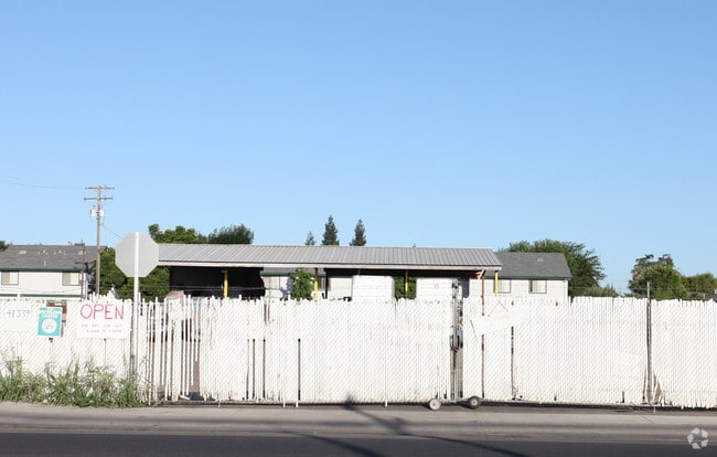
Property Record
41339 Road 128, Orosi, CA 93647

NEARBY LISTINGS FOR SALE OR LEASE
-
-
View all Orosi listings for sale on LoopNet.com
Property Detail
41339 Road 128
023-150-029-000
PARCEL 1 PAR MAP NO 4034PM 41-33
Commercialnec
Tulare
X
California
06107C0345E
1 AC
2024
NW Outlying Tulare County
2025
Visalia/Porterville
000204
Visalia, CA
3,200 SF
DEMOGRAPHICS near 41339 Road 128
1 Mile
3 Mile
5 Mile
2024 Total Population
9,945
15,587
19,972
2029 Population
10,134
15,803
20,254
Pop Growth 2024-2029
+ 1.90%
+ 1.39%
+ 1.41%
Average Age
34
34
33
2024 Total Households
2,462
3,906
5,016
HH Growth 2024-2029
+ 1.79%
+ 1.23%
+ 1.26%
Median Household Inc
$53,511
$53,053
$54,043
Avg Household Size
3.90
3.90
3.90
2024 Avg HH Vehicles
2.00
2.00
2.00
Median Home Value
$187,940
$195,818
$225,808
Median Year Built
1982
1977
1977
Nearby Places
Map Layers
Map Styles
 Street
 Aerial
- Restaurants
- Banks
- Shops
- Fitness
- Groceries
PUBLIC TRANSPORTATION
AIRPORT
Fresno Yosemite International
DRIVE
WALK
Distance
Fresno Yosemite International
52 min
36.6 mi
Nearby Properties
Address
Land Use
TOTAL SIZE
Lot Size
Zoning
Address
Land Use
TOTAL SIZE
Lot Size
Zoning
371,216 SF
45.02 AC
M-1
Address
Land Use
TOTAL SIZE
Lot Size
Zoning
65,268 SF
5 AC
R3
Address
Land Use
TOTAL SIZE
Lot Size
Zoning
3,079 SF
18.99 AC
AE-20
Address
Land Use
TOTAL SIZE
Lot Size
Zoning
9.33 AC
M1
Address
Land Use
TOTAL SIZE
Lot Size
Zoning
75,050 SF
16.24 AC
AE-20
Address
Land Use
TOTAL SIZE
Lot Size
Zoning
15,320 SF
0.94 AC
C-2
Address
Land Use
TOTAL SIZE
Lot Size
Zoning
9,541 SF
1.75 AC
PO-SR
Address
Land Use
TOTAL SIZE
Lot Size
Zoning
29,750 SF
2.90 AC
PO
Address
Land Use
TOTAL SIZE
Lot Size
Zoning
82,547 SF
12.05 AC
AE-20
Address
Land Use
TOTAL SIZE
Lot Size
Zoning
4,975 SF
1.75 AC
M-1
Address
Land Use
TOTAL SIZE
Lot Size
Zoning
33,898 SF
2.18 AC
R3
Address
Land Use
TOTAL SIZE
Lot Size
Zoning
3,553 SF
0.79 AC
C-2
Address
Land Use
TOTAL SIZE
Lot Size
Zoning
54.25 AC
Address
Land Use
TOTAL SIZE
Lot Size
Zoning
7,238 SF
0.69 AC
C2
Address
Land Use
TOTAL SIZE
Lot Size
Zoning
33,882 SF
2.35 AC
C2
Address
Land Use
TOTAL SIZE
Lot Size
Zoning
1,144 SF
40 AC
AE20
Address
Land Use
TOTAL SIZE
Lot Size
Zoning
9,312 SF
0.93 AC
C2
Address
Land Use
TOTAL SIZE
Lot Size
Zoning
72.21 AC
AE20
Address
Land Use
TOTAL SIZE
Lot Size
Zoning
0.37 AC
C-2
Address
Land Use
TOTAL SIZE
Lot Size
Zoning
27,655 SF
1.51 AC
R3
Address
Land Use
TOTAL SIZE
Lot Size
Zoning
2,570 SF
99.68 AC
AE20
Address
Land Use
TOTAL SIZE
Lot Size
Zoning
5,561 SF
17.46 AC
AE20
Address
Land Use
TOTAL SIZE
Lot Size
Zoning
4.13 AC
C3
Address
Land Use
TOTAL SIZE
Lot Size
Zoning
4,000 SF
0.51 AC
C2
Address
Land Use
TOTAL SIZE
Lot Size
Zoning
1,847 SF
0.94 AC
R3
Address
Land Use
TOTAL SIZE
Lot Size
Zoning
2,842 SF
1 AC
Address
Land Use
TOTAL SIZE
Lot Size
Zoning
80 AC
AE20
The World's #1 Commercial Real Estate Marketplace
Connect with us
© 2026 CoStar Group
The information above has been obtained from sources believed reliable. While we do not doubt its accuracy we have not verified it and make no guarantee, warranty or representation about it. It is your responsibility to independently confirm its accuracy and completeness. Any projections, opinions, assumptions, or estimates used are for example only and do not represent the current or future performance of the property. The value of this transaction to you depends on tax and other factors which should be evaluated by your tax, financial, and legal advisors. You and your advisors should conduct a careful, independent investigation of the property to determine to your satisfaction the suitability of the property for your needs.