Property Record
4135 Shopton Rd, Charlotte, NC 28217
Current Lease Availabilities
NEARBY LISTINGS FOR SALE OR LEASE
Property Detail
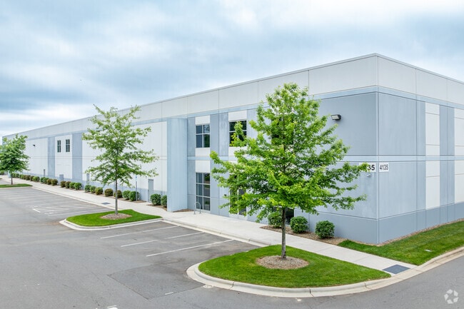
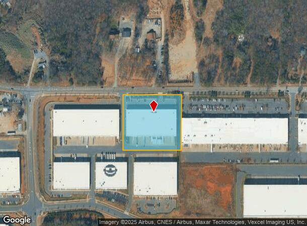
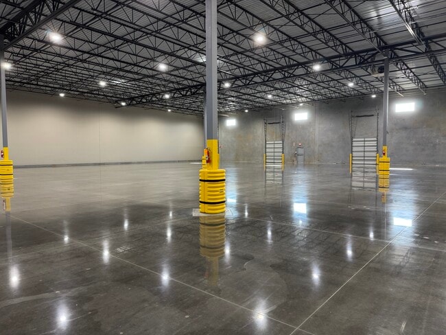
4135 Shopton Rd
Charlotte-Concord-Gastonia, NC-SC
Shopton Ridge Business Park
201-461-37
L1B M62-777
Industrialgeneral
Mecklenburg
X
North Carolina
3710451200K
1b
2024
3.03 AC
2025
State Line
005928
Charlotte
52,800 SF
DEMOGRAPHICS near 4135 Shopton Rd
1 Mile
3 Mile
5 Mile
2024 Total Population
676
41,890
115,039
2029 Population
719
44,468
122,475
Pop Growth 2024-2029
+ 6.36%
+ 6.15%
+ 6.46%
Average Age
40
36
36
2024 Total Households
236
17,317
45,899
HH Growth 2024-2029
+ 6.36%
+ 6.28%
+ 6.46%
Median Household Inc
$84,058
$80,216
$68,841
Avg Household Size
2.90
2.30
2.40
2024 Avg HH Vehicles
2.00
2.00
2.00
Median Home Value
$266,483
$282,425
$289,155
Median Year Built
1995
2006
1999
Nearby Places
Map Layers
Map Styles
 Street
 Aerial
- Restaurants
- Banks
- Shops
- Fitness
- Groceries
PUBLIC TRANSPORTATION
AIRPORT
Charlotte/Douglas International
DRIVE
WALK
Distance
Charlotte/Douglas International
14 min
5.2 mi
Concord-Padgett Regional
DRIVE
WALK
Distance
Concord-Padgett Regional
34 min
26.9 mi
Nearby Properties
Address
Land Use
TOTAL SIZE
Lot Size
Zoning
Address
Land Use
TOTAL SIZE
Lot Size
Zoning
1,519,630 SF
235.59 AC
I2
Address
Land Use
TOTAL SIZE
Lot Size
Zoning
459,020 SF
42 AC
R3
Address
Land Use
TOTAL SIZE
Lot Size
Zoning
399,398 SF
35.02 AC
Address
Land Use
TOTAL SIZE
Lot Size
Zoning
1,255,063 SF
292.46 AC
I2
Address
Land Use
TOTAL SIZE
Lot Size
Zoning
393,779 SF
26.71 AC
R17MF
Address
Land Use
TOTAL SIZE
Lot Size
Zoning
315,386 SF
26.83 AC
MX1
Address
Land Use
TOTAL SIZE
Lot Size
Zoning
24.40 AC
UR-2(CD)
Address
Land Use
TOTAL SIZE
Lot Size
Zoning
395,382 SF
9.84 AC
MUDDO
Address
Land Use
TOTAL SIZE
Lot Size
Zoning
408,632 SF
50 AC
R12MFCD
Address
Land Use
TOTAL SIZE
Lot Size
Zoning
371,416 SF
30.90 AC
BPCD
Address
Land Use
TOTAL SIZE
Lot Size
Zoning
298,298 SF
16.60 AC
R17MFCD
Address
Land Use
TOTAL SIZE
Lot Size
Zoning
399,178 SF
17.59 AC
Address
Land Use
TOTAL SIZE
Lot Size
Zoning
661,612 SF
32.38 AC
I1CD
Address
Land Use
TOTAL SIZE
Lot Size
Zoning
307,493 SF
24.47 AC
R12MFCD
Address
Land Use
TOTAL SIZE
Lot Size
Zoning
604,827 SF
41.01 AC
O1CD
Address
Land Use
TOTAL SIZE
Lot Size
Zoning
245,979 SF
7.60 AC
Address
Land Use
TOTAL SIZE
Lot Size
Zoning
268,872 SF
48.51 AC
I1CD
Address
Land Use
TOTAL SIZE
Lot Size
Zoning
289,148 SF
17.12 AC
Address
Land Use
TOTAL SIZE
Lot Size
Zoning
292,097 SF
16.26 AC
CC
Address
Land Use
TOTAL SIZE
Lot Size
Zoning
293,943 SF
12.90 AC
Address
Land Use
TOTAL SIZE
Lot Size
Zoning
290,581 SF
8.48 AC
Address
Land Use
TOTAL SIZE
Lot Size
Zoning
272,801 SF
12.90 AC
Address
Land Use
TOTAL SIZE
Lot Size
Zoning
305,078 SF
10.98 AC
Address
Land Use
TOTAL SIZE
Lot Size
Zoning
329,369 SF
23.03 AC
Address
Land Use
TOTAL SIZE
Lot Size
Zoning
267,294 SF
16.43 AC
NS
Address
Land Use
TOTAL SIZE
Lot Size
Zoning
229,094 SF
7.29 AC
R3
Address
Land Use
TOTAL SIZE
Lot Size
Zoning
899,731 SF
73.49 AC
Address
Land Use
TOTAL SIZE
Lot Size
Zoning
136,576 SF
4.75 AC
Address
Land Use
TOTAL SIZE
Lot Size
Zoning
254,393 SF
12.48 AC
Address
Land Use
TOTAL SIZE
Lot Size
Zoning
334,858 SF
40.40 AC
I-2
The World's #1 Commercial Real Estate Marketplace
Connect with us
© 2025 CoStar Group
The information above has been obtained from sources believed reliable. While we do not doubt its accuracy we have not verified it and make no guarantee, warranty or representation about it. It is your responsibility to independently confirm its accuracy and completeness. Any projections, opinions, assumptions, or estimates used are for example only and do not represent the current or future performance of the property. The value of this transaction to you depends on tax and other factors which should be evaluated by your tax, financial, and legal advisors. You and your advisors should conduct a careful, independent investigation of the property to determine to your satisfaction the suitability of the property for your needs.