Property Record
4136 Jimmy Carter Blvd, Norcross, GA 30093
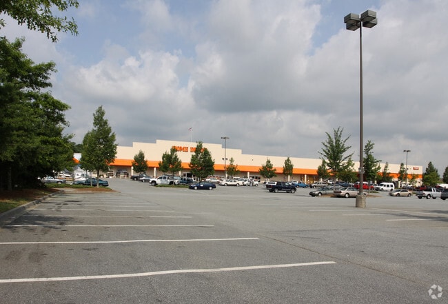


Property Detail
4136 Jimmy Carter Blvd
6-142-001
HWY 29
Departmentstore
GWINNETT
C2
Georgia
B and X Area of moderate flood hazard, usually the area between the limits of the 100-year and 500-year floods.
140
0
12.82 AC
2025
Stone Mtn/Clarkston
050463
Atlanta
110,079 SF
Atlanta-Sandy Springs-Roswell, GA
NEARBY LISTINGS FOR SALE OR LEASE
DEMOGRAPHICS near 4136 Jimmy Carter Blvd
1 mile
3 mile
5 mile
2025 Total Population
10,902
91,648
247,371
2030 Population
11,164
94,080
253,989
Pop Growth 2025-2030
+ 2.40%
+ 2.65%
+ 2.68%
Average Age
36
38
37
2025 Total Households
4,123
31,998
87,618
HH Growth 2025-2030
+ 1.94%
+ 2.54%
+ 2.59%
Median Household Inc
$74,550
$69,550
$65,406
Avg Household Size
2.60
2.80
2.80
2025 Avg HH Vehicles
2.00
2.00
2.00
Median Home Value
$349,732
$366,360
$363,255
Median Year Built
1991
1983
1982
Nearby Places
Map Layers
Map Styles
 Street
 Aerial
Layers
 Traffic
 Biking
Places
Listings with unknown addresses are not visible on the map
- Restaurants
- Banks
- Shops
- Fitness
- Groceries
PUBLIC TRANSPORTATION
AIRPORT
Hartsfield - Jackson Atlanta International
Drive
Walk
Distance
Hartsfield - Jackson Atlanta International
38 min
26.8 mi
Freight Ports
Georgia Ports - Savannah
Drive
Walk
Distance
Georgia Ports - Savannah
291 min
258.6 mi
Nearby Properties
Address
Land Use
TOTAL SIZE
Lot Size
Zoning
Address
Land Use
TOTAL SIZE
Lot Size
Zoning
247,662 SF
29.53 AC
RM
Address
Land Use
TOTAL SIZE
Lot Size
Zoning
273,492 SF
23.08 AC
RM
Address
Land Use
TOTAL SIZE
Lot Size
Zoning
285,440 SF
24.68 AC
RM
Address
Land Use
TOTAL SIZE
Lot Size
Zoning
819,703 SF
55.80 AC
M
Address
Land Use
TOTAL SIZE
Lot Size
Zoning
413,878 SF
29.13 AC
CB
Address
Land Use
TOTAL SIZE
Lot Size
Zoning
321,956 SF
26.87 AC
RM13
Address
Land Use
TOTAL SIZE
Lot Size
Zoning
334,795 SF
42.50 AC
RM13
Address
Land Use
TOTAL SIZE
Lot Size
Zoning
257,050 SF
26.17 AC
RM13
Address
Land Use
TOTAL SIZE
Lot Size
Zoning
375,436 SF
33.24 AC
RM10
Address
Land Use
TOTAL SIZE
Lot Size
Zoning
320,947 SF
29.14 AC
RM
Address
Land Use
TOTAL SIZE
Lot Size
Zoning
321,756 SF
26.28 AC
RM
Address
Land Use
TOTAL SIZE
Lot Size
Zoning
356,488 SF
33 AC
RM10
Address
Land Use
TOTAL SIZE
Lot Size
Zoning
284,236 SF
22.25 AC
RM100
Address
Land Use
TOTAL SIZE
Lot Size
Zoning
285,384 SF
21.32 AC
RM
Address
Land Use
TOTAL SIZE
Lot Size
Zoning
276,262 SF
22.17 AC
RM13
Address
Land Use
TOTAL SIZE
Lot Size
Zoning
367,517 SF
34.61 AC
RM13
Address
Land Use
TOTAL SIZE
Lot Size
Zoning
228,361 SF
19.21 AC
RM100
Address
Land Use
TOTAL SIZE
Lot Size
Zoning
245,165 SF
16.66 AC
RA200
Address
Land Use
TOTAL SIZE
Lot Size
Zoning
89,362 SF
13.99 AC
M
Address
Land Use
TOTAL SIZE
Lot Size
Zoning
170,933 SF
15.39 AC
X
Address
Land Use
TOTAL SIZE
Lot Size
Zoning
238,936 SF
16.47 AC
RM
Address
Land Use
TOTAL SIZE
Lot Size
Zoning
302,643 SF
23.65 AC
RM100
Address
Land Use
TOTAL SIZE
Lot Size
Zoning
244,131 SF
32.59 AC
RM8
Address
Land Use
TOTAL SIZE
Lot Size
Zoning
306,723 SF
21.81 AC
RM
Address
Land Use
TOTAL SIZE
Lot Size
Zoning
302,988 SF
41.36 AC
X
Address
Land Use
TOTAL SIZE
Lot Size
Zoning
176,454 SF
21.27 AC
R75
Address
Land Use
TOTAL SIZE
Lot Size
Zoning
216,016 SF
19.52 AC
RM13
Address
Land Use
TOTAL SIZE
Lot Size
Zoning
241,314 SF
20.22 AC
RM10
Address
Land Use
TOTAL SIZE
Lot Size
Zoning
490,343 SF
28.70 AC
X
Address
Land Use
TOTAL SIZE
Lot Size
Zoning
279,568 SF
0.15 AC
X
The World's #1 Commercial Real Estate Marketplace
Connect with us
© 2026 CoStar Group
The information above has been obtained from sources believed reliable. While we do not doubt its accuracy we have not verified it and make no guarantee, warranty or representation about it. It is your responsibility to independently confirm its accuracy and completeness. Any projections, opinions, assumptions, or estimates used are for example only and do not represent the current or future performance of the property. The value of this transaction to you depends on tax and other factors which should be evaluated by your tax, financial, and legal advisors. You and your advisors should conduct a careful, independent investigation of the property to determine to your satisfaction the suitability of the property for your needs.