Property Record
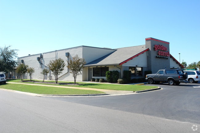
414 Mary Esther Cut Off Nw, Fort Walton Beach, FL 32548


NEARBY LISTINGS FOR SALE OR LEASE
Property Detail
414 Mary Esther Cut Off Nw
Crestview-Fort Walton Beach-Destin, FL
Oakland Heights
09-2S-24-1864-0000-0020
OAKLAND HEIGHTS SCHOOL SITE LOT 2
Restaurantbuilding
Okaloosa
X
Florida
12091C0442J
2
2025
1.61 AC
2025
Fort Walton Beach
022800
Other Market Areas
9,989 SF
DEMOGRAPHICS near 414 Mary Esther Cut Off Nw
1 Mile
3 Mile
5 Mile
2024 Total Population
10,478
57,610
73,900
2029 Population
10,844
60,385
77,695
Pop Growth 2024-2029
+ 3.49%
+ 4.82%
+ 5.14%
Average Age
39
40
40
2024 Total Households
4,199
24,742
31,574
HH Growth 2024-2029
+ 3.31%
+ 4.94%
+ 5.30%
Median Household Inc
$58,162
$57,834
$60,222
Avg Household Size
2.40
2.20
2.20
2024 Avg HH Vehicles
2.00
2.00
2.00
Median Home Value
$243,179
$258,670
$276,363
Median Year Built
1976
1981
1981
Nearby Places
Map Layers
Map Styles
 Street
 Aerial
- Restaurants
- Banks
- Shops
- Fitness
- Groceries
PUBLIC TRANSPORTATION
AIRPORT
Eglin AFB/Destin-Ft Walton Beach
DRIVE
WALK
Distance
Eglin AFB/Destin-Ft Walton Beach
29 min
12.2 mi
Pensacola International
DRIVE
WALK
Distance
Pensacola International
75 min
43.9 mi
SALE & LEASE HISTORY
LISTING DATE
SALE/LEASE

Jun 03, 2017
For Sale
Jun 01, 2017
For Sale
Nearby Properties
Address
Land Use
TOTAL SIZE
Lot Size
Zoning
Address
Land Use
TOTAL SIZE
Lot Size
Zoning
173,879 SF
9 AC
Address
Land Use
TOTAL SIZE
Lot Size
Zoning
71,584 SF
3 AC
Address
Land Use
TOTAL SIZE
Lot Size
Zoning
342,628 SF
14.83 AC
Address
Land Use
TOTAL SIZE
Lot Size
Zoning
117,852 SF
13.39 AC
Address
Land Use
TOTAL SIZE
Lot Size
Zoning
295,771 SF
18.52 AC
Address
Land Use
TOTAL SIZE
Lot Size
Zoning
120,159 SF
14.82 AC
Address
Land Use
TOTAL SIZE
Lot Size
Zoning
60,223 SF
2.73 AC
Address
Land Use
TOTAL SIZE
Lot Size
Zoning
48,449 SF
3.99 AC
Address
Land Use
TOTAL SIZE
Lot Size
Zoning
216,839 SF
9.63 AC
Address
Land Use
TOTAL SIZE
Lot Size
Zoning
55,566 SF
5.40 AC
Address
Land Use
TOTAL SIZE
Lot Size
Zoning
246,592 SF
24.24 AC
Address
Land Use
TOTAL SIZE
Lot Size
Zoning
85,571 SF
4.54 AC
Address
Land Use
TOTAL SIZE
Lot Size
Zoning
26,525 SF
1.41 AC
Address
Land Use
TOTAL SIZE
Lot Size
Zoning
73,434 SF
2.40 AC
Address
Land Use
TOTAL SIZE
Lot Size
Zoning
Address
Land Use
TOTAL SIZE
Lot Size
Zoning
182,844 SF
20.62 AC
Address
Land Use
TOTAL SIZE
Lot Size
Zoning
140,945 SF
80.64 AC
Address
Land Use
TOTAL SIZE
Lot Size
Zoning
76,342 SF
6.04 AC
Address
Land Use
TOTAL SIZE
Lot Size
Zoning
62,097 SF
4.86 AC
Address
Land Use
TOTAL SIZE
Lot Size
Zoning
75,892 SF
1.72 AC
Address
Land Use
TOTAL SIZE
Lot Size
Zoning
59,257 SF
2.99 AC
Address
Land Use
TOTAL SIZE
Lot Size
Zoning
50,294 SF
0.94 AC
Address
Land Use
TOTAL SIZE
Lot Size
Zoning
3,894 SF
315.07 AC
Address
Land Use
TOTAL SIZE
Lot Size
Zoning
121,164 SF
5.78 AC
Address
Land Use
TOTAL SIZE
Lot Size
Zoning
51,030 SF
1.82 AC
Address
Land Use
TOTAL SIZE
Lot Size
Zoning
216,395 SF
5.08 AC
Address
Land Use
TOTAL SIZE
Lot Size
Zoning
108,284 SF
5.47 AC
Address
Land Use
TOTAL SIZE
Lot Size
Zoning
52,275 SF
2.98 AC
Address
Land Use
TOTAL SIZE
Lot Size
Zoning
287,257 SF
13.86 AC
Address
Land Use
TOTAL SIZE
Lot Size
Zoning
229,805 SF
19.31 AC
The World's #1 Commercial Real Estate Marketplace
Connect with us
© 2026 CoStar Group
The information above has been obtained from sources believed reliable. While we do not doubt its accuracy we have not verified it and make no guarantee, warranty or representation about it. It is your responsibility to independently confirm its accuracy and completeness. Any projections, opinions, assumptions, or estimates used are for example only and do not represent the current or future performance of the property. The value of this transaction to you depends on tax and other factors which should be evaluated by your tax, financial, and legal advisors. You and your advisors should conduct a careful, independent investigation of the property to determine to your satisfaction the suitability of the property for your needs.