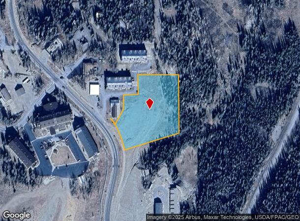
Property Record
414 N N Hwy, Brian Head, UT 84719


NEARBY LISTINGS FOR SALE OR LEASE
Property Detail
414 N N Hwy
Other Market Areas
Anderson Subdivision
Cedar City, UT
LOT 1, ANDERSON SUBDIVISION; SUBJ TO & TOG W/ ACCESS EASE DESC REC BK 1232/1705; LESS A-1203-1-1; NW1/4 SEC 2,T36S,R9W, SLM.
A-1203-0001-0000
Iron
Recreationalentertainmentgeneral
Utah
2025
1
2025
2.99 AC
110100
Cedar City & St George
DEMOGRAPHICS near 414 N N Hwy
1 Mile
3 Mile
5 Mile
2024 Total Population
4,086
17,903
29,584
2029 Population
5,041
22,052
36,481
Pop Growth 2024-2029
+ 23.37%
+ 23.17%
+ 23.31%
Average Age
34
34
33
2024 Total Households
1,198
5,418
9,300
HH Growth 2024-2029
+ 23.12%
+ 23.03%
+ 23.15%
Median Household Inc
$66,731
$63,585
$62,210
Avg Household Size
3.40
3.20
3.10
2024 Avg HH Vehicles
3.00
3.00
2.00
Median Home Value
$269,788
$301,897
$292,807
Median Year Built
1997
2001
2000
Nearby Places
Map Layers
Map Styles
 Street
 Aerial
- Restaurants
- Banks
- Shops
- Fitness
- Groceries
SALE & LEASE HISTORY
LISTING DATE
SALE/LEASE

Sep 15, 2021
For Sale
Nearby Properties
Address
Land Use
TOTAL SIZE
Lot Size
Zoning
Address
Land Use
TOTAL SIZE
Lot Size
Zoning
1,686 SF
5.90 AC
Address
Land Use
TOTAL SIZE
Lot Size
Zoning
6,889 SF
0.37 AC
Address
Land Use
TOTAL SIZE
Lot Size
Zoning
Address
Land Use
TOTAL SIZE
Lot Size
Zoning
6,732 SF
1 AC
Address
Land Use
TOTAL SIZE
Lot Size
Zoning
0.85 AC
Address
Land Use
TOTAL SIZE
Lot Size
Zoning
Address
Land Use
TOTAL SIZE
Lot Size
Zoning
Address
Land Use
TOTAL SIZE
Lot Size
Zoning
Address
Land Use
TOTAL SIZE
Lot Size
Zoning
4,767 SF
31 AC
Address
Land Use
TOTAL SIZE
Lot Size
Zoning
1.02 AC
Address
Land Use
TOTAL SIZE
Lot Size
Zoning
0.37 AC
Address
Land Use
TOTAL SIZE
Lot Size
Zoning
4,436 SF
0.35 AC
Address
Land Use
TOTAL SIZE
Lot Size
Zoning
3,999 SF
0.43 AC
Address
Land Use
TOTAL SIZE
Lot Size
Zoning
0.97 AC
Address
Land Use
TOTAL SIZE
Lot Size
Zoning
5,714 SF
1.67 AC
Address
Land Use
TOTAL SIZE
Lot Size
Zoning
4,161 SF
0.80 AC
Address
Land Use
TOTAL SIZE
Lot Size
Zoning
Address
Land Use
TOTAL SIZE
Lot Size
Zoning
4,638 SF
0.40 AC
Address
Land Use
TOTAL SIZE
Lot Size
Zoning
4,454 SF
0.20 AC
Address
Land Use
TOTAL SIZE
Lot Size
Zoning
Address
Land Use
TOTAL SIZE
Lot Size
Zoning
Address
Land Use
TOTAL SIZE
Lot Size
Zoning
Address
Land Use
TOTAL SIZE
Lot Size
Zoning
2,946 SF
0.50 AC
Address
Land Use
TOTAL SIZE
Lot Size
Zoning
Address
Land Use
TOTAL SIZE
Lot Size
Zoning
4,144 SF
0.19 AC
Address
Land Use
TOTAL SIZE
Lot Size
Zoning
5,140 SF
1.47 AC
Address
Land Use
TOTAL SIZE
Lot Size
Zoning
2,798 SF
1.80 AC
Address
Land Use
TOTAL SIZE
Lot Size
Zoning
Address
Land Use
TOTAL SIZE
Lot Size
Zoning
The World's #1 Commercial Real Estate Marketplace
Connect with us
© 2025 CoStar Group
The information above has been obtained from sources believed reliable. While we do not doubt its accuracy we have not verified it and make no guarantee, warranty or representation about it. It is your responsibility to independently confirm its accuracy and completeness. Any projections, opinions, assumptions, or estimates used are for example only and do not represent the current or future performance of the property. The value of this transaction to you depends on tax and other factors which should be evaluated by your tax, financial, and legal advisors. You and your advisors should conduct a careful, independent investigation of the property to determine to your satisfaction the suitability of the property for your needs.