Property Record
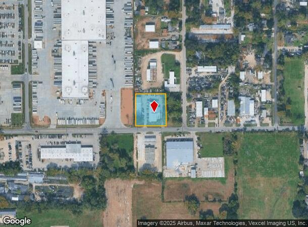
410 W Canino Rd, Houston, TX 77037


NEARBY LISTINGS FOR SALE OR LEASE
Property Detail
410 W Canino Rd
0440280000190
Abst 604 T Nellis
Warehouse
TR 2O ABST 604 T NELLIS
X
Harris
48201C0470L
Texas
2024
1 AC
2025
North Outer Loop
221602
Houston
12,650 SF
Houston-The Woodlands-Sugar Land, TX
DEMOGRAPHICS near 410 W Canino Rd
1 Mile
3 Mile
5 Mile
2024 Total Population
12,932
113,005
332,407
2029 Population
13,036
115,297
339,335
Pop Growth 2024-2029
+ 0.80%
+ 2.03%
+ 2.08%
Average Age
35
36
35
2024 Total Households
4,100
35,116
110,498
HH Growth 2024-2029
+ 0.73%
+ 2.13%
+ 2.24%
Median Household Inc
$33,604
$37,991
$43,293
Avg Household Size
3.10
3.10
2.90
2024 Avg HH Vehicles
2.00
2.00
2.00
Median Home Value
$156,930
$154,131
$189,777
Median Year Built
1978
1970
1975
Nearby Places
Map Layers
Map Styles
 Street
 Aerial
- Restaurants
- Banks
- Shops
- Fitness
- Groceries
PUBLIC TRANSPORTATION
COMMUTER RAIL
DRIVE
WALK
Distance
16 min
9.1 mi
AIRPORT
George Bush Intcntl/Houston
DRIVE
WALK
Distance
George Bush Intcntl/Houston
18 min
12.7 mi
William P Hobby
DRIVE
WALK
Distance
William P Hobby
37 min
21.9 mi
Freight Ports
Port of Houston
DRIVE
WALK
Distance
Port of Houston
29 min
17.5 mi
SALE & LEASE HISTORY
LISTING DATE
SALE/LEASE

Sep 24, 2016
For Sale
Oct 03, 2024
For Lease
Jan 27, 2020
For Sale
Feb 02, 2022
For Lease
Nearby Properties
Address
Land Use
TOTAL SIZE
Lot Size
Zoning
Address
Land Use
TOTAL SIZE
Lot Size
Zoning
594,105 SF
43.68 AC
Address
Land Use
TOTAL SIZE
Lot Size
Zoning
279,452 SF
5.69 AC
Address
Land Use
TOTAL SIZE
Lot Size
Zoning
531,786 SF
17.60 AC
Address
Land Use
TOTAL SIZE
Lot Size
Zoning
194,990 SF
16.36 AC
Address
Land Use
TOTAL SIZE
Lot Size
Zoning
218,734 SF
11.24 AC
Address
Land Use
TOTAL SIZE
Lot Size
Zoning
361,869 SF
39.62 AC
Address
Land Use
TOTAL SIZE
Lot Size
Zoning
236,780 SF
35.30 AC
Address
Land Use
TOTAL SIZE
Lot Size
Zoning
200,511 SF
9.48 AC
Address
Land Use
TOTAL SIZE
Lot Size
Zoning
139,886 SF
10.02 AC
Address
Land Use
TOTAL SIZE
Lot Size
Zoning
190,543 SF
9.09 AC
Address
Land Use
TOTAL SIZE
Lot Size
Zoning
178,824 SF
5.85 AC
Address
Land Use
TOTAL SIZE
Lot Size
Zoning
137,353 SF
15.25 AC
Address
Land Use
TOTAL SIZE
Lot Size
Zoning
43.68 AC
Address
Land Use
TOTAL SIZE
Lot Size
Zoning
293,049 SF
27.06 AC
Address
Land Use
TOTAL SIZE
Lot Size
Zoning
179,804 SF
11.24 AC
Address
Land Use
TOTAL SIZE
Lot Size
Zoning
49,933 SF
8.35 AC
Address
Land Use
TOTAL SIZE
Lot Size
Zoning
85,376 SF
4.35 AC
Address
Land Use
TOTAL SIZE
Lot Size
Zoning
220,976 SF
12.06 AC
Address
Land Use
TOTAL SIZE
Lot Size
Zoning
29,029 SF
17.85 AC
Address
Land Use
TOTAL SIZE
Lot Size
Zoning
271,832 SF
14.93 AC
Address
Land Use
TOTAL SIZE
Lot Size
Zoning
69,257 SF
20.32 AC
Address
Land Use
TOTAL SIZE
Lot Size
Zoning
184,536 SF
10 AC
Address
Land Use
TOTAL SIZE
Lot Size
Zoning
220,310 SF
10.88 AC
Address
Land Use
TOTAL SIZE
Lot Size
Zoning
108,155 SF
14.64 AC
Address
Land Use
TOTAL SIZE
Lot Size
Zoning
126,662 SF
4.77 AC
Address
Land Use
TOTAL SIZE
Lot Size
Zoning
112,212 SF
10.51 AC
Address
Land Use
TOTAL SIZE
Lot Size
Zoning
84,582 SF
4.86 AC
Address
Land Use
TOTAL SIZE
Lot Size
Zoning
131,494 SF
Address
Land Use
TOTAL SIZE
Lot Size
Zoning
69,777 SF
2.36 AC
Address
Land Use
TOTAL SIZE
Lot Size
Zoning
190,634 SF
8.75 AC
The World's #1 Commercial Real Estate Marketplace
Connect with us
© 2025 CoStar Group
The information above has been obtained from sources believed reliable. While we do not doubt its accuracy we have not verified it and make no guarantee, warranty or representation about it. It is your responsibility to independently confirm its accuracy and completeness. Any projections, opinions, assumptions, or estimates used are for example only and do not represent the current or future performance of the property. The value of this transaction to you depends on tax and other factors which should be evaluated by your tax, financial, and legal advisors. You and your advisors should conduct a careful, independent investigation of the property to determine to your satisfaction the suitability of the property for your needs.